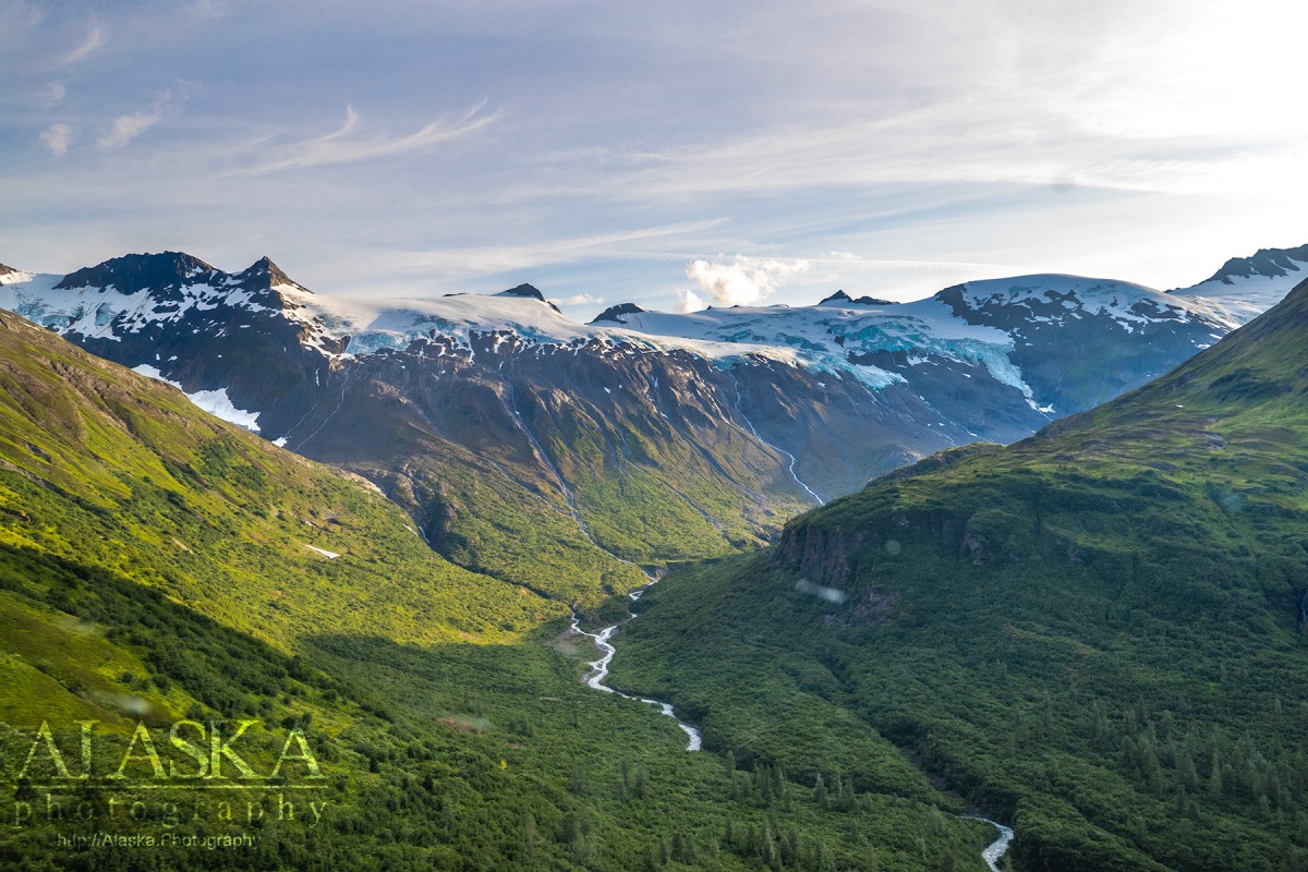
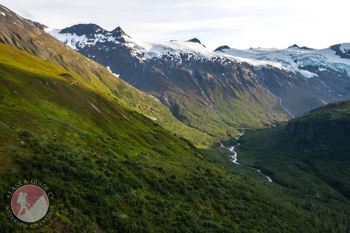
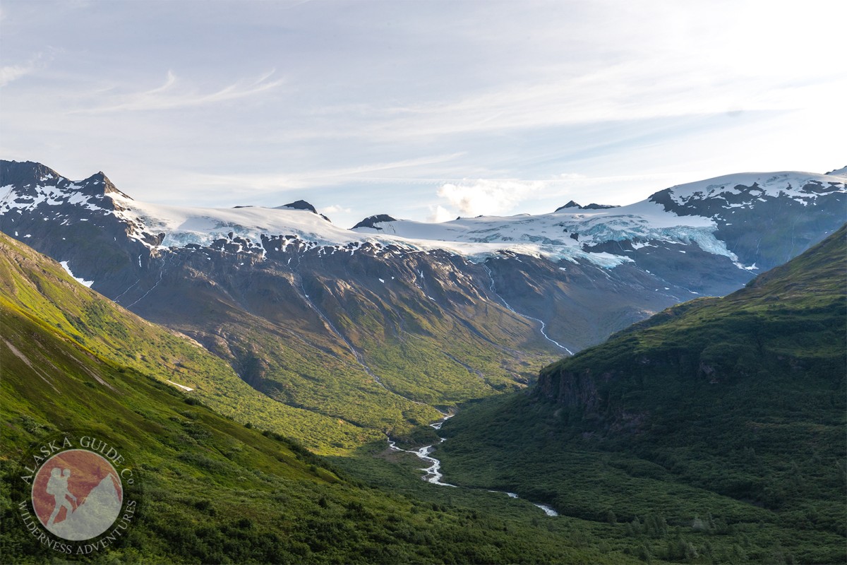
Browns Basin Gallery
Pictures of, from, or near Browns Basin.
Brickslide Glacier, Corbin Glacier, DOT Glacier, Glacier G213869E60950N, Glacier G213882E60988N, Glacier G213914E60880N, Glacier G213934E61146N, Glacier G213941E60895N, Glacier G213942E60986N, Glacier G213944E60979N, Glacier G213945E60907N, Glacier G213952E61151N, Glacier G213958E60963N, Glacier G213959E60945N, Glacier G213962E60977N, Glacier G213967E60919N, Glacier G213971E60895N, Glacier G213982E60906N, Glacier G213982E61094N, Glacier G213986E60928N, Glacier G214001E60962N, Glacier G214004E60942N, Glacier G214005E60907N, Glacier G214017E60985N, Glacier G214019E61092N, Glacier G214021E60977N, Glacier G214022E60997N, Glacier G214027E61088N, Glacier G214030E60925N, Glacier G214039E60964N, Glacier G214042E61141N, Glacier G214048E60957N, Glacier G214049E60918N, Glacier G214053E61154N, Glacier G214070E61096N, Glacier G214099E61139N, Glacier G214116E60878N, Glacier G214132E60990N, Glacier G214141E60880N, Glacier G214148E60959N, Glacier G214151E61165N, Glacier G214161E60914N, Glacier G214166E60906N, Glacier G214169E60899N, Glacier G214170E60888N, Glacier G214175E61036N, Glacier G214183E60923N, Glacier G214183E61143N, Glacier G214188E61150N, Glacier G214199E61016N, Glacier G214222E60989N, Glacier G214237E60874N, Glacier G214260E60794N, Glacier G214282E60871N, Glacier G214285E60829N, Glacier G214286E60849N, Glacier G214289E60837N, Glacier G214291E60861N, Hogback Glacier, Keystone Glacier, Rubin Glacier, Twentyseven Mile Glacier, Wortmanns Glacier,
Routes:Angel, Bridal Veil Falls (Ice Climb), Cidersicle, Crystal Visions, Dire Straits, Fang Gully, Fast Friends, Fishing for Fools, Flying Cloud, Foolagain, Glass Onion, Greensteps, Hanging Tree Left, Hanging Tree Right, Horsetail Falls (Ice Climb), Hung Jury, Jaws Wall, Mud Slide, My Three Rats, Oil Slick, Popsicle Pillar, POS, Secret Journey, Simple Twist of Fate, Ski Race, Spring Loaded, Stem City, The Bight, Tokyo Express, Tsuri Gane, VAC,
Lakes:Blueberry Lake, Crater Lake, Deep Lake, Worthington Lake,
Locales:19 Mile Wall, Catchers Mitt, DOT Face, Fracture Canyon, Heiden View Face, Little Odyssey, Loveland Basin, Mercury, North Odyssey, Road Run,
Mountains:East Peak, Hogsback, The Island, Meteorite Mountain,
Mountain Passes:Peaks:Mount Bonet, Heidi Peak, Loveland Peak, Repeater Peak, Sapphire, Satellite, Stone Mountain, Tones Temple, Twentyseven Mile Peak, Whistlers Mother,
Rivers:Streams:Bear Creek, Bench Creek, Brown Creek, Browns Creek, Cameron Creek, Canyon Slough, Dead Creek, Goat Creek, Sheep Creek, Wortmanns Creek,
Routes:Browns Creek Trail, DOT Glacier Trail, Little Odessey Trail, Pack Trail of 1899, Thompson Pass Pipeline Access Road,
Valleys:Browns Basin, Goat Gully, Heiden Canyon, Keystone Canyon, Snowslide Gulch,
Waterfalls:Pictures of, from, or near Browns Basin.