The Island Gallery
Pictures of, from, or near The Island.
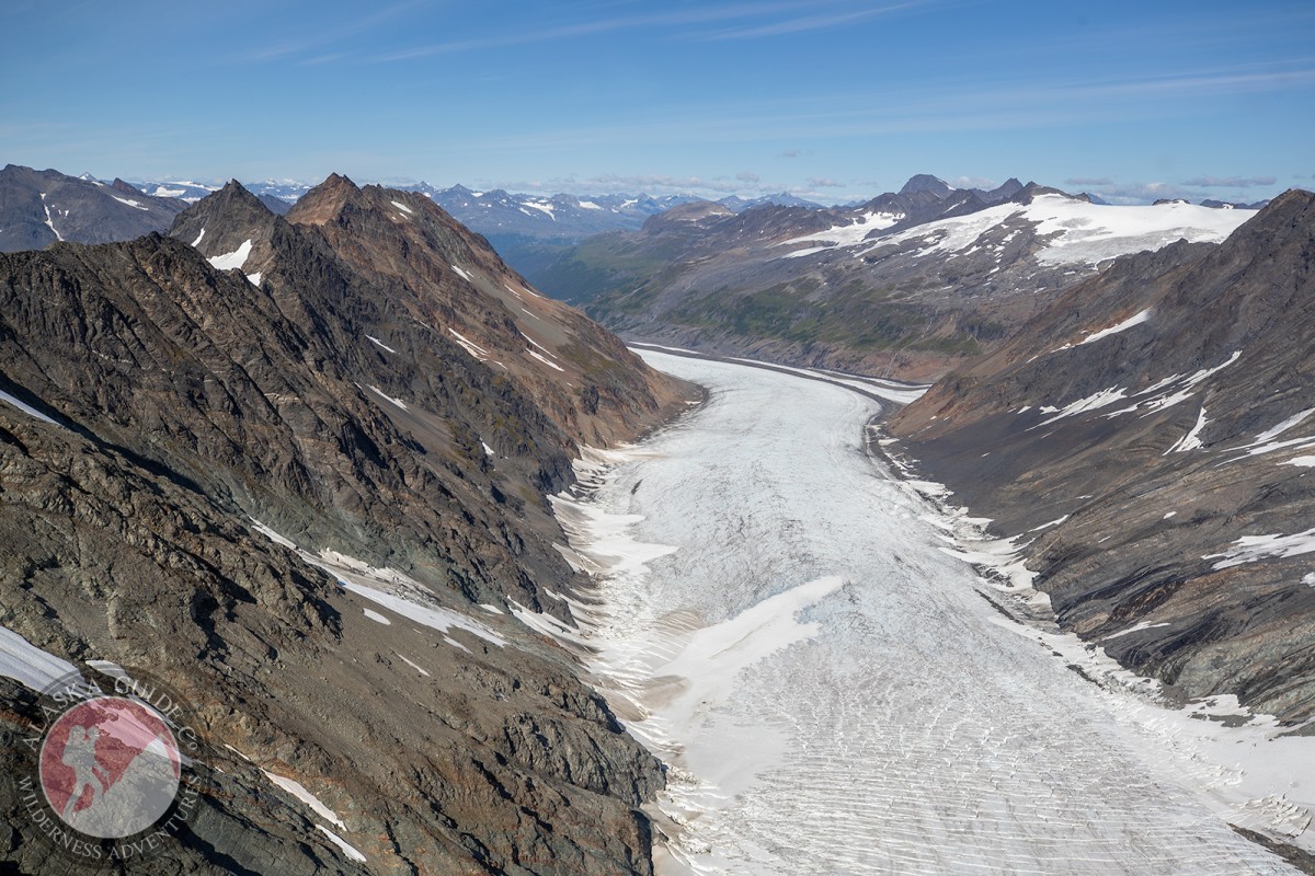
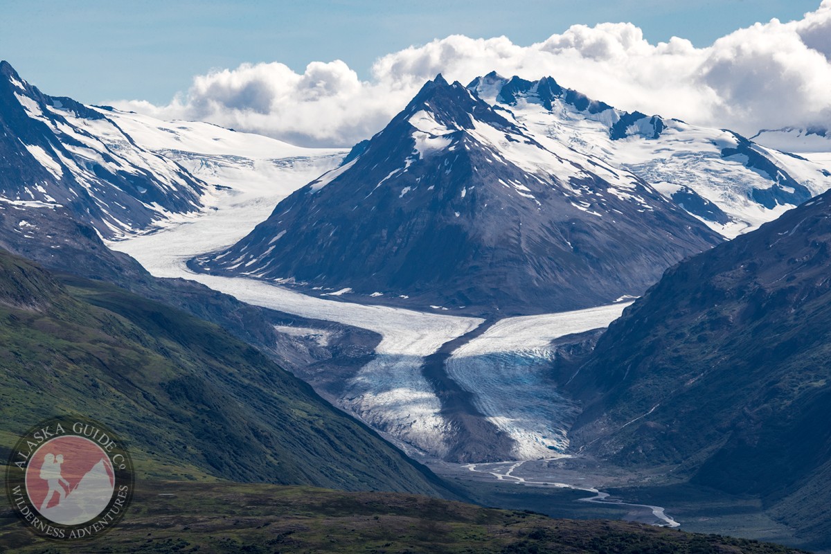
Bench Glacier, Cordova Glacier, Deserted Glacier, DOT Glacier, Glacier G214099E61139N, Glacier G214116E60878N, Glacier G214132E60990N, Glacier G214141E60880N, Glacier G214148E60959N, Glacier G214161E60914N, Glacier G214166E60906N, Glacier G214169E60899N, Glacier G214170E60888N, Glacier G214175E61036N, Glacier G214183E60923N, Glacier G214183E61143N, Glacier G214199E61016N, Glacier G214222E60989N, Glacier G214237E60874N, Glacier G214260E60794N, Glacier G214282E60871N, Glacier G214285E60829N, Glacier G214286E60849N, Glacier G214289E60837N, Glacier G214291E60861N, Glacier G214314E61049N, Glacier G214328E60976N, Glacier G214334E60964N, Glacier G214344E60960N, Glacier G214354E60949N, Glacier G214364E60797N, Glacier G214367E61057N, Heiden Glacier, Marshall Glacier, Tasnuna Glacier, The Beach, Wortmanns Glacier,
Routes:Angel, Bridal Veil Falls (Ice Climb), Cidersicle, Crystal Visions, Dire Straits, Fang Gully, Fast Friends, Fishing for Fools, Flying Cloud, Foolagain, Glass Onion, Greensteps, Hanging Tree Left, Hanging Tree Right, Horsetail Falls (Ice Climb), Hung Jury, Jaws Wall, Mud Slide, My Three Rats, Oil Slick, Popsicle Pillar, POS, Secret Journey, Simple Twist of Fate, Ski Race, Spring Loaded, Stem City, The Bight, Tokyo Express, Tsuri Gane,
Lakes:Blueberry Lake, Rude Lake, Sahlin Lagoon, Thompson Lake,
Locales:19 Mile Wall, DOT Face, Fracture Canyon, Heiden View Face, Little Odyssey, Mega Sumo, Mercury, Moonlight Basin, Road Run, Valley of the Tusk,
Mountains:Parks:Blueberry Lake State Recreation Site,
Mountain Passes:Peaks:Bronto, Halibut Head, Ivory Tusk, Loveland Peak, Stone Mountain, The Tusk, Whistlers Mother,
Ridges:Routes:Blueberry Crack , Bluebies, S.K.K., Talons, Unknown, Unknown 3,
Streams:Bear Creek, Bench Creek, Browns Creek, Heiden Creek, Sheep Creek, Wortmanns Creek,
Routes:Browns Creek Trail, Little Odessey Trail, Thompson Pass Pipeline Access Road,
Valleys:Browns Basin, Heiden Canyon, Keystone Canyon, Snowslide Gulch,
Waterfalls:Pictures of, from, or near The Island.