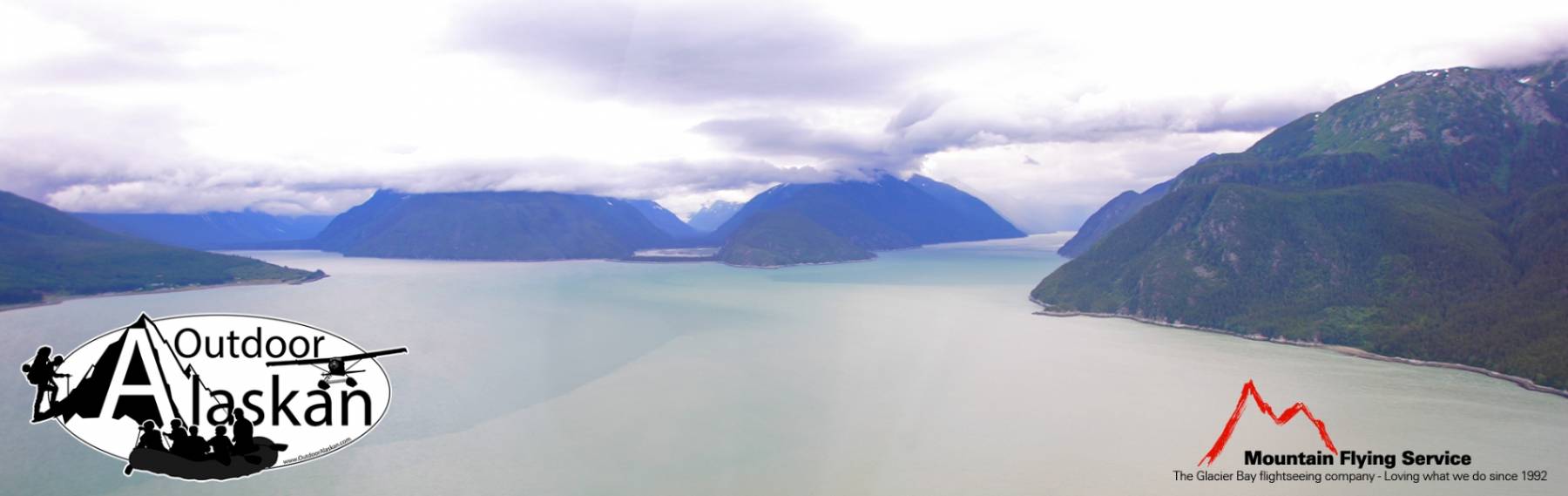
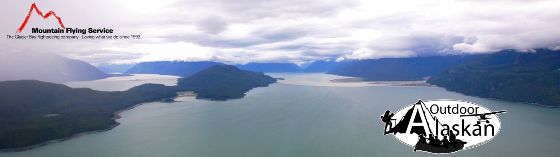
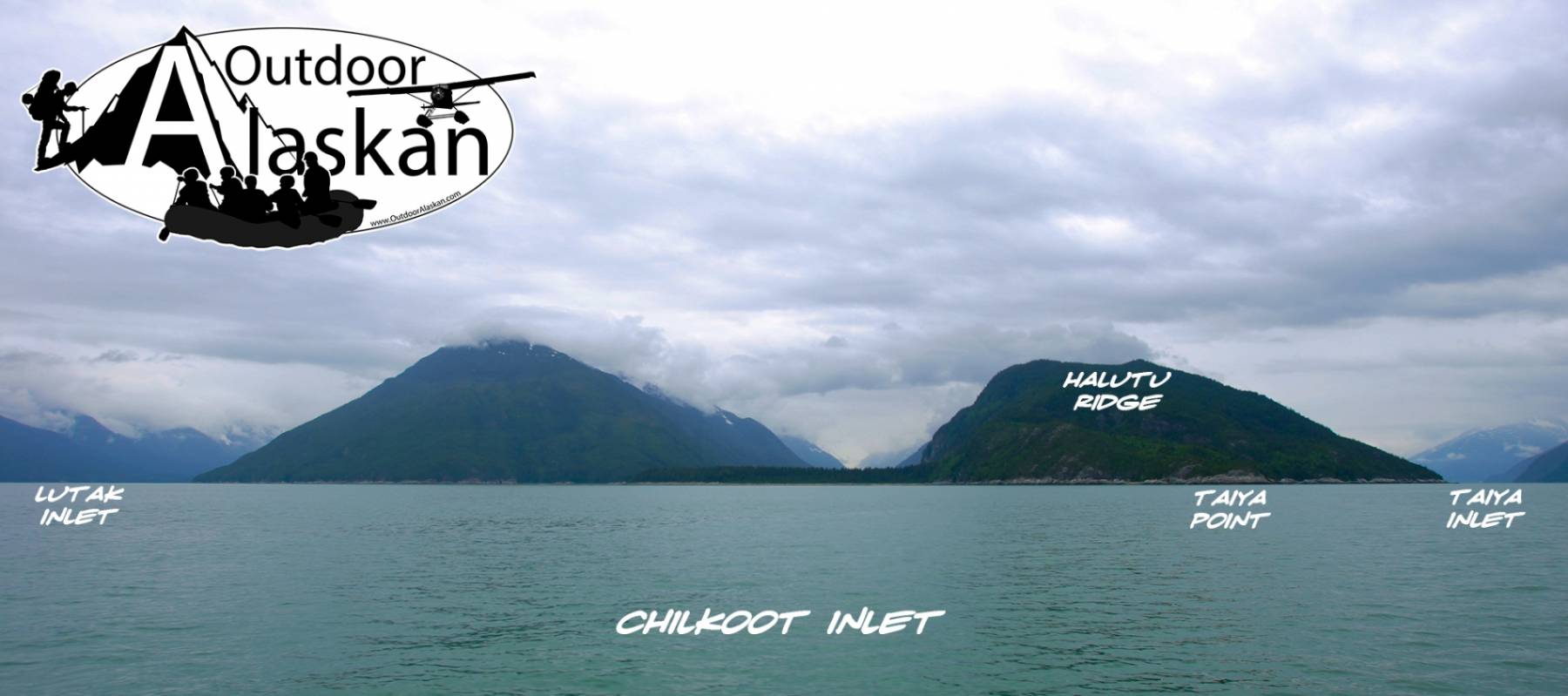
Taiya Point Gallery
Pictures of, from, or near Taiya Point.
at head of Chilkoot Inlet, 1 mi. SE of Taiyasanka Harbor and 12 mi. SW of Skagway, Coast Mts.
Named for Taiya Inlet in 1923 on International Boundary Commission (IBC) Sheet 9 (1951 atlas).
Chilkoot, Denver, Gantegastaki,
Bars:Indian Rock, Jenkins Rock, Johnson Rock, McClellan Flats,
Bays:Carrs Cove, Chilkat Inlet, Chilkoot Inlet, Kalhagu Cove, Kelgaya Bay, Letnikof Cove, Lutak Inlet, Mud Bay, Nahku Bay, Paradise Cove, Portage Cove, Pyramid Harbor, Shiyi Bay, Smugglers Cove, Taiya Inlet, Taiyasanka Harbor, Tanani Bay,
Beaches:Capes:Anchorage Point, Battery Point, Chilkat Peninsula, Dok Point, Dyea Point, False Battery Point, Glacier Point, Green Point, Halutu Peninsula, Kaskulu Point, Kelgaya Point, Lehunua Point, Low Point, Nukdik Point, Seduction Point, Taiya Point, Tanani Point, Yakutania Point,
Cities:Dams:Haines Army Depot Water Supply Dam, Louie Nelson Homestead Dam, Lower Dewey Lake Forebay Dam, Lower Dewey Lake Number 1 Dam, Upper Dewey Lake Dam,
Fictional Places:Glaciers:Davidson Glacier, Rainbow Glacier, Schubee Glacier, Villard Glacier,
Islands:Dalasuga Island, Kochu Island, Lehunua Island, Pyramid Island, Talsani Island,
Lakes:Black Lake, Chilkoot Lake, Devils Punch Bowl, Icy Lake, Lily Lake, Lower Dewey Lake, Paradise Lake, Rustabach Lake, Rutzebeck Lake, Upper Dewey Lake,
Mountains:Face Mountain, Mount Gollum, Mount Harding, Mount Riley, Mount Ripinski, Twin Dewey Peaks, Mount Villard,
Parks:Chilkat State Park, Chilkoot Lake State Recreation Area,
Peaks:Lactic Acid Peak, Mount Mordor, Nelson Tower, Satans Mistress, Shakuseyi Peak, Twin,
Ridges:Rivers:Chilkat River, East Fork Skagway River, Ferebee River, Glacier River, Katzehin River, Skagway River, Taiya River,
Streams:Burro Creek, Dayehas Creek, Dewey Creek, Haska Creek, Johnson Creek, Johnson Creek, Kasidaya Creek, Ludaseska Creek, Mink Creek, Nelson Creek, Reid Creek, Shakuseyi Creek, Snyder Creek, Yeldagalga Creek,
Routes:Mount Riley Trail, Battery Point Trail, Dewey Lakes and Devils Punch Bowl, Lower Dewey Lake Loop Trail, Mount Ripinsky and 7 Mile Saddle Trail, Nahku Portage, Reid Falls Trail, Seduction Point Trail, Sturgill's Landing Trail,
Valleys:Cities:Lutak, Mud Bay, Port Chilkoot, Tanani,
Waterfalls:Pictures of, from, or near Taiya Point.