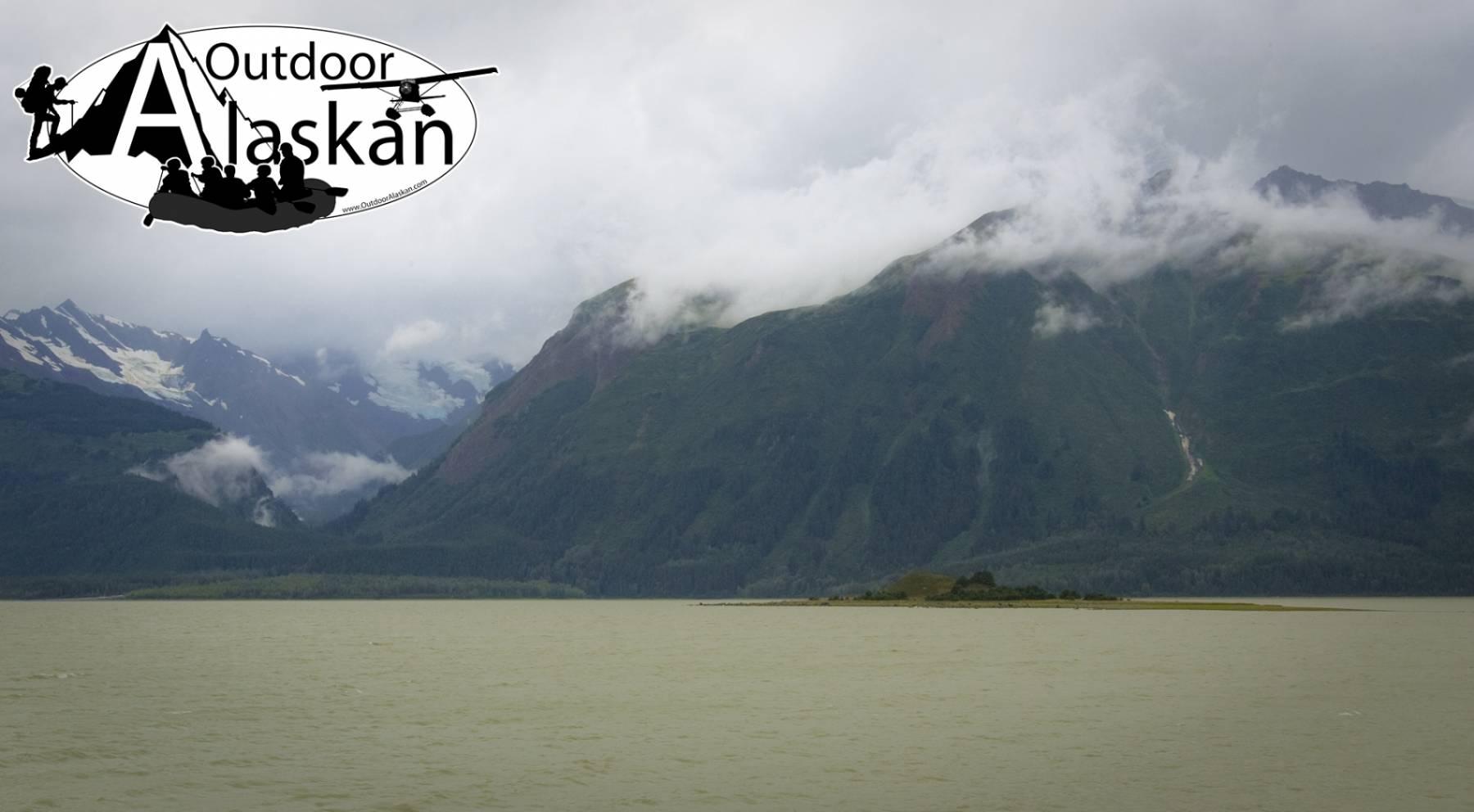
Pyramid Island Gallery
Pictures of, from, or near Pyramid Island.
in Chilkat Inlet, 1 mi. SW of Chilkat and 19 mi. SW of Skagway, Coast Mts.
Descriptive name given in 1869 by Commander Meade, U.S. Navy (USN). It was called "Os(trov) Peschanyy," meaning "sandy (or gritty) island," by "Captain Lindenbert" in 1838. In 1868, it was called Indian Island by Commander Meade, U.S. Navy (USN), and Farewell Island, through a mistranslation of "Peschanyy," by G. D. Davidson, U.S. Coast and Geodetic Survey (USC&GS), in 1869. It has also been called Stony Island and Observatory Island (1883, Coast Pilot, p. 197). According to Aurel and Arthur Krause (1883, map), the Tlinget Indian name is Chlachatsch; according to W. H. Dall, U.S. Coast and Geodetic Survey (USC&GS), it is Shla-hatch (1883 Coast Pilot, p. 197).
Indian Rock, Jenkins Rock, Johnson Rock, McClellan Flats,
Bays:Carrs Cove, Chilkat Inlet, Chilkoot Inlet, Kalhagu Cove, Kelgaya Bay, Letnikof Cove, Lutak Inlet, Mud Bay, Paradise Cove, Portage Cove, Pyramid Harbor, Shiyi Bay, Taiya Inlet, Taiyasanka Harbor, Tanani Bay,
Beaches:Capes:Anchorage Point, Battery Point, Chilkat Peninsula, Dok Point, False Battery Point, Glacier Point, Green Point, Halutu Peninsula, Kaskulu Point, Kelgaya Point, Lehunua Point, Low Point, Nukdik Point, Seduction Point, Taiya Point, Tanani Point, Zimovia Point,
Cities:Dams:Haines Army Depot Water Supply Dam, Louie Nelson Homestead Dam,
Fictional Places:Glaciers:Davidson Glacier, Rainbow Glacier, Schubee Glacier, Villard Glacier,
Islands:Anyaka Island, Dalasuga Island, Kataguni Island, Kochu Island, Lehunua Island, Pyramid Island, Shikosi Island, Talsani Island,
Lakes:Chilkoot Lake, Lily Lake, Paradise Lake, Rustabach Lake, Rutzebeck Lake,
Mountains:Cathedral Peak, Mount Gollum, Mount Riley, Mount Ripinski, Sullivan Mountain, Tukgahgo Mountain, Mount Villard,
Parks:Chilkat Islands State Marine Park, Chilkat State Park, Chilkoot Lake State Recreation Area,
Peaks:Lactic Acid Peak, Mount Mordor, Nelson Tower, Shakuseyi Peak,
Ridges:Rivers:Chilkat River, Chilkoot River, Ferebee River, Glacier River, Katzehin River, Kicking Horse River, Takhin River,
Streams:Dayehas Creek, Haska Creek, Johnson Creek, Kasidaya Creek, Ludaseska Creek, Mink Creek, Shakuseyi Creek,
Routes:Mount Riley Trail, Battery Point Trail, Mount Ripinsky and 7 Mile Saddle Trail, Nahku Portage, Seduction Point Trail,
Valleys:Cities:Pictures of, from, or near Pyramid Island.