Letnikof Cove Gallery
Pictures of, from, or near Letnikof Cove.
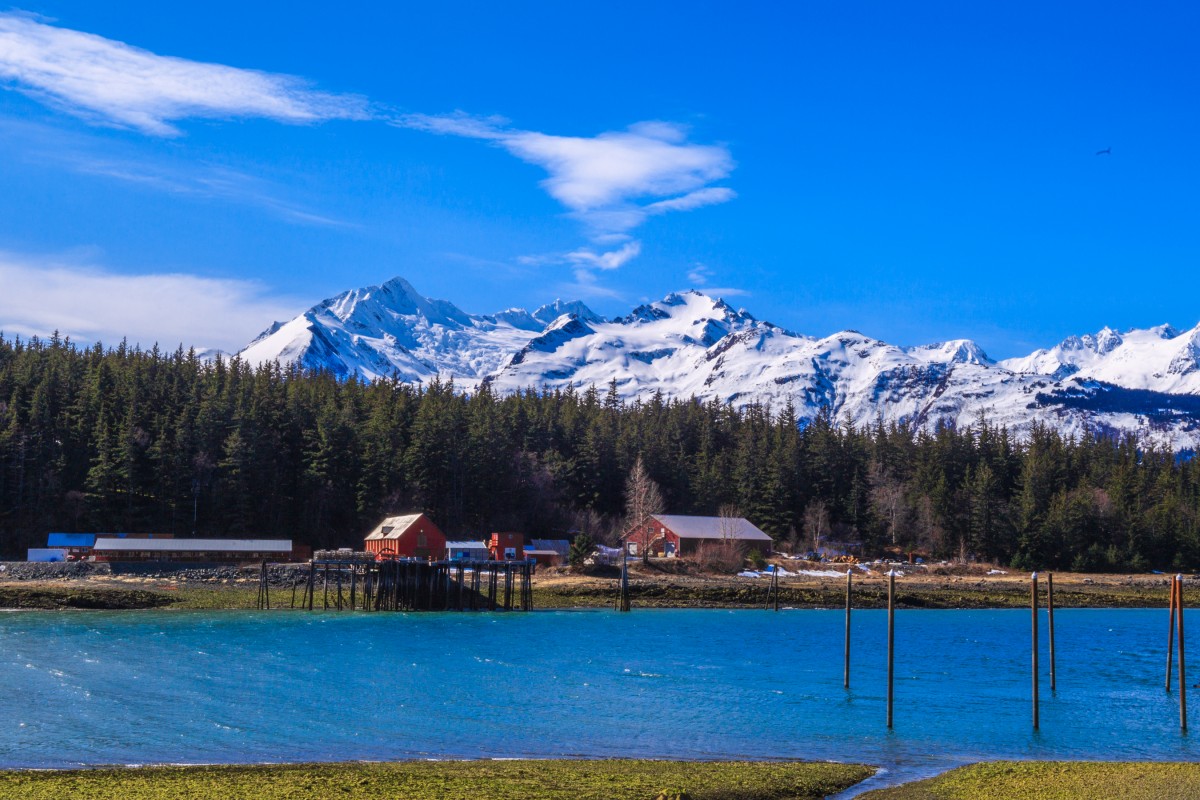
on SW coast of Chikat Peninsula, 1.6 mi. N of Kochu I., in Chilkat Inlet, 19 mi. SW of Skagway; Coast Mts.
Letnikof Cove is just down from Haines on the Chilkat Peninsula. It's home to a little cannery and boat launch, serving as a put in for Chilkat Inlet.
From Haines, take 3rd Ave south, it will turn into Small Tract Rd, or you can turn left to Mud Bay Rd for a more scenic drive. Either way Small Tract will merge with Mud Bay Rd. Proceed down Mud Bay Rd until you're at Letnikof Cove.
named "B(ukhta) Letnikov," meaning "Letnikov Cove," on the 1848 Russian Hydrographic Dept. Chart 1396. Letnikoff Cove by U.S. Coast and Geodetic Survey (USC&GS) in the 1883 Coast Pilot (p. 197).Naming: Originally named "B[ukhta] Letnikov," meaning Letnikov Cove, on the 1848 Russian Hydrographic Department Chart 1396. If was published as Letnikoff Cove by USC&GS in the 1883 Coast Pilot (page 197).
Indian Rock, Jenkins Rock, Johnson Rock, McClellan Flats,
Bays:Carrs Cove, Chilkat Inlet, Chilkoot Inlet, Kalhagu Cove, Kelgaya Bay, Letnikof Cove, Lutak Inlet, Mud Bay, Paradise Cove, Portage Cove, Pyramid Harbor, Shiyi Bay, Taiya Inlet, Taiyasanka Harbor, Tanani Bay,
Beaches:Capes:Anchorage Point, Battery Point, Chilkat Peninsula, Dok Point, False Battery Point, Glacier Point, Green Point, Halutu Peninsula, Kaskulu Point, Kelgaya Point, Lehunua Point, Low Point, Nukdik Point, Seduction Point, Taiya Point, Tanani Point,
Cities:Dams:Haines Army Depot Water Supply Dam, Louie Nelson Homestead Dam,
Fictional Places:Glaciers:Davidson Glacier, Rainbow Glacier, Schubee Glacier, Villard Glacier,
Islands:Anyaka Island, Dalasuga Island, Eldred Rock, Kataguni Island, Kochu Island, Lehunua Island, Pyramid Island, Shikosi Island, Sullivan Island, Talsani Island,
Lakes:Chilkoot Lake, Lily Lake, Paradise Lake, Rustabach Lake, Rutzebeck Lake,
Mountains:Mount Gollum, Mount Riley, Mount Ripinski, Sullivan Mountain, Mount Villard,
Parks:Chilkat Islands State Marine Park, Chilkat State Park, Chilkoot Lake State Recreation Area,
Peaks:Mount Mordor, Satans Mistress, Shakuseyi Peak, Twin,
Ridges:Rivers:Chilkat River, Ferebee River, Glacier River, Katzehin River,
Streams:Dayehas Creek, Haska Creek, Johnson Creek, Ludaseska Creek, Mink Creek, Shakuseyi Creek, Yeldagalga Creek,
Routes:Mount Riley Trail, Battery Point Trail, Mount Ripinsky and 7 Mile Saddle Trail, Nahku Portage, Seduction Point Trail,
Valleys:Cities:Pictures of, from, or near Letnikof Cove.