Taiya River Gallery
Pictures of, from, or near Taiya River.
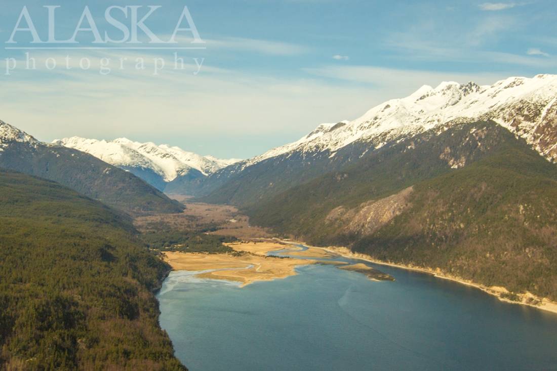
heads at Chilkoot Pass, on the Alaska-Canada boundary, flows S to head of Taiya Inlet, 1 mi. N of Dyea Point, and 2 mi. NW of Skagway, Coast Mts.
Name derived from Taiya Inlet and published by U.S. Coast and Geodetic Survey (USC&GS) in the 1891 Coast Pilot (p. 203). This stream was the first part of the "Dyea Trail" from Dyea through Chilkoot Pass to the Klondike. See Dyea, locality.
Canyon City, Chilkoot, Denver, Rocky Point,
Bars:Bays:Lutak Inlet, Nahku Bay, Smugglers Cove, Taiya Inlet, Taiyasanka Harbor, Tanani Bay,
Beaches:Capes:Dyea Point, Halutu Peninsula, Low Point, Taiya Point, Tanani Point, Yakutania Point,
Cities:Dams:Haines Army Depot Water Supply Dam, Lower Dewey Lake Forebay Dam, Lower Dewey Lake Number 1 Dam, Upper Dewey Lake Dam,
Glaciers:Irene Glacier, Saussure Glacier, Schubee Glacier, Villard Glacier,
Lakes:Black Lake, Devils Punch Bowl, Goat Lake, Icy Lake, Lost Lake, Lower Dewey Lake, Pump House Lake, Summit Lake, Upper Dewey Lake,
Locales:Mine:Eight Mile Canyon Prospect, Inspiration Mine,
Mountains:A B Mountain, Mount Carmack, Mount Cleveland, Mount Clifford, Face Mountain, Mount Gollum, Mount Harding, Mount Hoffman, Porcupine Hill, Mount Ripinski, Twin Dewey Peaks, Mount Villard, Mount Yeatman,
Parks:Chilkoot Lake State Recreation Area, Klondike Gold Rush National Historical Park,
Mountain Passes:Peaks:Lactic Acid Peak, Mount Mordor, Nelson Tower,
Ridges:Rivers:East Fork Skagway River, Ferebee River, Nourse River, Skagway River, Taiya River, White Pass Fork Skagway River,
Streams:Burro Creek, Captain William Moore Creek, Dayehas Creek, Dewey Creek, Johnson Creek, Kasidaya Creek, Mink Creek, Nelson Creek, Porcupine Creek, Reid Creek, Shakuseyi Creek, Snyder Creek, West Creek,
Routes:Chilkoot Trail, Dewey Lakes and Devils Punch Bowl, Lower Dewey Lake Loop Trail, Mount Ripinsky and 7 Mile Saddle Trail, Reid Falls Trail, Skyline Trail, Sturgill's Landing Trail,
Valleys:Ferebee Valley, Glacier Gorge, Warm Pass Valley,
Cities:Waterfalls:Pictures of, from, or near Taiya River.