Lost Toque Trail Gallery
Pictures of, from, or near Lost Toque Trail.
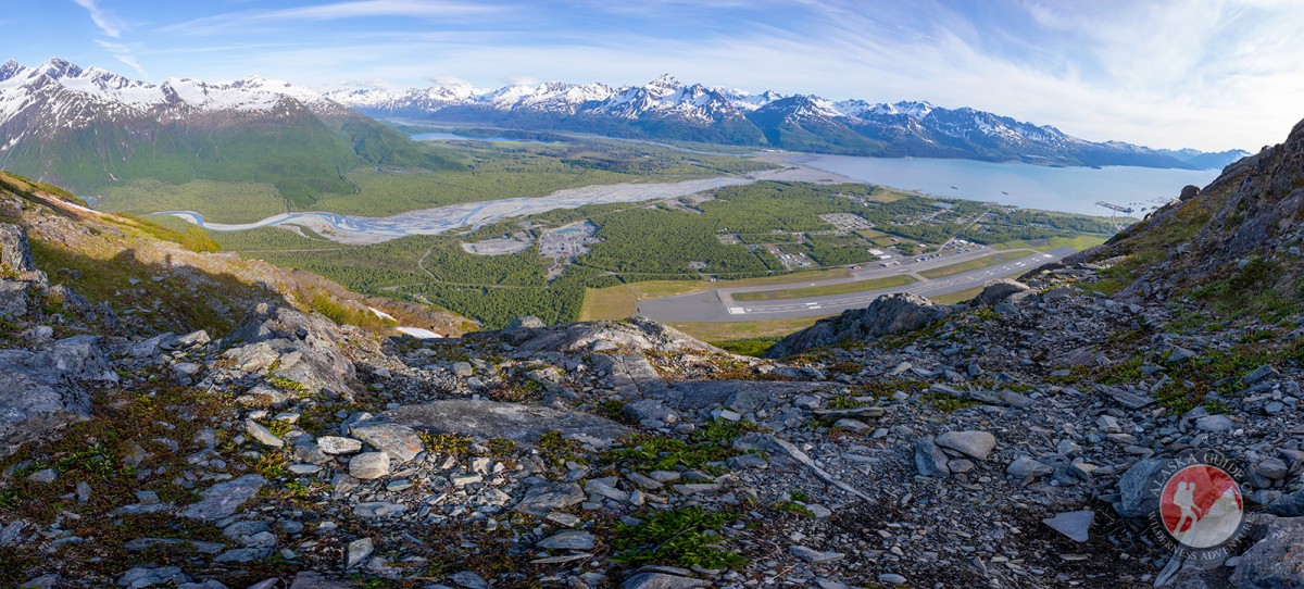
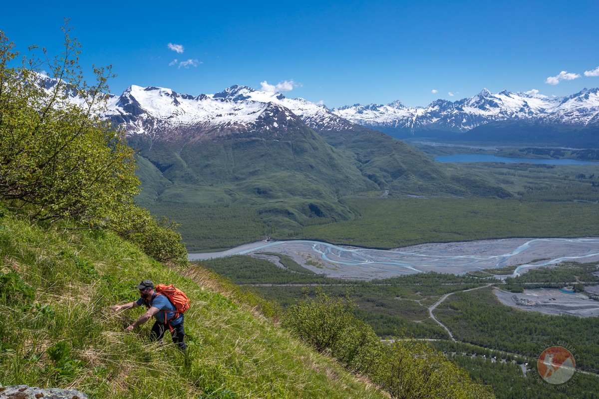
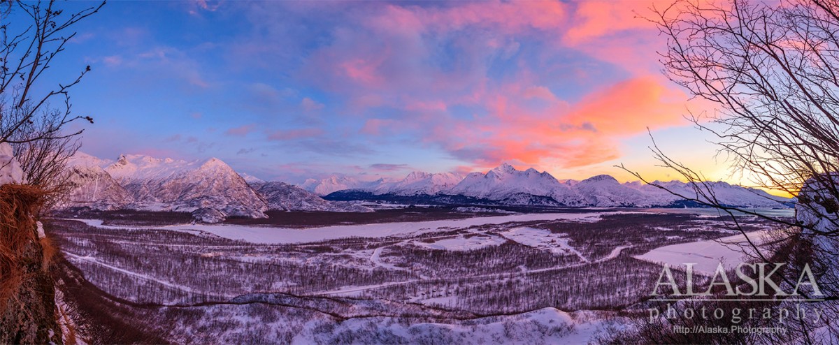
Lost Toque (pronounced two-k) is a nice moderate hike for the first half. Once you get to East Airport Overlook it begins to pick it up a little. Soon after Big Boulder Overlook it gets interesting. It stays a hike for several hundred more feet but then becomes a bushwhacking scramble. If you're able to keep to the trail it's not much real bushwhacking. Then there's a little bit of very minor climbing, like 12ft of 5.7 slopes. Then you're out of the alders and climb up a steep grassy slope, you might want to bring gloves. But after that you're in the alpine with incredible views.
There wasn't much limbing done to the trail to preserve the canopy and keep from having to battle overgrowth. There's frequent bear activity on the trail so be as best prepared as you like to be when handling bears.
Please do not use this trail for trapping or hunting. It was a lot of effort for the sake of people to enjoy observing and being in nature.
Drive past the Airport on Airport Rd, just past Glacier View Campground but before the gun range, there is a day use area access road with a waterfall at the end. That used to be an old campground. Just over half way down the road there's a lower pull out on the right (east) park there and then walk back down the road about 40ft and cross the creek (west) and that's where the trail starts.
Lost Toque Trail was begun as a path local photographer Zachary Sheldon would skin up in winter. Picking a line through the tops of the alders when the bush whacking was easiest. One evening in a rush to get altitude before the sun set, he took off his ski and gear and punched up the slope and scrambled up a wall. When he got back down the wind had taken his favorite winter hat, a toque his mom bought him roughly 15 years earlier. With the guiding season quiet in 2020 he decided to find a route up West Peak.
Allison Point, Dock Point, Jackson Point,
Cities:Crags:Valdez Glacier Campground Wall, Lookout Rock, Panorama Point,
Dams:Solomon Gulch Dam A, Solomon Gulch Dam B, Solomon Lake Dam,
Flats:Glaciers:Abercrombie Shelf Glacier, Allison Glacier, Area 51 Glacier, Camicia Glacier, Glacier G213585E61165N, Glacier G213585E61165N, Glacier G213602E61200N, Glacier G213603E61218N, Glacier G213614E61180N, Glacier G213653E61264N, Glacier G213685E61168N, Glacier G213687E60954N, Glacier G213708E60993N, Glacier G213722E60985N, Glacier G213723E61170N, Glacier G213727E61240N, Glacier G213737E60948N, Glacier G213739E61247N, Glacier G213740E61167N, Glacier G213742E61233N, Glacier G213749E60966N, Glacier G213750E61221N, Glacier G213756E61212N, Glacier G213756E61263N, Glacier G213767E61200N, Glacier G213767E61245N, Glacier G213770E61226N, Glacier G213775E60940N, Glacier G213777E61166N, Glacier G213778E61174N, Glacier G213780E61222N, Glacier G213780E61222N, Glacier G213783E60980N, Glacier G213784E61033N, Glacier G213788E60991N, Glacier G213798E61012N, Glacier G213804E61037N, Glacier G213821E60955N, Glacier G213835E60986N, Glacier G213860E61028N, Glacier G213869E60950N, Glacier G213881E61189N, Glacier G213882E60988N, Glacier G213883E61190N, Glacier G213898E61187N, Glacier G213934E61146N, Glacier G213935E61200N, Glacier G213942E60986N, Glacier G213944E60979N, Glacier G213952E61151N, Glacier G213958E60963N, Glacier G213959E60945N, Glacier G213962E60977N, Glacier G213964E61199N, Glacier G213981E61263N, Glacier G213982E61094N, Glacier G213986E60928N, Glacier G214001E61199N, Glacier G214004E60942N, G-g-g-g-g Glacier, Johnson Glacier, Kate Glacier, Mineral Creek Glacier, Rubin Glacier, Salmon Creek Glacier, Valdez Glacier,
Hills:Routes:Blue Horizons, Diamond in the Sky, Excalibur, Gravy Tran, Kayaker's Delight, Necromancer, Peggy's Mane, Wowie Zowie,
Islands:Ammunition Island, Mineral Creek Islands,
Lakes:Allison Lake, Crater Lake, Deep Lake, Robe Lake, Solomon Gulch Lake, Solomon Lake, Solomon Lake, Valdez Glacier Lake,
Locales:Airport Chute, Alaska Guide Company - Office, Area 51, Basin Cove, Cabell Chute, Chuck Chute, Chuck Junior, Delta Chute, Grant Chute, Jago Chute, Lookout Bowl, Lucky 13, Runner's Delight, Sentinel, Sheepshead Chute, Tombstone Wall,
Mine:Big Four Mine, Cash Mine, Giant Mine, Hercules Mine, Johnson Mine, Midas Mine,
Mountains:Prospectors Peak, Abercrombie Mountain, East Peak, Mount Francis, Hogsback, Mount Kate, Mount Logan, Mount Mahlo, Mummy Mountain, Mount Schrader, Sugarloaf Mountain, Townsend Peak, Valdez Summit, West Peak,
Peaks:Benzene, Bob's Knob, Mount Bonet, Comstock, Embick, Heidi Peak, High Back, Mile High Peak, Snow Dome, Titan Chair,
Rivers:Routes:Lazy Days, No Floss Necessary, Route number 1, Route number 3, Trim the Bush, Wet Finish,
Routes:Already Herd, Bicentennial, Bongo That Bitch, Brand New, Canadian Heat Wave, Cotter Unlimited, Danger Stranger, Dragon's Teeth, Dynosaur, The Firing Line, Gusel Jugs, Harristotle, Kentner's Mill, Leaf BlowersL, Ledgeway to Sleven, Lefty Lucy, People Get Up And Drive Your Funky Soul, Quartzsite's Strike, Reacharound, Redheaded Stepchild, Righty Tighty, Route number 2, Slabawooke, The Nose Knows, Your Favorite Weapon,
Streams:Abercrombie Creek, Allison Creek, Brevier Creek, Cameron Creek, Camicia Creek, Canyon Slough, Corbin Creek, Crooked Creek, Dayville Creek, East Fork Mineral Creek, Glacier Creek, Goat Creek, Horsetail Creek, Mineral Creek, Slater Creek, Valdez Glacier Stream, Wood Creek,
Routes:Area 51 Access Trail, Dayville Power Line Trail, Dock Point Trail, East Peak Access Trail, Mount Francis Winter Trail, High School Hill, High School Hill to Summit Trail, High School Hill Water Tower Trail, Hogsback Trail, Homestead Trail, John Hunter Memorial Trail, Levee to Valdez Glacier Trail, Lost Toque Trail, Mineral Creek East Trail, Mineral Creek Stamp Mill Trail, Mineral Creek West Trail, Northern Robe Lake Trail, River Drive Trail, Robe River Hogsback Access Trail, Shoup Bay Trail, Solomon Gulch Valdez Overlook Spur, Southern Robe Lake Trail, Valdez Bike Path, Valdez Overlook Trail,
Valleys:Abercrombie Gulch, Goat Gully, Solomon Gulch, Sulphide Gulch,
Cities:Pictures of, from, or near Lost Toque Trail.