Shoup Bay Trail Gallery
Pictures of, from, or near Shoup Bay Trail.
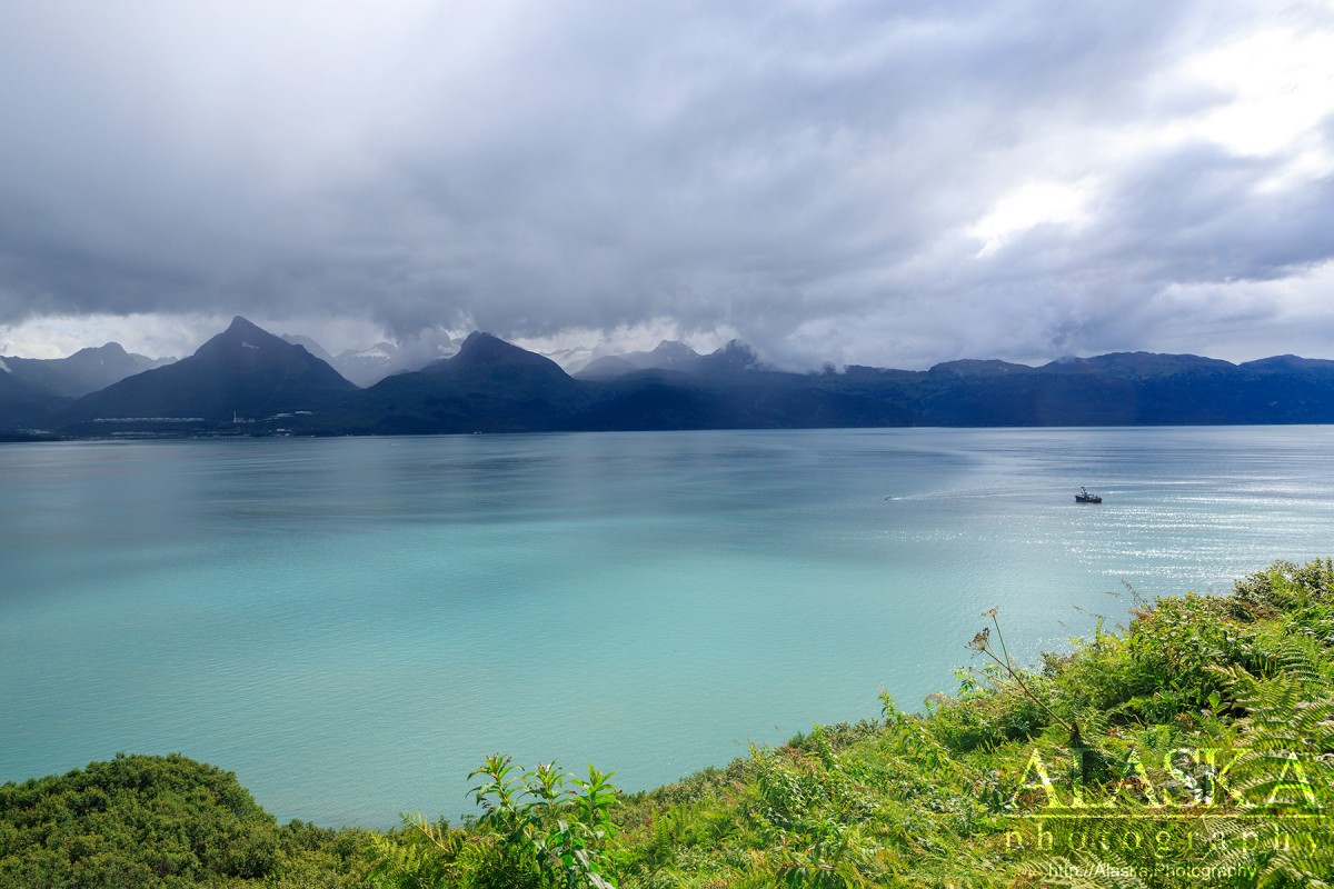
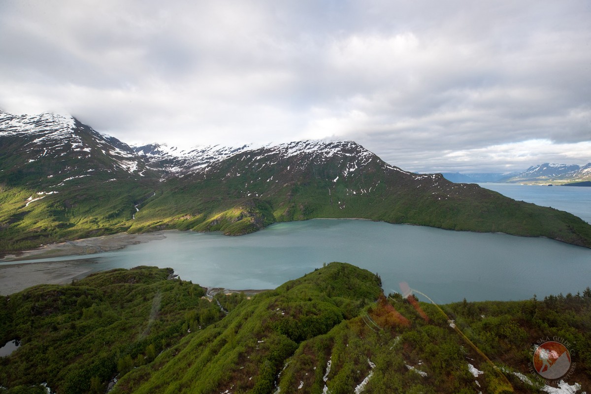
Shoup Bay Trail begins outside of Valdez on the other side of Mineral Creek and follows Port Valdez 3.11 miles to Gold Creek before continuing another 3.5 miles to Shoup Bay. If you're hiking the trail as early as April there can still be snow and the trail. May through October the trail should be 100% clear.
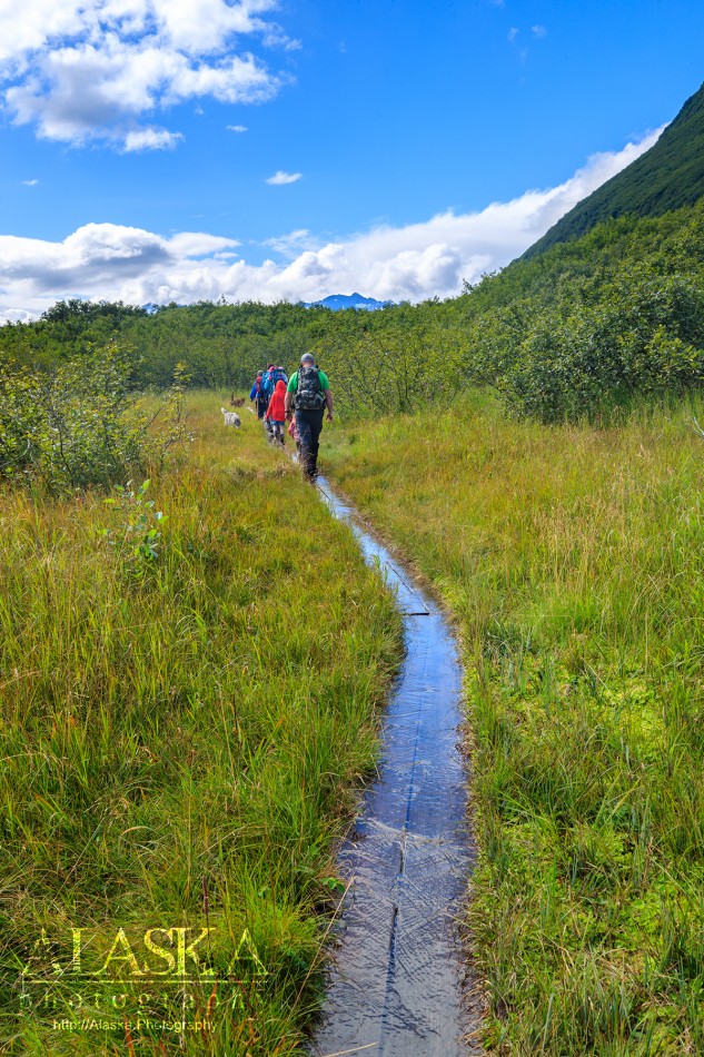
The trail begins, well cleared and wide through alders and cottonwood for the first half-mile, before coming out to the flats. This portion of the trail can be particularly muddy if it has been raining. There is a section about 15ft long once you come to the flats that can be ankle deep with no way around but through. As you make your way around the flats it can continue to be wet and ankle deep in sections. However if it has been dry for a few days this portion of the trail is great.
In 2016 Shoup Bay Trail received much needed attention. Including brushing of the side and widening of the trail. However since regular maintenance isn't kept, once you leave the flat the trail becomes lined with stinging nettle. Not the entirety of the remaining trail, but thick enough you better wear pants or convertible pants, and don't be surprised if you hand brushes some on the hike if you let your guard down.
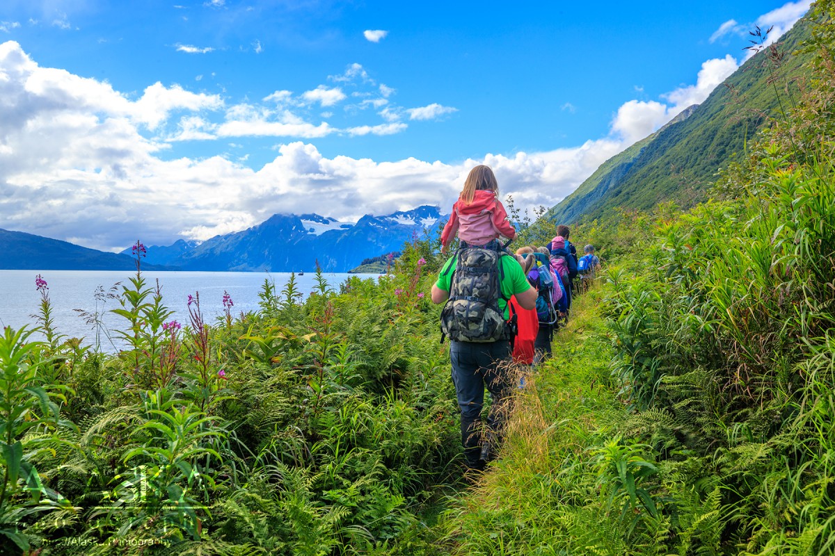
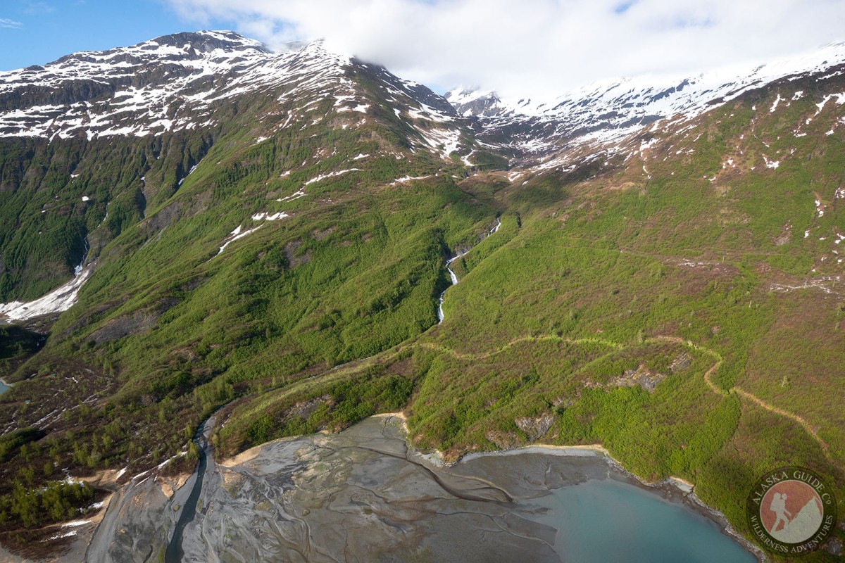
Quickly the trail narrows as it follows the slope which gets steeper and steeper. The the slope gets steep, but the grade of the trail maintains an easy climb. Mountain goats may sometimes be found high above the trail along the rock faces. In May it is possible to watch humpback whales breaching in Port Valdez.
The trail in this section passes across many waterfalls. They are easily crossed without getting wet. Sometimes hikers will pack little water assuming to refill at these falls but it is possible for them to run dry if it has been hot and dry for successive days. So always a good idea to bring a full water bottle on this hike, especially if it's been hot.
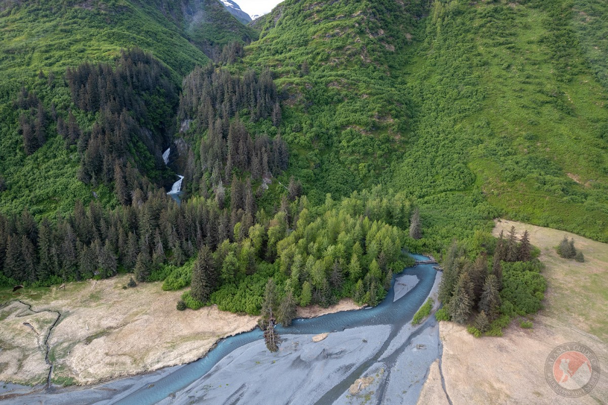
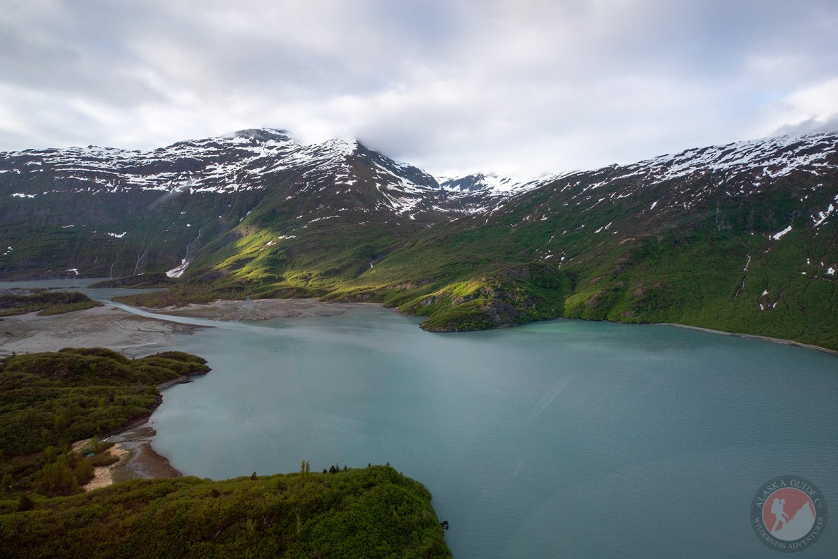
Once Shoup Bay Trail reaches Gold Creek the trail comes down near the beach and has trails to the beach. There are a couple camping spots along Gold Creek, and bear proof food lockers. The camping spots can become flooded if it has been heavily raining for a few days.
Most hikers will end their hike here and return to Valdez to make for an adequate day hike, while many hikers continuing to Shoup Bay plan on it being a multi-day hike or having someone pick them up in a boat.
In Valdez, the Richardson Highway turns into Egan Dr. As if driving into Valdez on the Richardson Highway, proceed along Egan Dr. Egan Dr crosses Mineral Creek (which might look more like a small river to some). Keep going straight after crossing the bridge and the road ends. The trailhead is on the left side of the road with a small outhouse in the parking lot.
Shoup Bay Trail was an old trail put in to Camp Bowie and the Cliff Mine, both are now abandoned. The trail was supposedly state maintained but little was done so it was a narrow trail. In 2015-2016 local outdoors group Levitation 49 became official care takers of the trail and sporadically host trail improvement sessions on Shoup Bay Trail.
Anderson Bay, Jack Bay, The Lagoon, Port Valdez, Shoup Bay,
Capes:Allison Point, Dock Point, Jackson Point,
Caves:Cities:Crags:Valdez Glacier Campground Wall, Lookout Rock, Panorama Point,
Dams:Solomon Gulch Dam A, Solomon Gulch Dam B, Solomon Lake Dam,
Flats:Glaciers:Glacier G213478E61182N, Allison Glacier, Area 51 Glacier, Glacier G213498E61160N, Glacier G213500E61175N, Glacier G213550E61021N, Glacier G213583E61167N, Glacier G213585E61165N, Glacier G213585E61165N, Glacier G213602E61200N, Glacier G213603E61218N, Glacier G213614E61180N, Glacier G213653E61264N, Glacier G213685E61168N, Glacier G213687E60954N, Glacier G213708E60993N, Glacier G213722E60985N, Glacier G213723E61170N, Glacier G213727E61240N, Glacier G213737E60948N, Glacier G213739E61247N, Glacier G213740E61167N, Glacier G213742E61233N, Glacier G213749E60966N, Glacier G213750E61221N, Glacier G213756E61212N, Glacier G213756E61263N, Glacier G213766E60924N, Glacier G213767E61200N, Glacier G213767E61245N, Glacier G213770E61226N, Glacier G213775E60940N, Glacier G213777E61166N, Glacier G213778E61174N, Glacier G213780E61222N, Glacier G213780E61222N, Glacier G213783E60980N, Glacier G213784E61033N, Glacier G213788E60991N, Glacier G213798E61012N, Glacier G213804E61037N, G-g-g-g-g Glacier, Johnson Glacier, Kate Glacier, Mineral Creek Glacier, Salmon Creek Glacier, Shoup Glacier, Valdez Glacier,
Routes:Blue Horizons, Excalibur, Gravy Tran, Kayaker's Delight, Necromancer, Peggy's Mane, Wowie Zowie,
Islands:Ammunition Island, Mineral Creek Islands,
Lakes:Allison Lake, Silver Lake, Solomon Gulch Lake, Solomon Lake, Solomon Lake,
Locales:Airport Chute, Alaska Guide Company - Office, Area 51, Basin Cove, Cabell Chute, Chuck Chute, Chuck Junior, Delta Chute, Grant Chute, Jago Chute, Lookout Bowl, Lucky 13, Runner's Delight, Sentinel, Sheepshead Chute, Tombstone Wall,
Mine:Big Four Mine, Cash Mine, Giant Mine, Hercules Mine, Johnson Mine, Midas Mine,
Mountains:Mount Francis, Mount Kate, Mount Logan, Mount Hogan, Mummy Mountain, Mount Shasta, Mount Shouplina, Sugarloaf Mountain, Valdez Summit, West Peak,
Parks:Jack Bay State Marine Park, Shoup Bay State Marine Park,
Peaks:Benzene, Bob's Knob, Comstock, Embick, High Back, Mile High Peak, Snow Dome, Titan Chair,
Rivers:Duck River, Lowe River, Robe River,
Routes:Lazy Days, No Floss Necessary, Route number 1, Route number 3, Trim the Bush, Wet Finish,
Routes:Already Herd, Bicentennial, Bongo That Bitch, Brand New, Canadian Heat Wave, Cotter Unlimited, Danger Stranger, Dragon's Teeth, Dynosaur, The Firing Line, Gusel Jugs, Harristotle, Kentner's Mill, Leaf BlowersL, Ledgeway to Sleven, Lefty Lucy, People Get Up And Drive Your Funky Soul, Quartzsite's Strike, Reacharound, Redheaded Stepchild, Righty Tighty, Route number 2, Slabawooke, The Nose Knows, Your Favorite Weapon,
Streams:Abercrombie Creek, Allison Creek, Brevier Creek, Corbin Creek, Crooked Creek, Dayville Creek, East Fork Mineral Creek, Glacier Creek, Gold Creek, Horsetail Creek, McAllister Creek, Millard Creek, Mineral Creek, Palmer Creek, Salmon Creek, Sawmill Creek, Slater Creek, Uno Creek, Valdez Glacier Stream, Wood Creek,
Routes:Area 51 Access Trail, Dayville Power Line Trail, Dock Point Trail, Mount Francis Winter Trail, High School Hill, High School Hill to Summit Trail, High School Hill Water Tower Trail, Hogsback Trail, Homestead Trail, Jack Bay Island Trail, John Hunter Memorial Trail, Levee to Valdez Glacier Trail, Lost Toque Trail, Mineral Creek East Trail, Mineral Creek Stamp Mill Trail, Mineral Creek West Trail, Northern Robe Lake Trail, River Drive Trail, Robe River Hogsback Access Trail, Shoup Bay Trail, Solomon Gulch Valdez Overlook Spur, Southern Robe Lake Trail, Valdez Bike Path, Valdez Overlook Trail,
Valleys:Abercrombie Gulch, Solomon Gulch,
Cities:Pictures of, from, or near Shoup Bay Trail.