Gold Creek Gallery
Pictures of, from, or near Gold Creek.
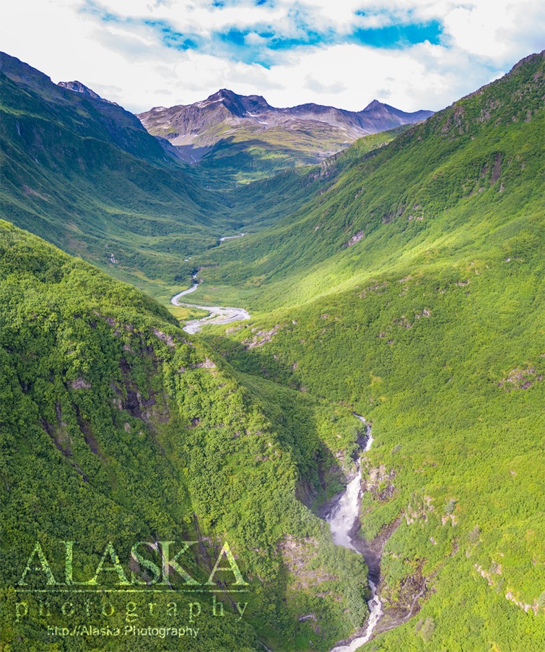
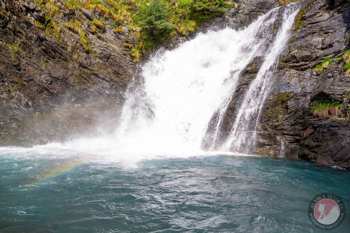
heads in a glacier, flows S to Port Valdez, 0.7 mi. NE of Camp Bowie, 7 mi. W of Valdez, Chugach Mts. 4 miles long.
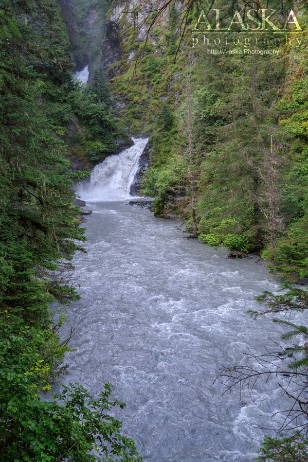
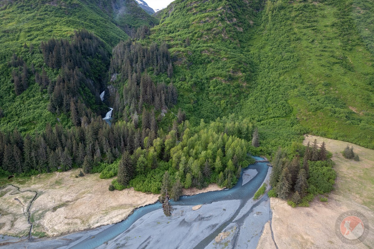
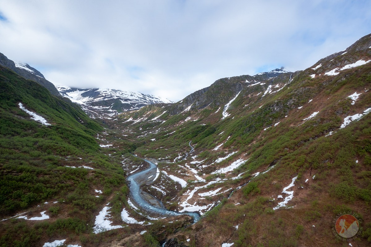
Gold Creek is a good sized creek that if one were to cross without using the Shoup Bay Trail bridge, might find themselves in swift waist deep water. Much of the creek runs high in the mountains in a bowl valley before dropping over a series of falls. Only the last 1,000 ft of the creek flows down along fairly level ground, that 99.9% of the time, is the only portion of the creek ever accessed.
The easiest ways to access Gold Creek are via boat in Port Valdez, or hiking out along the Shoup Bay Trail.
Local name published in 1950 by U.S. Geological Survey (USGS).Naming: Gold Creek was a local name published in 1950 by USGS.
Anderson Bay, Galena Bay, Jack Bay, The Lagoon, Port Valdez, Shoup Bay,
Capes:Allison Point, Dock Point, Entrance Point, Jackson Point, Tongue Point,
Caves:Channels:Cities:Dams:Solomon Gulch Dam A, Solomon Gulch Dam B, Solomon Lake Dam,
Flats:Glaciers:Glacier G213478E61182N, Allison Glacier, Annin Glacier, Area 51 Glacier, Glacier G213498E61160N, Glacier G213500E61175N, Glacier G213550E61021N, Glacier G213583E61167N, Glacier G213585E61165N, Glacier G213585E61165N, Glacier G213602E61200N, Glacier G213603E61218N, Glacier G213614E61180N, Glacier G213653E61264N, Glacier G213685E61168N, Glacier G213687E60954N, Glacier G213708E60993N, Glacier G213722E60985N, Glacier G213723E61170N, Glacier G213727E61240N, Glacier G213740E61167N, Glacier G213742E61233N, Johnson Glacier, Kate Glacier, Mineral Creek Glacier, Salmon Creek Glacier, Shoup Glacier, Westbrook Glacier,
Routes:Blue Horizons, Excalibur, Gravy Tran, Kayaker's Delight, Necromancer, Peggy's Mane, Wowie Zowie,
Islands:Ammunition Island, Entrance Island, Middle Rock, Mineral Creek Islands,
Lakes:Allison Lake, Silver Lake, Solomon Gulch Lake, Solomon Lake, Solomon Lake,
Locales:Area 51, Basin Cove, Cabell Chute, Chuck Chute, Chuck Junior, Jago Chute, Lucky 13, Runner's Delight, Sentinel, Sheepshead Chute,
Mine:Big Four Mine, Cash Mine, Giant Mine, Hercules Mine, Johnson Mine, Midas Mine,
Mountains:Mount Cameron, Ellamar Mountain, Mount Kate, Lindita Peak, Mount Logan, Mount Hogan, Mummy Mountain, Mount Shasta, Mount Shouplina, Sugarloaf Mountain, Tazcol Peak,
Parks:Jack Bay State Marine Park, Shoup Bay State Marine Park,
Peaks:Benzene, Mile High Peak, Snow Dome,
Rivers:Streams:Allison Creek, Big Creek, Brevier Creek, Crooked Creek, Dayville Creek, East Fork Mineral Creek, Glacier Creek, Gold Creek, Gregorioff Creek, Horsetail Creek, Indian Creek, Johnson Creek, Levshakoff Creek, McAllister Creek, Millard Creek, Mineral Creek, Palmer Creek, Salmon Creek, Sawmill Creek, Uno Creek, Valdez Glacier Stream, Wood Creek,
Routes:Area 51 Access Trail, Dock Point Trail, High School Hill, High School Hill to Summit Trail, High School Hill Water Tower Trail, Homestead Trail, Jack Bay Island Trail, John Hunter Memorial Trail, Mineral Creek East Trail, Mineral Creek Stamp Mill Trail, Mineral Creek West Trail, Shoup Bay Trail, Solomon Gulch Valdez Overlook Spur, Valdez Bike Path, Valdez Overlook Trail,
Valleys:Cities:Pictures of, from, or near Gold Creek.