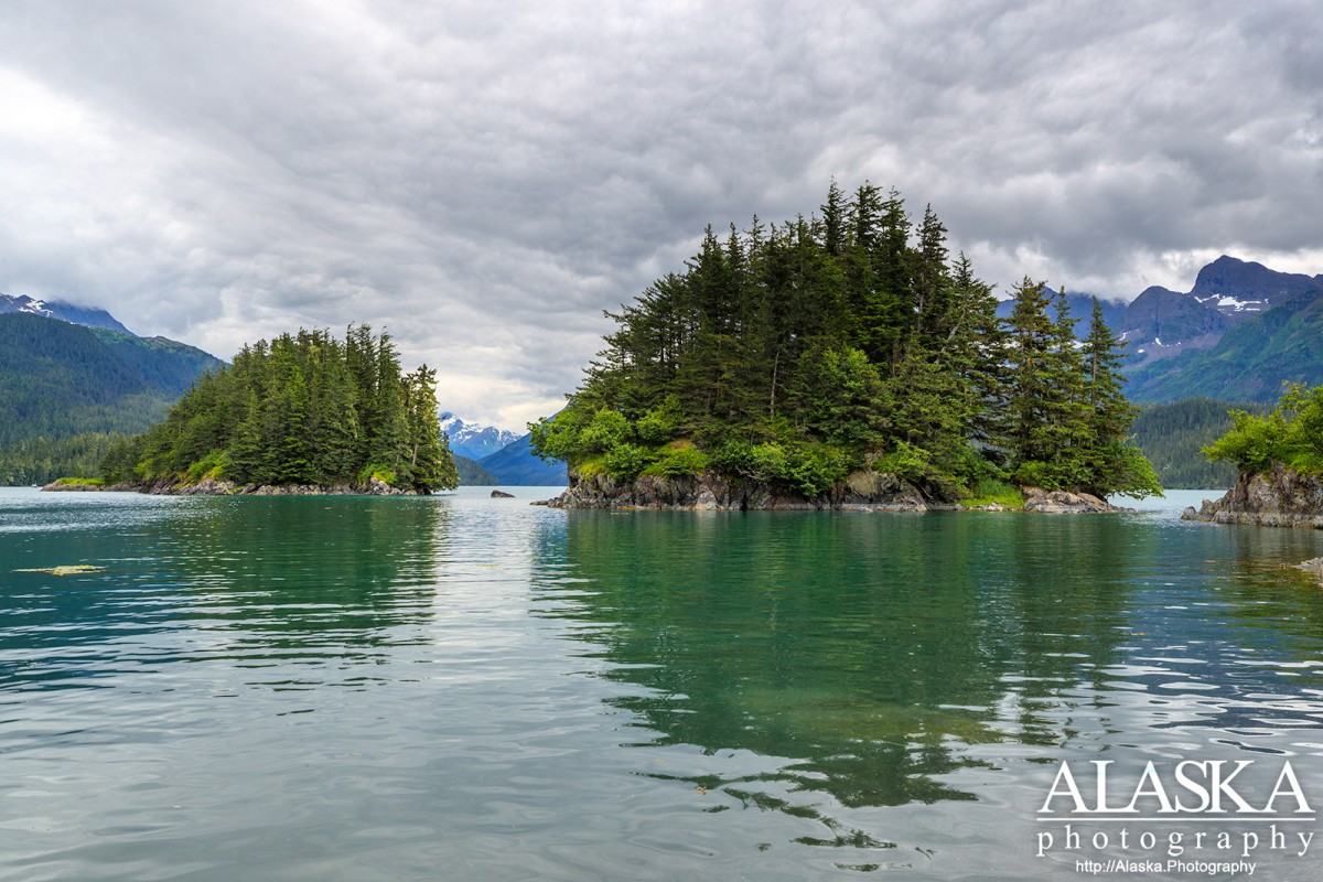
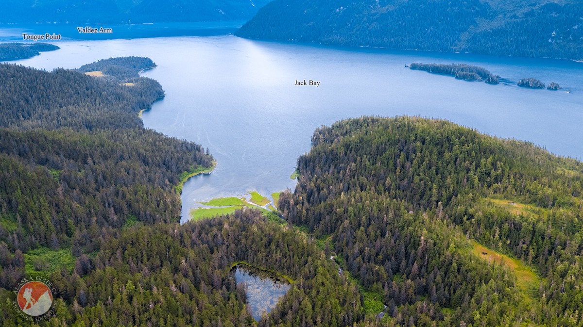
Jack Bay Gallery
Pictures of, from, or near Jack Bay.
Located 14 miles southwest of Valdez, among the Chugach Mountains. Jack Bay trends south from Valdez Arm for 7 miles.
The easiest way to access Jack Bay is by taking a boat from Valdez. If you don't bring your own, there are a few charters and boat rental places in town.
Naming: Named "Jack's Bay" in 1898 by Captain W. R. Abercrombie, USA, presumably for W. G. Jack, a local prospector.
Anderson Bay, Boulder Bay, Cloudman Bay, Fish Bay, Galena Bay, Jack Bay, The Lagoon, Landlocked Bay, Port Valdez, Sawmill Bay, Shoup Bay, Valdez Arm, Virgin Bay, West Bay,
Capes:Bidarka Point, Black Point, Copper Mountain Peninsula, Entrance Point, Point Lowe, Potato Point, Rocky Point, Tongue Point,
Caves:Channels:The Narrows, Tatitlek Narrows, Valdez Narrows,
Dams:Ellamar Dam Number 1, Ellamar Dam Number 2, Tatitlek Dam, Tatitlek Supply Dam,
Fictional Places:Glaciers:Glacier G213478E61182N, Anderson Glacier, Annin Glacier, Glacier G213498E61160N, Glacier G213500E61175N, Glacier G213550E61021N, Glacier G213583E61167N, Glacier G213585E61165N, Glacier G213585E61165N, Glacier G213602E61200N, Glacier G213603E61218N, Glacier G213614E61180N, Salmon Creek Glacier, Shoup Glacier, Silver Glacier, Westbrook Glacier,
Islands:Bligh Island, Busby Island, Entrance Island, Middle Rock,
Lakes:Copper Lake, Devish Lake, Millard Lake, Lake Number 1, Silver Lake, Turner Lake,
Locales:Mine:Mountains:Bells Butte, Billygoat Mountain, Mount Cameron, Copper Mountain, Ellamar Mountain, Mount Hogan, Mount Shasta, Mount Thomas,
Parks:Jack Bay State Marine Park, Sawmill Bay State Marine Park, Shoup Bay State Marine Park,
Mountain Passes:Peaks:Rivers:Streams:Banzer Creek, Big Creek, Black Creek, Chisna Creek, Clear Creek, Copper Creek, Dayville Creek, Donaldson Creek, Fault Creek, Gladhaugh Creek, Gold Creek, Gregorioff Creek, Horsetail Falls Creek, Indian Creek, Johnson Cove Creek, Johnson Creek, Lagoon Creek, Levshakoff Creek, McAllister Creek, Millard Creek, Mineral Creek, Palmer Creek, Reynolds Creek, Salmon Creek, Sawmill Creek, Stellar Creek, Twin Falls Creek, Uno Creek,
Routes:Homestead Trail, Jack Bay Island Trail, Mineral Creek East Trail, Mineral Creek West Trail, Shoup Bay Trail,
Valleys:Cities:Pictures of, from, or near Jack Bay.