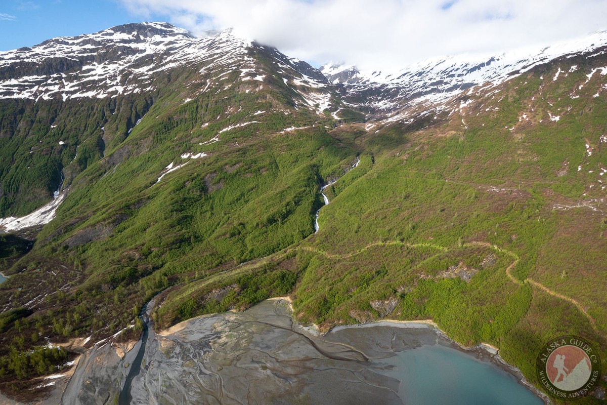
Mount Hogan Gallery
Pictures of, from, or near Mount Hogan.
1.8 mi. NE of Mount Shasta and 10.5 mi. NW of Valdez, Chugach Mts.
Prospectors name reported in 1911 by J. W. Bagley and C. E. Giffin, U.S. Geological Survey (USGS).
Anderson Bay, Jack Bay, Port Valdez, Shoup Bay,
Capes:Allison Point, Dock Point, Entrance Point, Jackson Point, Potato Point, Tongue Point,
Caves:Channels:Cities:Dams:Solomon Gulch Dam A, Solomon Gulch Dam B, Solomon Lake Dam,
Flats:Glaciers:Glacier G213478E61182N, Allison Glacier, Anderson Glacier, Annin Glacier, Area 51 Glacier, Glacier G213498E61160N, Glacier G213500E61175N, Glacier G213550E61021N, Glacier G213583E61167N, Glacier G213585E61165N, Glacier G213585E61165N, Glacier G213602E61200N, Glacier G213603E61218N, Glacier G213614E61180N, Glacier G213653E61264N, Glacier G213685E61168N, Johnson Glacier, Kate Glacier, Mineral Creek Glacier, Salmon Creek Glacier, Shoup Glacier, Westbrook Glacier,
Routes:Blue Horizons, Excalibur, Gravy Tran, Kayaker's Delight, Necromancer, Peggy's Mane, Wowie Zowie,
Islands:Ammunition Island, Entrance Island, Middle Rock, Mineral Creek Islands,
Lakes:Allison Lake, Solomon Gulch Lake, Solomon Lake,
Locales:Area 51, Cabell Chute, Chuck Chute, Chuck Junior, Jago Chute, Lucky 13, Runner's Delight, Sentinel, Sheepshead Chute,
Mine:Big Four Mine, Hercules Mine, Johnson Mine,
Mountains:Mount Cameron, Mount Cashman, Mount Kate, Lindita Peak, Mount Logan, Mount Hogan, Mummy Mountain, Pandora Peak, Mount Shasta, Mount Shouplina, Tazcol Peak, Mount Thomas,
Parks:Jack Bay State Marine Park, Shoup Bay State Marine Park,
Mountain Passes:Peaks:Benzene, Dorothita, Freuchen, Mile High Peak, Mount Rachel Carson, Snow Dome, Stegosaurus,
Streams:Allison Creek, Big Creek, Brevier Creek, Crooked Creek, Dayville Creek, Donaldson Creek, East Fork Mineral Creek, Glacier Creek, Gold Creek, Gregorioff Creek, Horsetail Creek, Johnson Cove Creek, Johnson Creek, Levshakoff Creek, McAllister Creek, Mineral Creek, Palmer Creek, Salmon Creek, Sawmill Creek, Uno Creek, Wood Creek,
Routes:Area 51 Access Trail, Dock Point Trail, High School Hill, High School Hill to Summit Trail, High School Hill Water Tower Trail, Homestead Trail, Jack Bay Island Trail, John Hunter Memorial Trail, Mineral Creek East Trail, Mineral Creek Stamp Mill Trail, Mineral Creek West Trail, Shoup Bay Trail, Solomon Gulch Valdez Overlook Spur, Valdez Bike Path, Valdez Overlook Trail,
Valleys:Pictures of, from, or near Mount Hogan.