Flower Mountain Gallery
Pictures of, from, or near Flower Mountain.
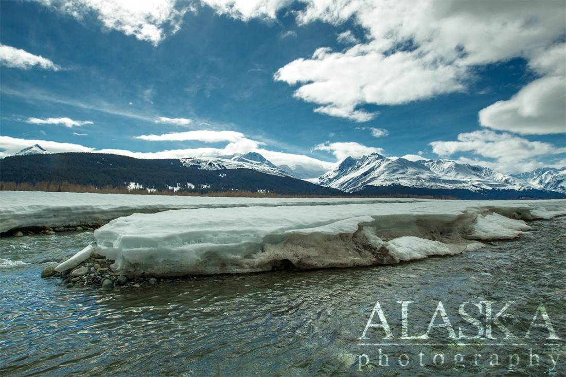
1.8 mi. S of terminus of Saksaia Glacier and 38 mi. SW of Skagway, St. Elias Mts.
Located west of Haines, along the south side of the Klehini River, Flower Mountain is a beautiful long alpine ridge with a prominent peak at its end.
To get to Flower Mountain you head 26 miles up the Haines Highway from Haines. From there you turn left over the steel bridge. The road splits after the bridge and you stay to the right. About a mile further the road splits again once again stay to the right following the Klehini River west about 8 miles. At that point you come to an area with lots of roads. Go straight and you pass over Porcupine Creek, through some tall brush, to the historic site of Porcupine. There is a road going left, through the remains of Porcupine, then up the hill side. After you pass through Porcupine stay straight. The road forks to the left right as you can go up the hill. If you go left it will take you to the scene of Discovery Channels "Gold Rush Alaska" and they won't be too happy about you interrupting filming. You will need a tough 4 wheel drive vehicle or ATV to make it up along the ridge. It will take you above the tree line and to beautiful Flower Mountain. From Porcupine to actual Flower Mountain is about 7.5 miles.
Name reported in 1952 by E. C. Robertson, U.S. Geological Survey (USGS), to have been given by "an unknown botanist between 1932-42, who found a luxuriant growth of a great variety of flowers on the mountain."Naming: It's name was reported in 1952 by E.C. Robertson, USGS, to have been given by "an unknown botanist between 1932-1942, who found a luxuriant growth of a great variety of flowers on the mountain."
Le Blondeau Glacier, Boundary Glacier, Glacier G223637E59372N, Glacier G223641E59360N, Glacier G223642E59341N, Jarvis Glacier, Little Jarvis Glacier, Morse Glacier, Riggs Glacier, Saksaia Glacier, Tsirku Glacier,
Mine:Cahoon Creek Mine, Christmas Creek Mine, Glacier Creek Mine, Porcupine Creek Mine,
Mountains:Boundary Peak 154, Boundary Peak 155, Mount Cheetdeekahyu, Chilkat Peak, Flower Mountain, Mount Harris, Mount Henry Clay, Mount McDonell, Porcupine Peak, Mount Prinsep, Sunshine Mountain, Surgeon Mountain,
Streams:37 Mile Creek, Bear Creek, Big Boulder Creek, Cahoon Creek, Cottonwood Creek, Glacier Creek, Jarvis Creek, McKinley Creek, Nugget Creek, Porcupine Creek, Rosaunt Creek,
Cities:Pictures of, from, or near Flower Mountain.