Sullivan Island Gallery
Pictures of, from, or near Sullivan Island.
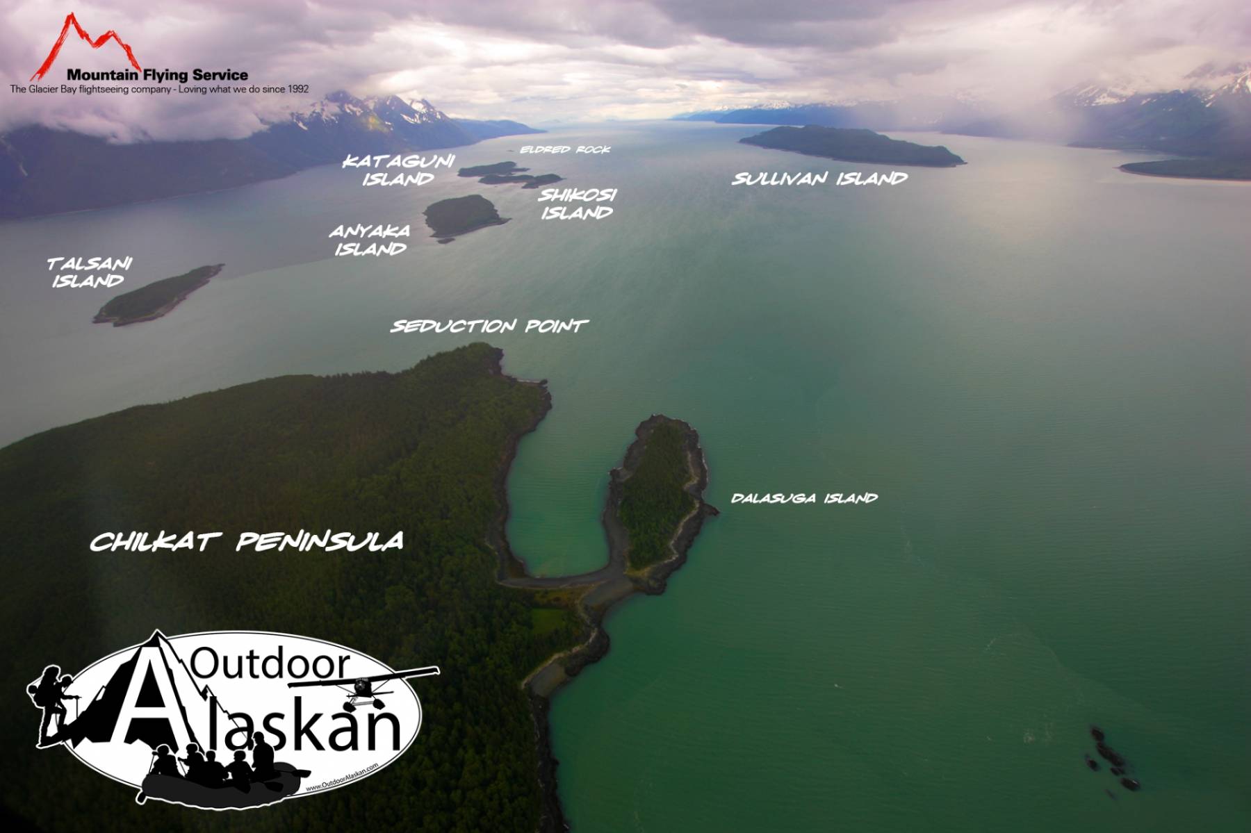
off W shore of Lynn Canal, 2.5 mi. SW of Chilkat Island and 53 mi. NW of Juneau, St. Elias Mts.
Named by Commander R. W. Meade, U.S. Navy (USN), in 1869 for the master of the American Schooner Louisa Downs, which was wrecked on the island in 1867. The name was published by U.S. Coast and Geodetic Survey (USC&GS) in the 1883 Coast Pilot (p. 196). The Tlingit Indian name for this island is "Schikuk" (Krause, 1885, p. 253).
Chilkat Inlet, Kalhagu Cove, Letnikof Cove, Mud Bay, Paradise Cove, Pyramid Harbor, Rescue Harbor,
Capes:Anchorage Point, Chilkat Peninsula, Glacier Point, Green Point, Lehunua Point, Seduction Point, Point Sherman,
Dams:Glaciers:Davidson Glacier, Rainbow Glacier,
Islands:Anyaka Island, Dalasuga Island, Eldred Rock, Kataguni Island, Kochu Island, Lehunua Island, Shikosi Island, Sullivan Island, Sullivan Rock, Talsani Island,
Lakes:Independence Lake, Rustabach Lake, Rutzebeck Lake,
Mountains:Mount Riley, Sinclair Mountain, Sullivan Mountain,
Parks:Chilkat Islands State Marine Park,
Peaks:Devils Fist, Outkaste Picket, Rockfall Tower, Rotting Death Spire, Satans Mistress, Selby, Termination Peak, The Trickster, Twin,
Reserves:Rivers:Endicott River, Glacier River,
Streams:Ludaseska Creek, Ophir Creek, Sherman Creek, Sweeny Creek, Yeldagalga Creek,
Routes:Nahku Portage, Seduction Point Trail,
Cities:Pictures of, from, or near Sullivan Island.