Bare Island Gallery
Pictures of, from, or near Bare Island.
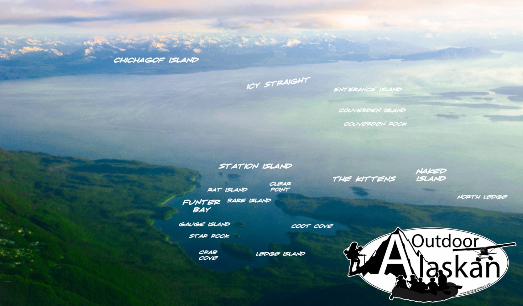
in Kupreanof Strait at mouth of Dry Spruce Bay, N of Kodiak I. 1 mile long.
Translation of the name "(Ostrov) Goloy," given in 1839 or 1840 by Sub-Lt. Mikhail Murashev Imperial Russian Navy (IRN) and published in 1849 on Russian Hydrographic Dept. Chart 1425.
Barabara Cove, Dry Spruce Bay, Kizhuyak Bay, Muskomee Bay, Onion Bay, Selief Bay, Settler Cove, Terror Bay, Viekoda Bay, Waskanareska Bay, Yukuk Bay,
Capes:Bukti Point, Cape Nuniliak, Chernof Point, Dolphin Point, Drying Point, Gori Point, Kupreanof Peninsula, Last Timber Point, Low Cape, Nachalni Point, Naugolka Point, Nochlega Point, Occident Point, Ostrovka Point, Outlet Cape, Perenosa Point, Rolling Point, Seiba Point, Tiger Cape, Ustia Point,
Channels:Kupreanof Strait, The Narrows, Raspberry Strait, The Slough,
Cities:Dams:Port Lions Dam, Port Wakefield Dam,
Islands:Bare Island, Deranof Island, Dry Spruce Island, Little Raspberry Island, Nachalni Island, Raspberry Island,
Lakes:Afognak Lake, Lower Malina Lake, Upper Malina Lake,
Mountains:Afognak Mountain, Cloud Peak, Mount Ellison, Godfrey Mountain, Kupreanof Mountain, Mount Lowell Wakefield,
Pillars:Streams:Cities:Pictures of, from, or near Bare Island.