Cleave Creek Glacier Gallery
Pictures of, from, or near Cleave Creek Glacier.
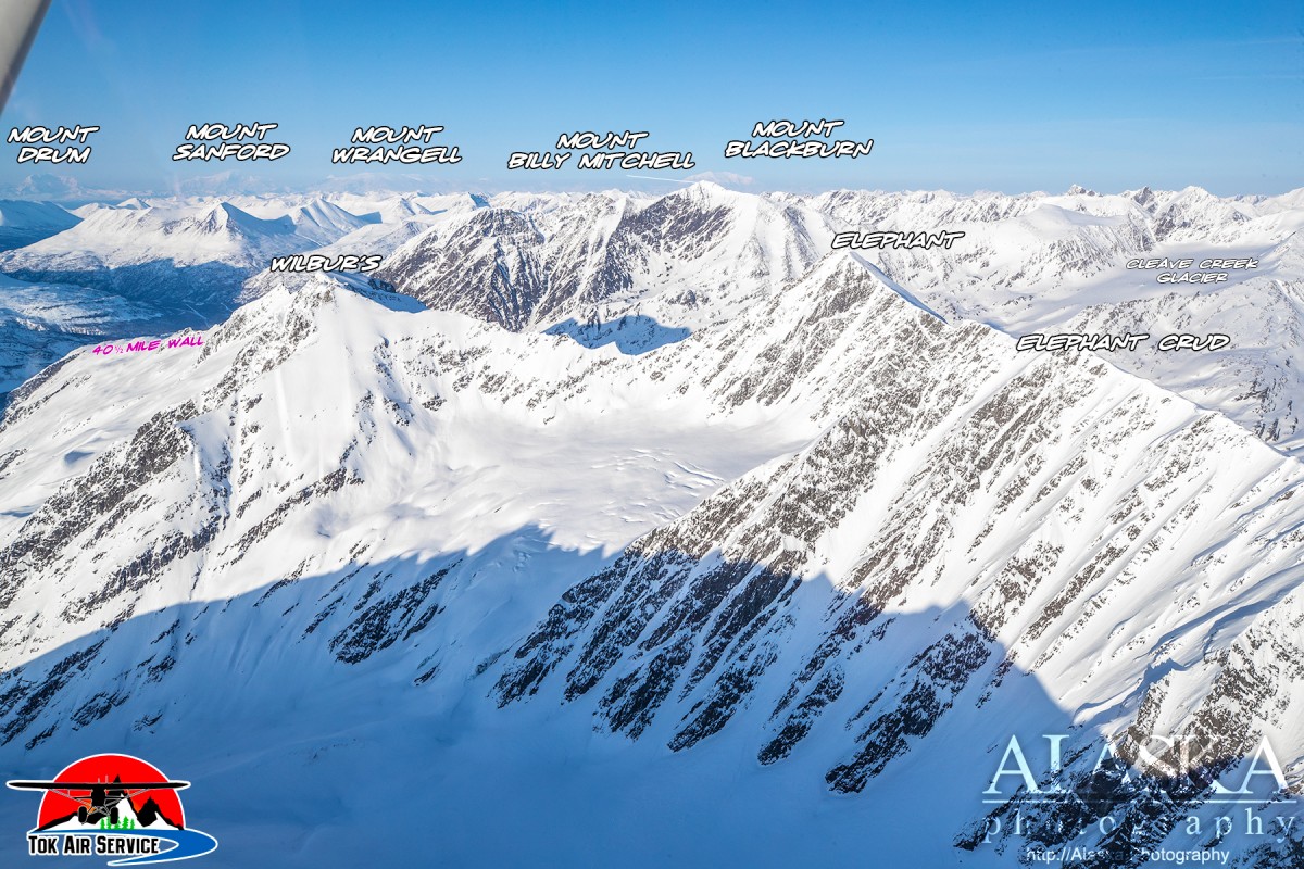
Cleave Creek Glacier sits on the back side of the mountains that line Thompson Pass to the south, and 9 mi. ENE of Marshall Pass, 34 miles E of Valdez, on the far east end of the Chugach Mountains.
Cleave Creek Glacier is sometimes used for glacier base camp for those wishing to get in some famous backcountry skiing away from the hustle and bustle along Thompson Pass.
In late March through April Tok Air Service flies out of Thompson Pass. Otherwise people can ski back there.
Local name published in 1950 by U.S. Geological Survey (USGS).
Cleave Creek Glacier, Glacier G214627E61131N, Glacier G214638E61142N, Glacier G214716E61218N, Glacier G214732E61226N, Glacier G214744E61225N, Glacier G214747E61188N, Glacier G214858E61201N, Glacier G214859E61214N, Glacier G214875E61208N, Glacier G214977E61192N, Glacier G215003E61201N, Pencil Glacier, Schwan Glacier, Woodworth Glacier, Woodworth Glacier,
Locales:43 Mile Chute, Aftermath, Cauliflowers, Crudbusters, Disney World, Natural Selection 2023, Repeater Couloirs, Seal, Spaghetti Chutes, Three Towers,
Mountains:Mount Billy Mitchell, Mount Jimmy Doolittle, Rice Mountain, Mount Tiekel,
Peaks:Elephant, Elephant Crud, Happiness, Purple Nurple, Pyramid, Super Bowl, Total Crud, Wilbur's,
Mountain Ranges:Ridges:Rivers:Streams:Pictures of, from, or near Cleave Creek Glacier.