Steller Glacier Gallery
Pictures of, from, or near Steller Glacier.
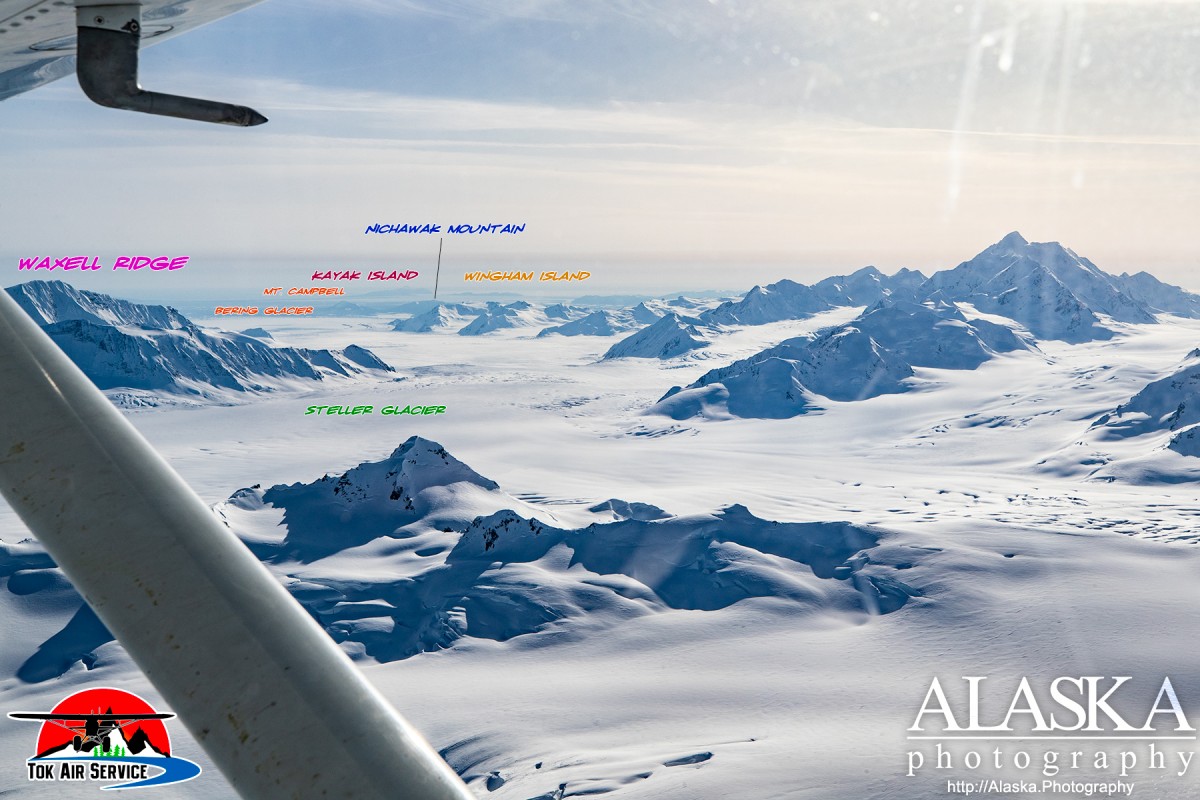
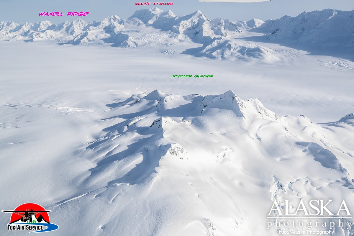
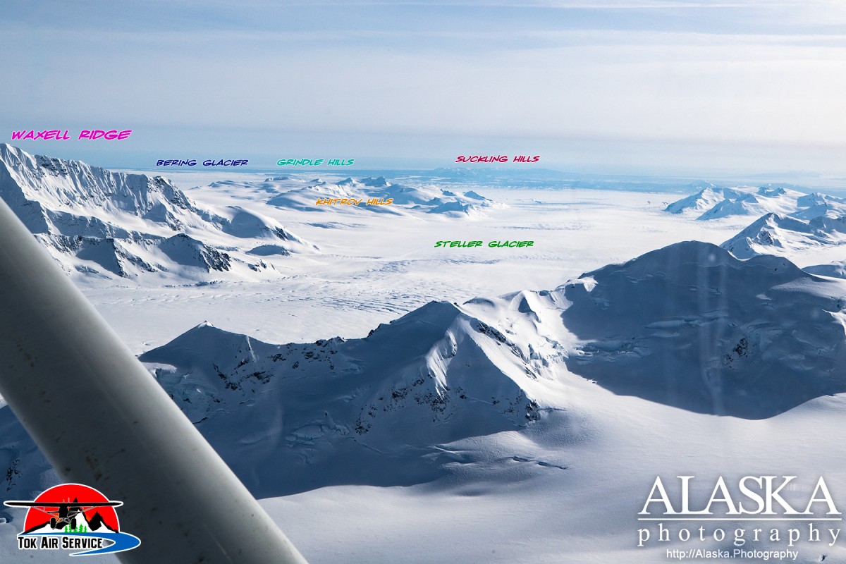
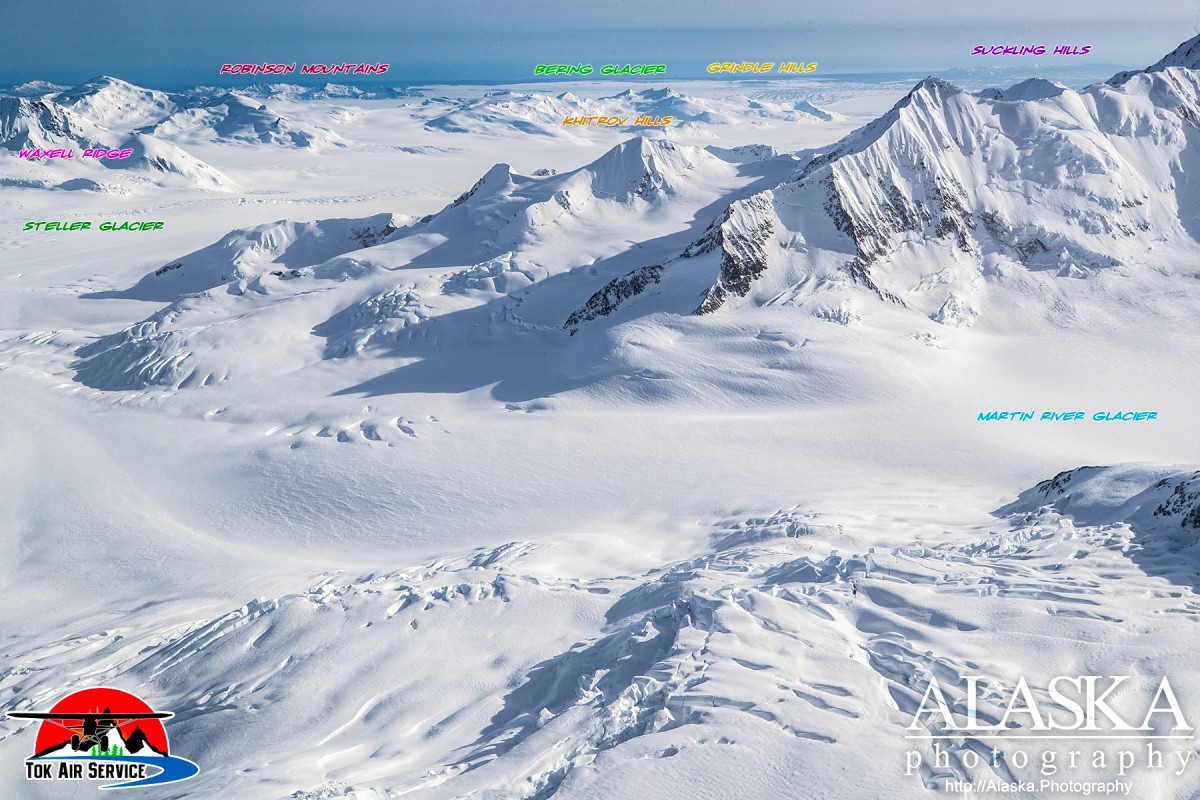
Heads in the west end of Bagley Icefield, trends southwest to Bering Glacier, 3 miles east of Fourth Lake and 73 miles east of Cordova, Chugach Mountains. 12 miles long.
Name derived from Mount Steller near the glacier's head and published in 1950 by U.S. Geological Survey (USGS). (AK-T1)
Bering Glacier, Griddlecake Glacier, Hesselberg Glacier, Steller Glacier, Steller Lobe,
Lakes:Lake Sofron, Fifth Lake, Fourth Berg Lake, Hohlinsock Lake,
Mountains:Mount Hawkins, Mount Tom White,
Mountain Ranges:Pictures of, from, or near Steller Glacier.