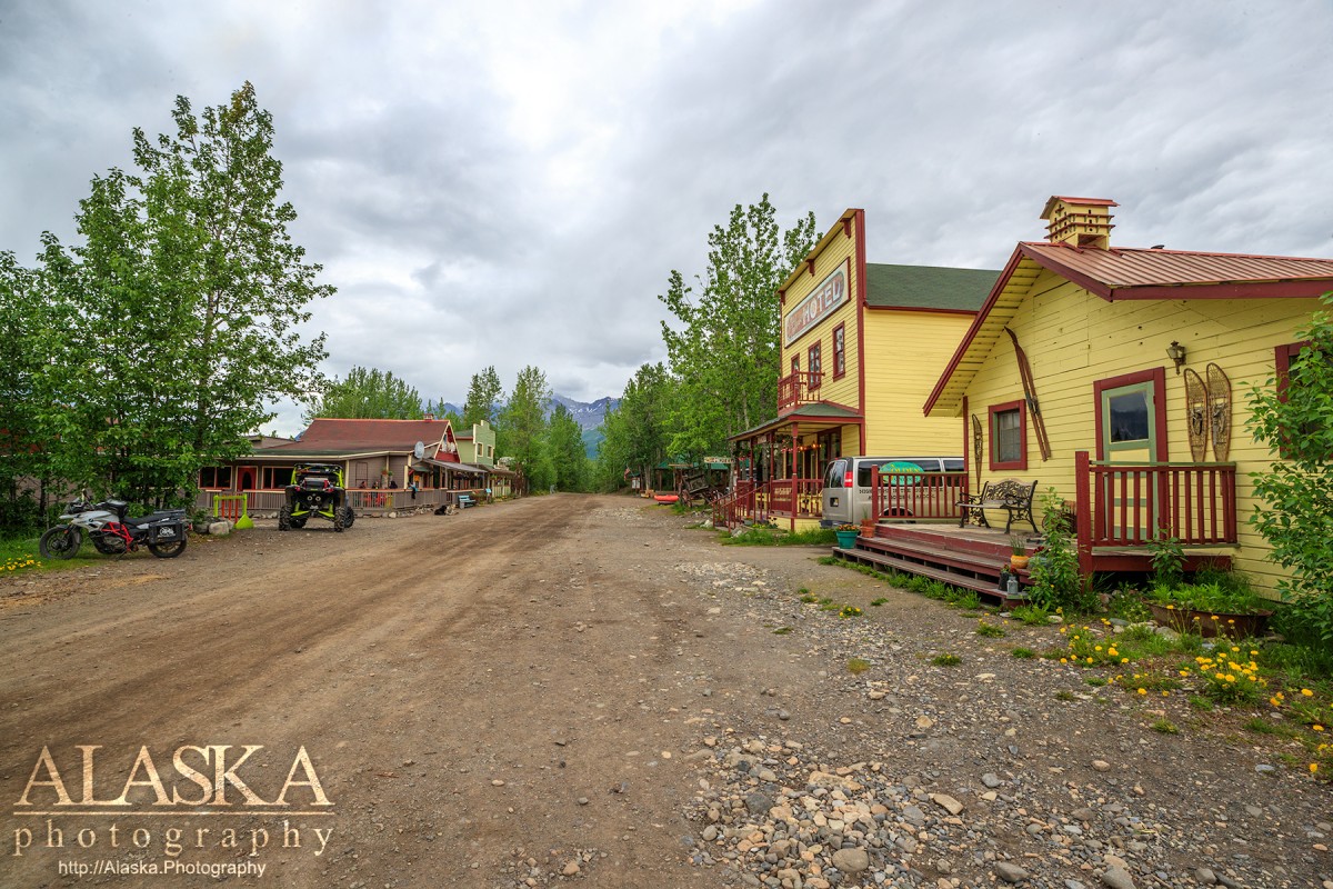
McCarthy Gallery
Pictures of, from, or near McCarthy.
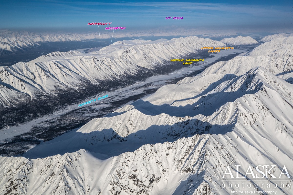
at mouth of McCarthy Creek, near Kennicott Glacier, 12 mi. NE of the junction of the Nizina and Chitina Rivers, Wrangell Mts.
Driving you if starting from Anchorage you will need to take the Glenn Highway to Glennallen and then south on Richardson Highway. From Fairbanks head south on the Richardson Highway. About 30 miles after Glennallen, after to reach Pippin Lake, turn left on to AK-10/Edgerton Hwy. Stay on the for 33 miles until you reach Chitina. The road will make a sharp left turn at the restaurant. Stay on it as it turns into McCarthy Rd, stay on that till it ends 60 miles later.
At McCarthy outskirts you park at "Basecamp" and proceed across the foot bridge. ATV's and bikes are permitted on the foot bridge. If on foot during the summer season there is a shuttle every half hour $5 each way.
Mining camp named for the stream established about 1908 with a population of 127 in 1920; 115 in 1930; and 49 in 1939. The McCarthy post office operated from 1912 to 1943. See Kennicott.
Gates Glacier, Kennicott Glacier, McCarthy Creek Glacier, Root Glacier, Stairway Icefall,
Lakes:Baultoff Lakes, Camel Lake, Hidden Creek Lake, Star Lake, Threemile Lake, Wheat Lake,
Mine:Bonanza Mine, Green Butte Mine, Jumbo Mine, Mother Lode Mine, Regal Mine,
Mountains:Bonanza Peak, Donoho Peak, Green Butte, Porphyry Mountain, Sourdough Peak,
Parks:Kennecott Mines National Historic Landmark,
Ridges:Bonanza Ridge, Sourdough Hill,
Rivers:Chakina River, Kennicott River,
Streams:Amazon Creek, Bonanza Creek, Dimond Creek, East Fork McCarthy Creek, Farm Creek, Fireweed Creek, Fourth of July Creek, Hidden Creek, Jumbo Creek, Lubbe Creek, McCarthy Creek, National Creek, Nikolai Creek, Swift Creek, Tractor Creek, Young Creek,
Routes:Bonanza Mine Road, Bonanza-Jumbo Mine Road, Erie Mine Trail, Jumbo Mine Trail, Root Glacier Trail,
Valleys:Amazon Gulch, Fivemile Gulch, Glacier Gulch, Kaufman Gulch, Sawmill Gulch,
Cities:Pictures of, from, or near McCarthy.
Sorted by Most Common to Least Common Viewings
Tree Swallow, American Robin, Yellow-rumped Warbler, White-crowned Sparrow, Violet-green Swallow, Dark-eyed Junco, Black-capped Chickadee, Golden-crowned Kinglet, Common Redpoll, Green-winged Teal, Swainson's Thrush, Western Wood-Pewee, Boreal Chickadee, Cliff Swallow, Hermit Thrush, Pine Grosbeak, Hoary Redpoll, White-winged Crossbill, Townsend's Warbler, Northern Shoveler, Mallard, Ring-necked Duck, Barrow's Goldeneye, Horned Grebe, Downy Woodpecker, Northern Flicker, Gray Jay, Common Raven, Ruby-crowned Kinglet, Pine Siskin, Northern Waterthrush, Orange-crowned Warbler, Yellow Warbler, Wilson's Warbler, Trumpeter Swan, American Wigeon, Wilson's Snipe, Spotted Sandpiper, Sharp-shinned Hawk, Belted Kingfisher, Hairy Woodpecker, Peregrine Falcon, Olive-sided Flycatcher, Alder Flycatcher, Hammond's Flycatcher, Say's Phoebe, Bank Swallow, Red-breasted Nuthatch, Brown Creeper, Varied Thrush, Gray-cheeked Thrush, Bohemian Waxwing, Fox Sparrow, Savannah Sparrow, Lincoln's Sparrow