McBride Glacier Gallery
Pictures of, from, or near McBride Glacier.
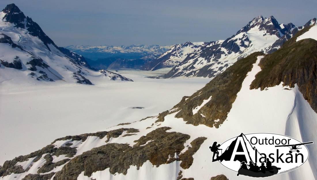
Located in Glacier Bay National Monument, heads on the southern side of the Takhinsha Mountains, trends south to Muir Inlet, 4 miles north of Sealers Island, and 42 miles southwest of Skagway, St Elias Mountains. (AK-T1)
Named in 1890 by Reid (1896, pl. 86) U.S. Geological Survey (USGS), for H. McBride, a member of his party in 1890. On the map dated 1890, Reid (1892, pl. 14) had named the glacier "Second North Tributary Muir Glacier," but later he changed the name to McBride Glacier. (AK-T1)
Goose Cove, Hunter Cove, Muir Inlet, Nunatak Cove, Stump Cove,
Capes:Point McLeod, Rowlee Point, Westdahl Point, Wolf Point,
Glaciers:Arthur Glacier, Aurel Glacier, Le Blondeau Glacier, Casement Glacier, Dickinson Glacier, McBride Glacier, Riggs Glacier, Takhin Glacier, Willard Glacier,
Hills:Islands:Mountains:Black Mountain, Mount Brock, Chunekukleik Mountain, Coleman Peak, Mount Elder, Mount Krause, The Nunatak, Nunatak Knob, Red Mountain, Sitth-gha-ee Peak, Snow Dome,
Peaks:Mountain Ranges:Ridges:Idaho Ridge, McConnell Ridge, Minnesota Ridge, Takhin Ridge, Van Horn Ridge, White Thunder Ridge,
Streams:Cottonwood Creek, Forest Creek, Nugget Creek,
Valleys:Pictures of, from, or near McBride Glacier.