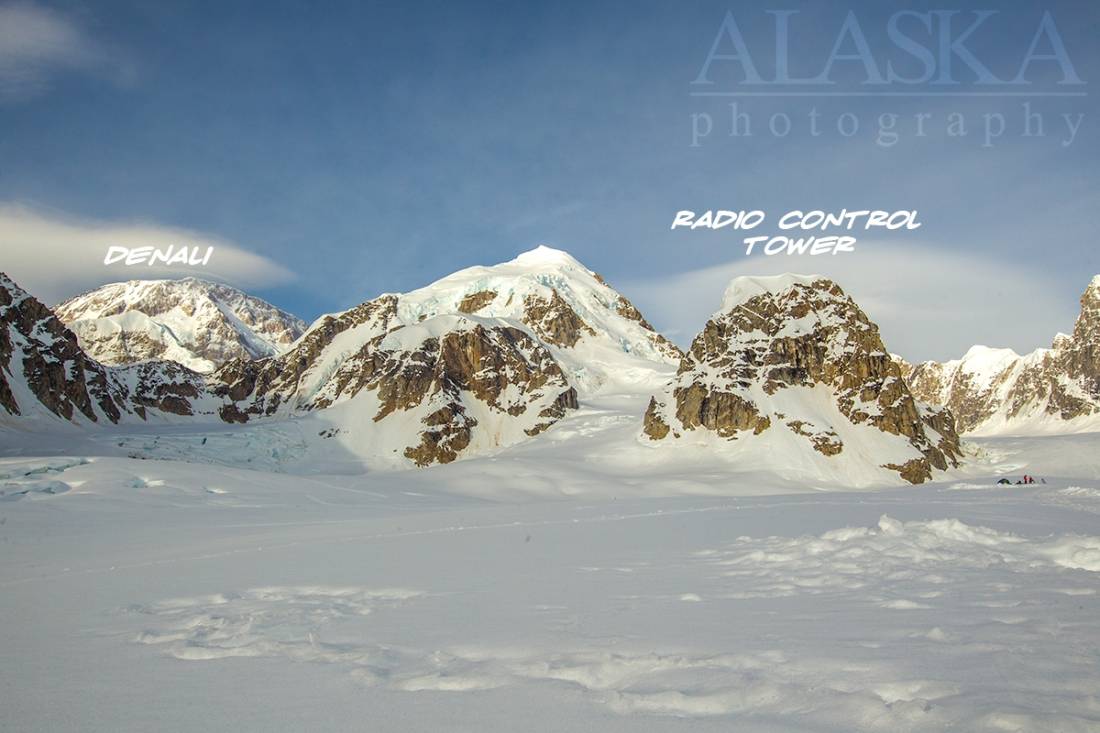
Radio Control Tower Gallery
Pictures of, from, or near Radio Control Tower.
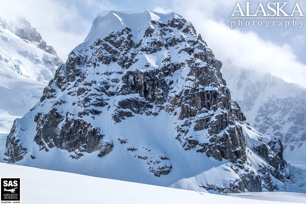
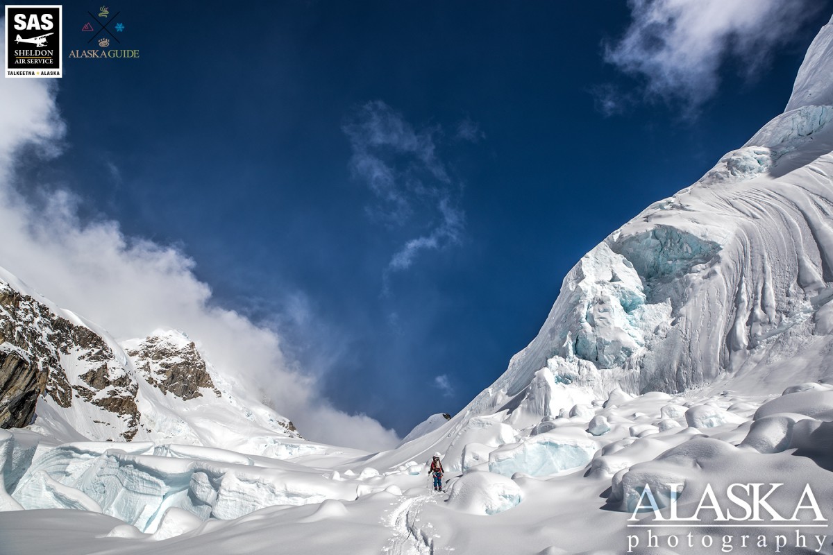
Radio Control Tower is just a short 4 mile round trip trek out of Denali Base Camp. One needs to exercise precaution and should be roped up if attempting it as there are many crevasses in route from basecamp. Even though it's not a difficult climb for the area, it's not one to be taken lightly.
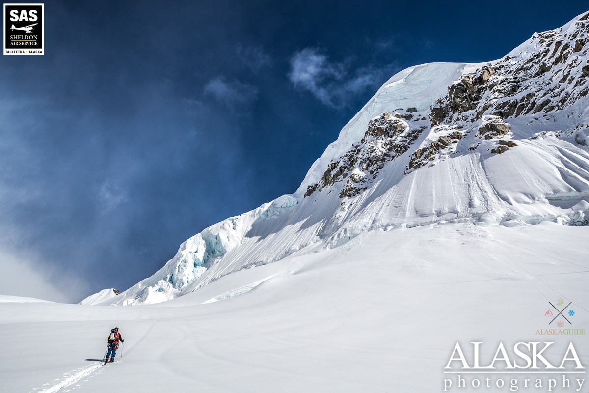
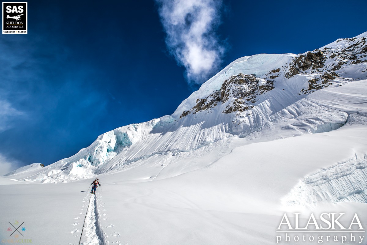
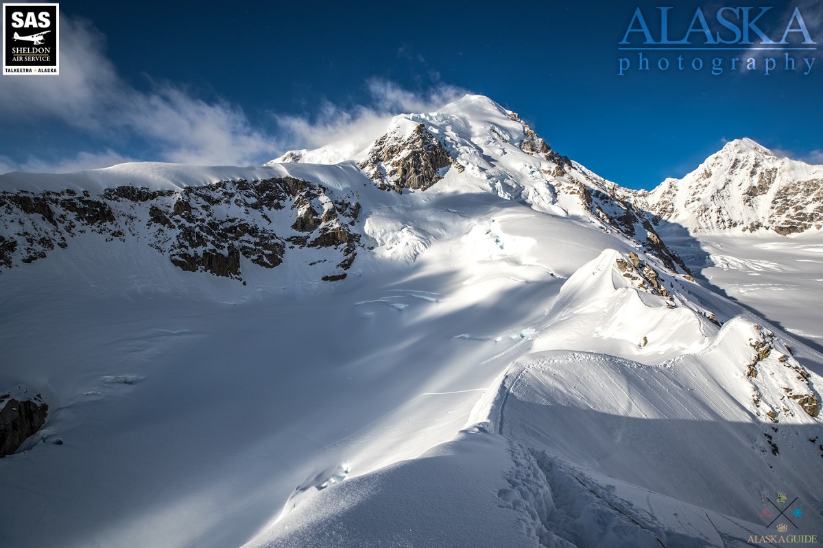
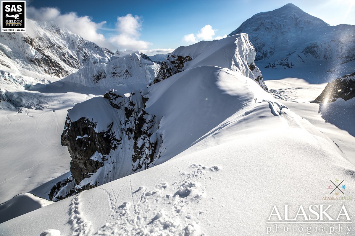
There are two routes up Radio Control Tower. Probably the most common route is further up the Southeast Fork of the Kahiltna Glacier. The other is up along the northern side of Radio Control Tower. Both meet on the northeastern ridge.
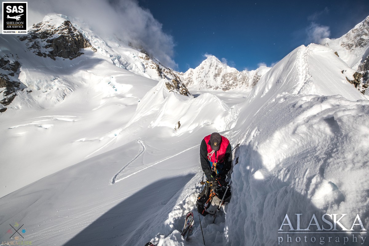
If taken the northern route you pass under seracs, and is easiest if you continue up the middle of to the back of the bowl. If you split south to take the more direct route to the ridge, climbing on to the ridge can be somewhat tricky as your essentially climbing a small cornice. There's an area where your feet punch through and it's a gap between the snow on which you're standing and the rock of the ridge, and about 2-3ft between that and the hard pack of the ridge. While climbing on to the ridge the back side (the side facing Hunter) is a rather steep drop.
Radio Control Tower is located right off base camp for Denali, Hunter, and Foraker. To get out there the easiest and fastest way is taking an air taxi from Talkeetna. There are three air taxi outfits which hold permits to land on the Southeast Fork Kahiltna Glacier.
East Fork Kahiltna Glacier, Harper Glacier, Harper Icefall, Jeffery Glacier, Kahiltna Glacier, Northeast Fork Kahiltna Glacier, Peters Basin, Peters Glacier, Southeast Fork Kahiltna Glacier, Straightaway Glacier, Tluna Icefall,
Locales:11K Camp, The Autobahn, Camp 1, Cassin Ridge, Czech Direct, Denali Base Camp, Edge of the World, Football Field, Heartbreak Hill, Messner Couloir, Motorcycle Hill, Orient Express, Rescue Gully, Ski Hill, Squirrel Hill, West Rib, West Rim, Windy Corner,
Mountains:Archdeacons Tower, Browne Tower, Mount Capps, Carter Horn, Churchill Peaks, Mount Crosson, Farthing Horn, Mount Frances, Mount Hunter, Jeffery Dome, Jeffery Point, Kahiltna Dome, Kahiltna Peaks, Denali, North Peak, Peters Dome, South Peak - Denali, Mount Stevens,
Mountain Passes:Denali Pass, Kahiltna Notch, Kahiltna Pass, One Shot Gap, Parker Pass, Peters Pass, Ruth Gap, Windy Corner,
Peaks:Avalanche Spire, Radio Control Tower,
Ridges:Annie's Ridge, Crosson Ridge, Flatiron, Pioneer Ridge, Taylor Spur, Thunder Mountain, West Buttress,
Routes:Pictures of, from, or near Radio Control Tower.