Reid Glacier Gallery
Pictures of, from, or near Reid Glacier.
heads 2 mi. SW of Contact Nunatak, trends N to Reid Inlet, 2 mi. S of Glacier Bay, in Glacier Bay National Monument, 72 mi. NW of Hoonah, St. Elias Mts.
Reid Glacier sits inside Glacier Bay National Park, sharing a large icefield with Lamplugh Glacier, and Brady Glacier. It flows north into Reid Inlet off of Glacier Bay the actual bay.
You can get to Reid Glacier by a boat from Gustavus, or pass by it on a cruise ship. However to get on Reid Glacier the best option is chartering a flight with Mountain Flying Service out of Haines as the glacier face is steep, large and calving, and the mountains around it are steep fjords.
Named by members of the Harriman Expedition in 1899 (Gilbert, 1910, v. 3, p. 25) for Harry Fielding Reid, 1859-1943, geologist and professor at the Case School of Applied Sciences and Johns Hopkins University, who visited Glacier Bay in 1890 and 1892, and made a study of the glaciers in the area.Reid Glacier was named by members of the Harriman Expedition in 1899 for Harry Fielding Reid, 1859-1943, geologist and professor at the Case School of Applied Sciences and John Hopkins University, who visited Glacier Bay in 1890 and 1892, and made a study of the glaciers in the area.
Reid Inlet, Rendu Inlet, Scidmore Bay,
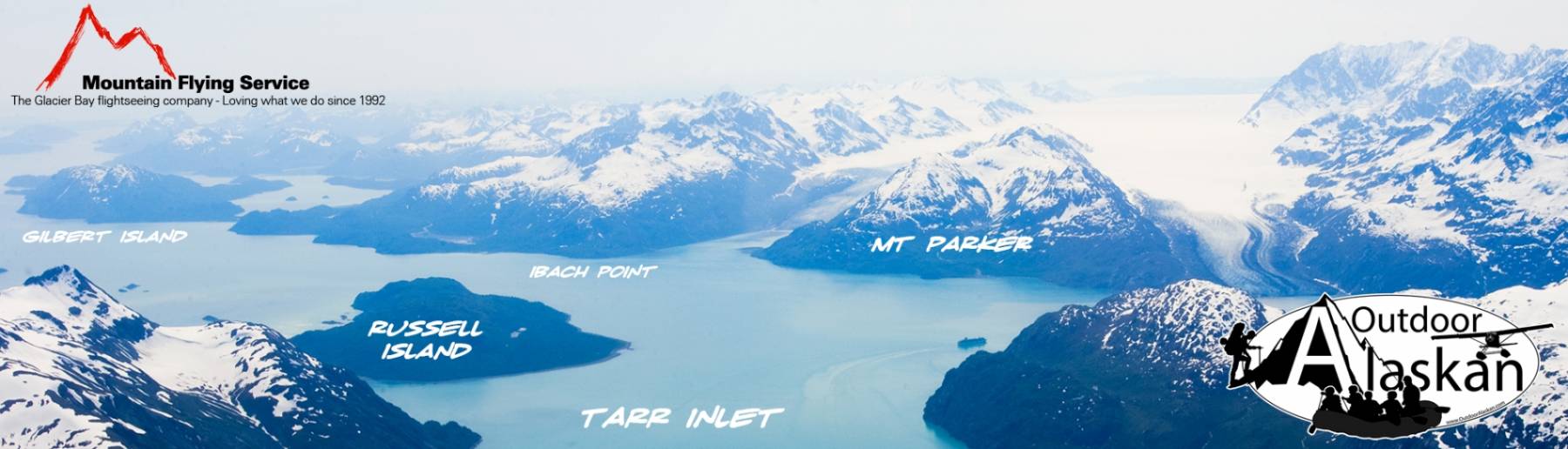
Capes:Confusion Point, Eerie Point, Eerie Point, Ibach Point, Jaw Point,
Glaciers:Aurora Glacier, Brady Glacier, Geikie Glacier, Hugh Miller Glacier, Kashoto Glacier, Lamplugh Glacier, Maynard Glacier, Reid Glacier, Romer Glacier, Scidmore Glacier,
Islands:Mine:Mountains:Mount Abdallah, Contact Nunatak, Mount Cooper, Mount Divide, Fossil Peak, Mount Friable, Gullied Peak, Heather Nunatak, July Fourth Mountain, Mount Parker,
Parks:Ridges:Streams:Pictures of, from, or near Reid Glacier.