April Bowl Trail Gallery
Pictures of, from, or near April Bowl Trail.
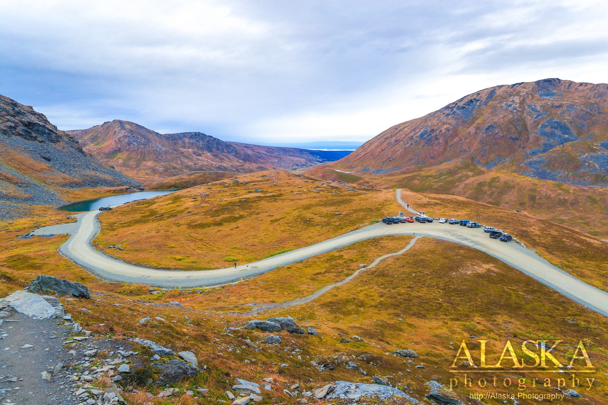
April Bowl trail head it located at Hatcher Pass. It is a great trail with excellent footing. As it begins in the alpine there is no worry about bush whacking or plants, and there is seldom ever wildlife encounters to concerned with. Though the lack of wildlife isn't an addition to the quality of the trail, just a peace of mind for some.
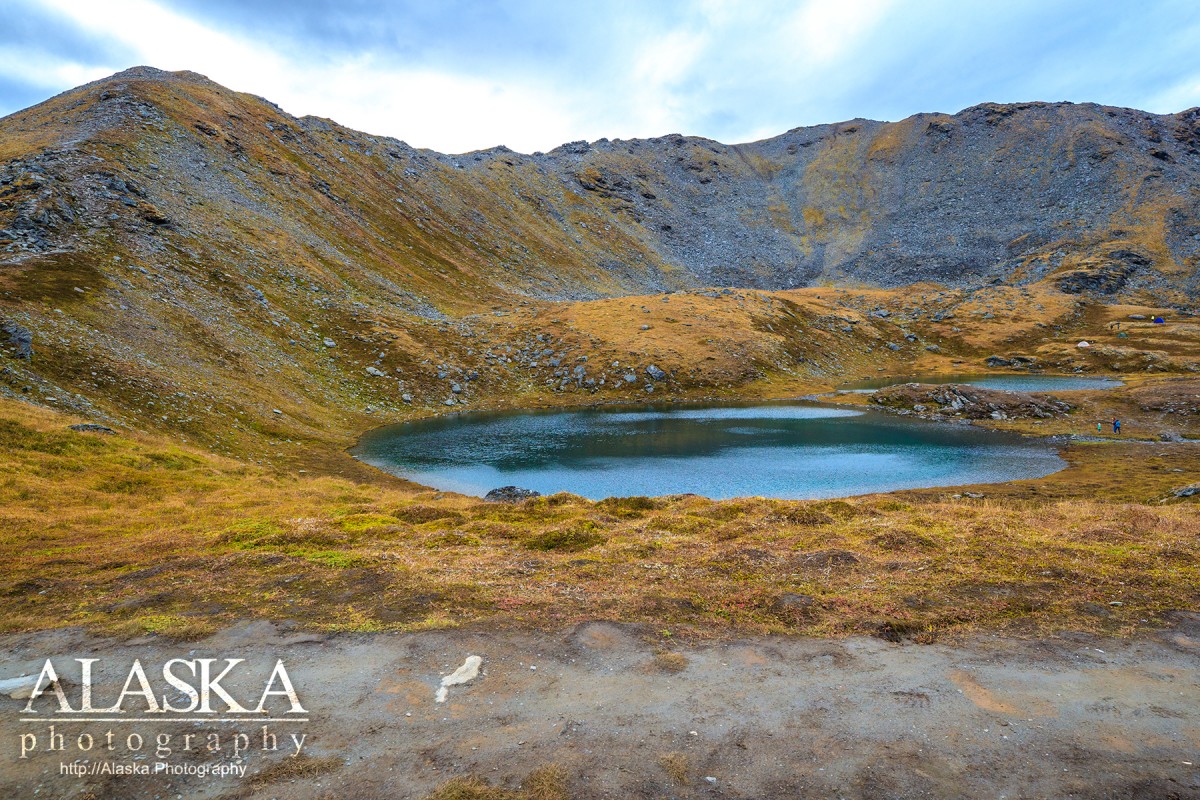
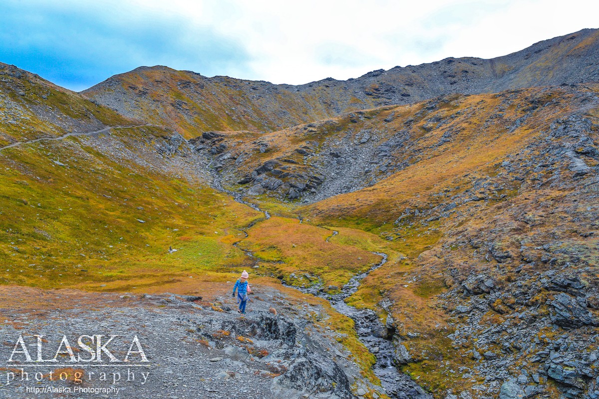
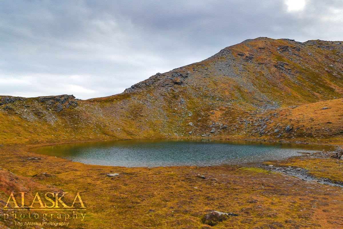
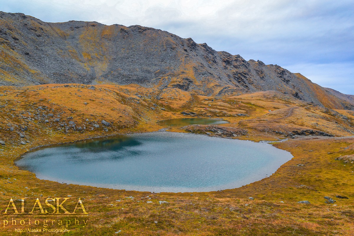
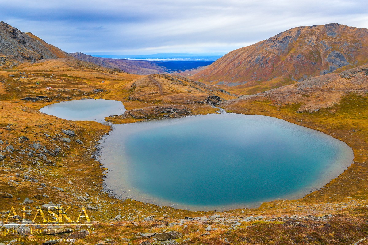
The trail begins with a few wide sweeping switch backs and gets up on a shelf looking on the creek the flows from the lakes. From there the trail takes a sweeping hooks around and up the inside of the bowl. Once past that part it opens up to April Bowl with a series of four small lakes. Many people stop and enjoy the lakes in the bowl and call it good.
The trail proceeds along the ridge of the mountain to the peak. This section of the trail it a moderate climb with continued good footing. It is possible to find a slick place to put your foot but if you're mindful of where you're stepping it should be no problem.
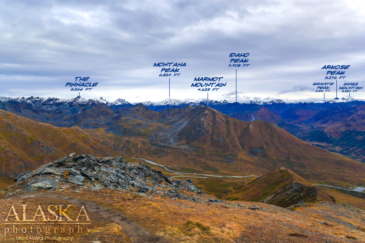
At the peak you can see the end of Knik Glacier, the back of Government Peak, many peaks around Hatcher Pass and even the Alaska Range.
The trail to the peak takes a couple hours at a comfortable pace. From the Peak it is easily possible to follow ridges to get over to Government Peak.
From Palmer take Glenn Highway to Fishhook Willow Road. Stay on that and it will lead to Hatcher Pass. Before getting to the lodge near the end of the pavement, there is a turn to the left continuing to Hatcher Pass, it is a dirt road. Take that and continue to Hatcher Pass and the trail head parking is right at the pass.
Independence Mine Dam, Memory Lake Estates Dam Number 1, Memory Lake Estates Dam Number 2,
Routes:Lakes:Anderson Lake, Baird Lake, Black Lake, Bradley Lake, Canoe Lake, Chignaki Pond, Clear Lake, Cornelius Lake, Cottonwood Lake, Dandy Lake, Dry Lake, Dusk Lake, Emerald Lake, Finger Lake, Gold Cord Lake, Gooding Lake, Hart Lake, High Ridge Lake, Irene Lake, Johnson Lake, Kennedy Lake, Kepler Lake, Kings Lake, Klaire Lake, Loberg Lake, Long Lake, Lower Reed Lake, Lucile Lake, Matanuska Lake, McLeod Lake, Meier Lake, Memory Lake, Mud Lake, Mud Lake, Mud Lake, Neklason Lake, Paradise Lake, Pinnacle Lake, Reed Lake, Summit Lake, Triangle Lake, Upper Reed Lake, Walby Lake, Wasilla Lake, Wolf Lake,
Locales:7 Sacred Chutes, April Bowl, Baby Ruth, Bennet's Ridge, Black Prospect, Eldorodo Bowl, Face of Hatch, Fairangel Cirque Gully, Farside, Gold Chord Death Traverse, Lake Run, Lake Run, Nixon's Nose, Nosebleed, Nunatak East, Nunatak West, Point 30, Rock Garden, Seldom Seen, Stairstep, Sunnyside, Sunnyside of Hatch, Swimmin' Tims, The Glades, The Lost Couloir, Valley of Sin, Wimp Bowl, Womens Run,
Mine:Arch Prospect, Black Prospect, Conrock North Pit, Eldorado Mine, Fern Mine, Gold Bullion Mine, Gold Cord Mine, High Grade Mine, Holland Prospect, Independence Mine, Kelly-Willow Prospect, Lane Prospect, Lonesome Mine, Lucky Shot Mine, Mabel Mine, Marion Twin Mine, Martin Mine, Premier Mine, Rae-Wallace Mine, Schroff-O-Neil Mine, Snowbird Mine, Talkeetna Mine, Thorpe Mine, War Baby Mine, Webfoot Prospect,
Mountains:Bald Mountain, Bullion Mountain, Government Peak, Idaho Peak, Marmot Mountain, Skyscraper Mountain,
Parks:Independence Mine State Historical Park, Finger Lake State Recreation Site, Wolf Lake State Recreation Site,
Mountain Passes:Birthday Pass, Bomber-in-a-day Pass, Dogsled Pass, Friendship Pass, Hatcher Pass, Point 40,
Peaks:Blueberry Knoll, Delia Benchmark, Didikama, Fairangel Cirque, Fairangel Peak, Fish Peak, Gold Chord, Good Hope Towers, Granite Mountain, Hatch Peak, Higher Spire, Lower Spire, Luck Peak, Lynx Peak, Managemint, Microdot, Nelteni, Nunatak, Outpost Peak, Parlimint, Pass Peak, The Pinnacle, Rae-Wallace, Rainy Day Knoll, Teeny Weene, Top Peak, Turnkey Peak, Yisbo,
Ridges:Arkose Ridge, Bald Mountain Ridge, Murphy Ridge, President's Ridge,
Routes:Mile 16 Ski Run, Paradise Ski Run,
Streams:Archangel Creek, Bartholf Creek, Carnegie Creek, Coal Creek, Cottonwood Creek, Craigie Creek, Delia Creek, East Fork Fishhook Creek, East Fork Sawmill Creek, Fairangel Creek, Fishhook Creek, Francie Creek, Glacier Creek, Goodhope Creek, Government Creek, Grubstake Creek, Hatcher Creek, Homestake Creek, Moon Princess Creek, Reed Creek, Shorty Creek, Sidney Creek, Upper Willow Creek, West Fork, West Fork Grubstake Creek, West Fork Sawmill Creek,
Routes:April Bowl Trail, Arch Prospect Trail, Assay Spur Trail, Blueberry Knoll Trail, Fairangel Trail, Gold Cord Lake Trail, Gold Mint Trail, Hard Rock 2 Trail, Hard Rock Trail, Hatcher Pass Snowmobile Trail, Hatcher Pass Snowmobile Trail 1, Hatcher Pass Snowmobile Trail 2, Hatcher Pass Winter Maintenance Trail, Independence Mine Trail, Lane Basin (Old Road) Trail, Lane Basin Trail, Marmot Mountain Trail, Martin Mill Trail, Mill Loop Trail, Rae-Wallace Mine Trail, Reed Lakes Trail, Snow Trail to Lodge, Snowbird Trail,
Valleys:Cable Valley, Grubstake Gulch, Lone Tree Gulch, West Fork Grubstake Gulch, Wet Gulch,
Cities:Pictures of, from, or near April Bowl Trail.