Independence Mine State Historical Park Gallery
Pictures of, from, or near Independence Mine State Historical Park.
761 acres in size in secs 28&33,T20N,R1E,Seward Meridian
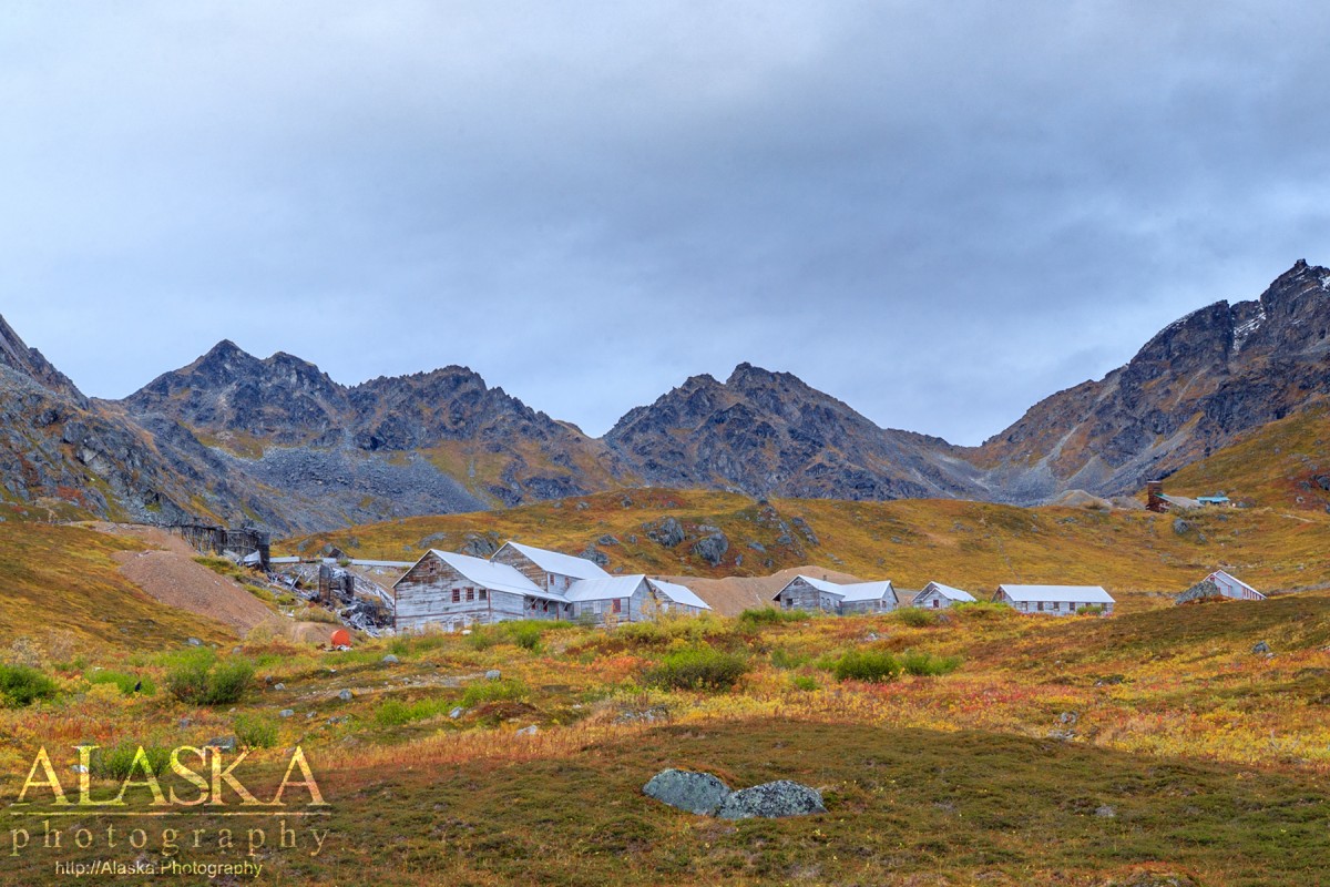
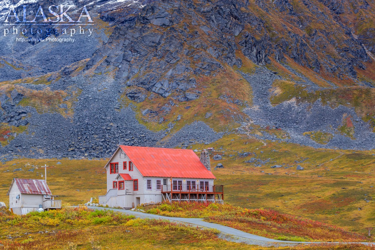
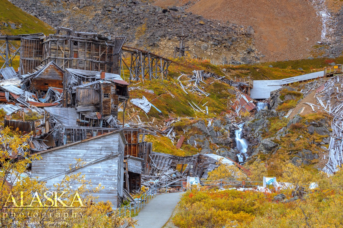
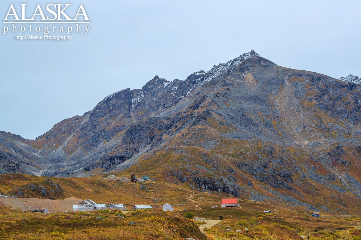
Independence Mine State Historical Park is an inactive gold mine set in the alpine along the East Fork of Fishhook Creek. It holds abandoned mining buildings in various conditions from preserved to dilapidated.
There are many trails around the area and descriptive signs for self-guided tours.
From Palmer take Glenn Highway to Milepost 49.5, turn left onto Palmer-Fishhook Road. Stay on that and it will lead right to the Independence Mine parking lot. Generally the gate is closed and one will need to walk to the mine from the parking lot.
Established in 1980.Independence Mine used to be two mines: The Alaska Free Gold (Martin) Mine, and Independence Mine. In 1938 the two mines merged into one company, the Alaska-Pacific Consolidated Mining Company (APC). Independence Mine became the largest producing mine in the Willow Creek Mining District. In 1941 the mine reached its peak employing 204 men, and producing 34,416 ounces of gold worth $1,204,560; today $17,208,000. The mine closed production in 1951 after mining over six million dollars in gold.
Independence Mine Dam, Memory Lake Estates Dam Number 1, Memory Lake Estates Dam Number 2,
Routes:Lakes:Anderson Lake, Baird Lake, Chignaki Pond, Cornelius Lake, Cottonwood Lake, Dandy Lake, Dry Lake, Dusk Lake, Emerald Lake, Finger Lake, Gold Cord Lake, Gooding Lake, Hart Lake, High Ridge Lake, Kennedy Lake, Kings Lake, Lower Reed Lake, Lucile Lake, Meier Lake, Memory Lake, Mud Lake, Mud Lake, Mud Lake, Neklason Lake, Paradise Lake, Pinnacle Lake, Reed Lake, Summit Lake, Upper Reed Lake, Walby Lake, Wasilla Lake, Wolf Lake,
Locales:7 Sacred Chutes, April Bowl, Baby Ruth, Bennet's Ridge, Black Prospect, Eldorodo Bowl, Face of Hatch, Fairangel Cirque Gully, Farside, Gold Chord Death Traverse, Lake Run, Lake Run, Nixon's Nose, Nosebleed, Nunatak East, Nunatak West, Point 30, Rock Garden, Seldom Seen, Stairstep, Sunnyside, Sunnyside of Hatch, Swimmin' Tims, The Glades, The Lost Couloir, Valley of Sin, Wimp Bowl, Womens Run,
Mine:Arch Prospect, Baxter Mine, Black Prospect, Eldorado Mine, Fern Mine, Gold Bullion Mine, Gold Cord Mine, High Grade Mine, Holland Prospect, Independence Mine, Kelly-Willow Prospect, Lane Prospect, Lonesome Mine, Lucky Shot Mine, Mabel Mine, Marion Twin Mine, Martin Mine, Premier Mine, Rae-Wallace Mine, Schroff-O-Neil Mine, Snowbird Mine, Talkeetna Mine, Thorpe Mine, War Baby Mine, Webfoot Prospect,
Mountains:Bullion Mountain, Government Peak, Idaho Peak, Marmot Mountain, Skyscraper Mountain,
Parks:Independence Mine State Historical Park, Finger Lake State Recreation Site, Wolf Lake State Recreation Site,
Mountain Passes:Backdoor Gap, Birthday Pass, Bomber-in-a-day Pass, Dogsled Pass, Friendship Pass, Hatcher Pass, Point 40, Sobriety Pass,
Peaks:3 Bell Spire, Arkose Peak, Blueberry Knoll, Delia Benchmark, Didikama, Fairangel Cirque, Fairangel Peak, Fish Peak, Gold Chord, Good Hope Towers, Granite Mountain, Hatch Peak, Higher Spire, Hunchback Spire, Lower Spire, Luck Peak, Lynx Peak, Managemint, Microdot, Nelteni, Nunatak, Outpost Peak, Ozone, Parlimint, Pass Peak, The Pinnacle, Rae-Wallace, Rainy Day Knoll, Teeny Weene, Tenemint, Top Peak, Turnkey Peak, Yisbo,
Ridges:Arkose Ridge, Bald Mountain Ridge, Murphy Ridge, President's Ridge,
Routes:Mile 16 Ski Run, Paradise Ski Run,
Streams:Archangel Creek, Bartholf Creek, Buffalo Creek, Carnegie Creek, Coal Creek, Cottonwood Creek, Craigie Creek, Delia Creek, East Fork Fishhook Creek, Fairangel Creek, Fishhook Creek, Glacier Creek, Goodhope Creek, Government Creek, Grubstake Creek, Hatcher Creek, Homestake Creek, Moon Princess Creek, Premier Creek, Reed Creek, Shorty Creek, Sidney Creek, Upper Willow Creek, West Fork, West Fork Grubstake Creek,
Routes:April Bowl Trail, Arch Prospect Trail, Assay Spur Trail, Blueberry Knoll Trail, Fairangel Trail, Gold Cord Lake Trail, Gold Mint Trail, Hard Rock 2 Trail, Hard Rock Trail, Hatcher Pass Snowmobile Trail, Hatcher Pass Snowmobile Trail 1, Hatcher Pass Snowmobile Trail 2, Hatcher Pass Winter Maintenance Trail, Independence Mine Trail, Lane Basin (Old Road) Trail, Lane Basin Trail, Marmot Mountain Trail, Martin Mill Trail, Mill Loop Trail, Rae-Wallace Mine Trail, Reed Lakes Trail, Snow Trail to Lodge, Snowbird Trail,
Valleys:Cable Valley, Grubstake Gulch, Lone Tree Gulch, Matanuska Valley, West Fork Grubstake Gulch, Wet Gulch,
Cities:Pictures of, from, or near Independence Mine State Historical Park.