Flattop Mountain Gallery
Pictures of, from, or near Flattop Mountain.
At the NW end of a ridge in Chugach Mountains, between South Fork Campbell and Rabbit Creeks, 11 mi SE of Anchorage, Chugach Mountains.
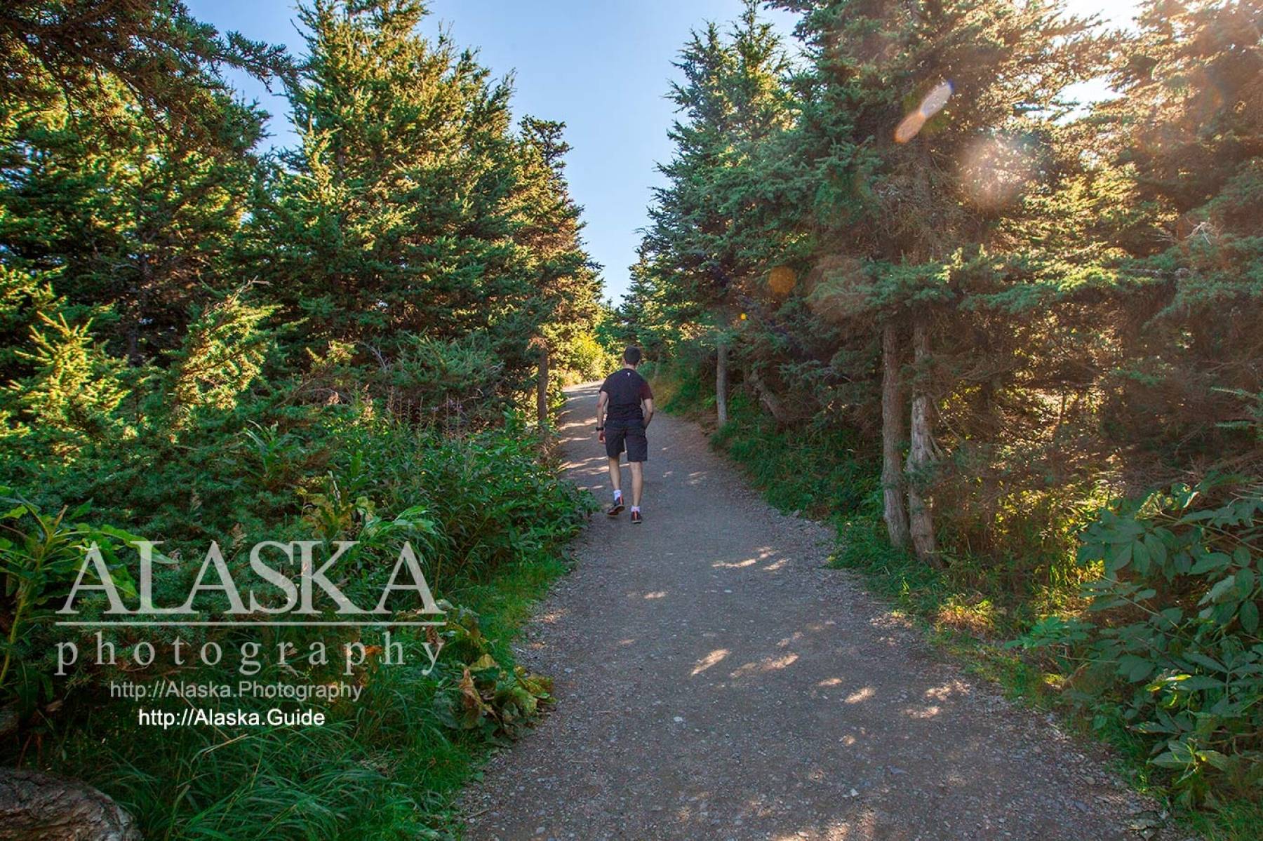
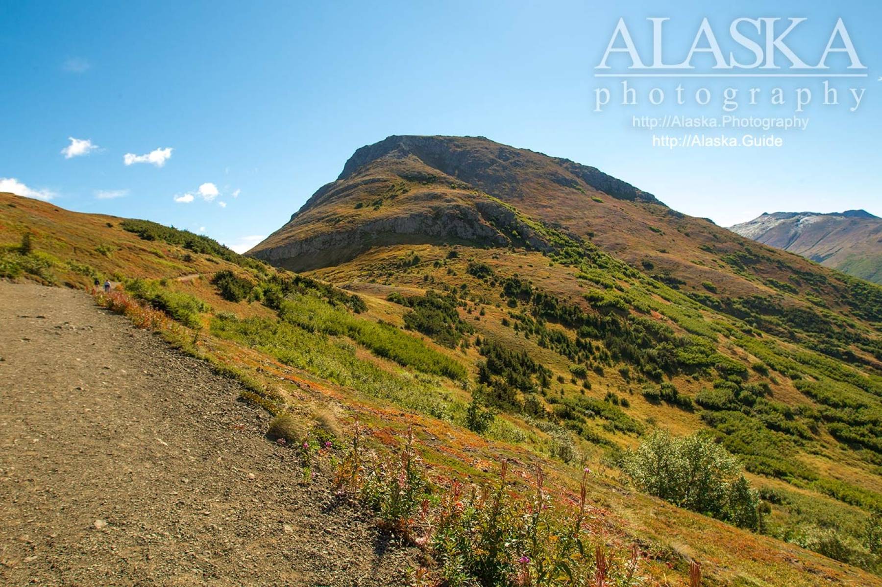
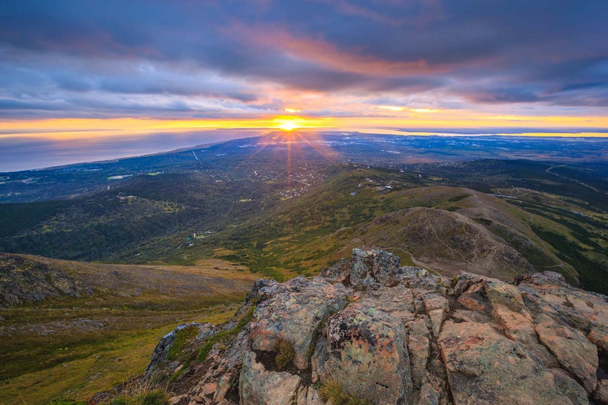
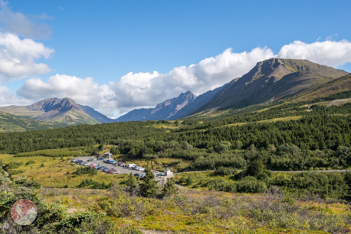
Flattop Mountain is nice because the trailhead starts at around 2,300', a fair chunk of the climb gets knocked out by your vehicle. The summit is only 1.5 miles one-way from the parking area, with an elevation gain of 1252 feet. You gain roughly 1,000 feet in the last mile. The hike can takes around two and a half - four hours RT. For more information on the hike check out the Flattop Mountain Trail page.
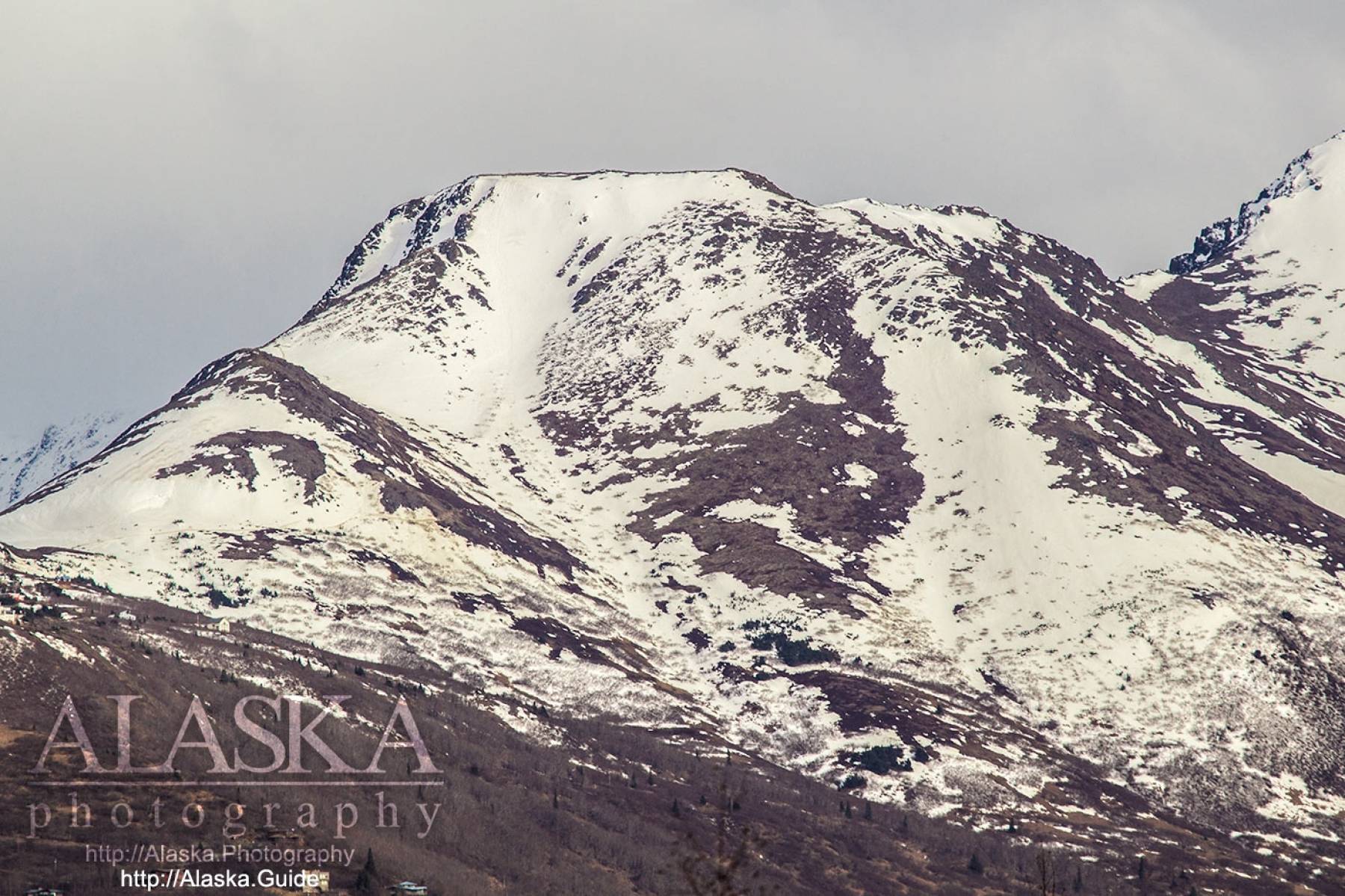
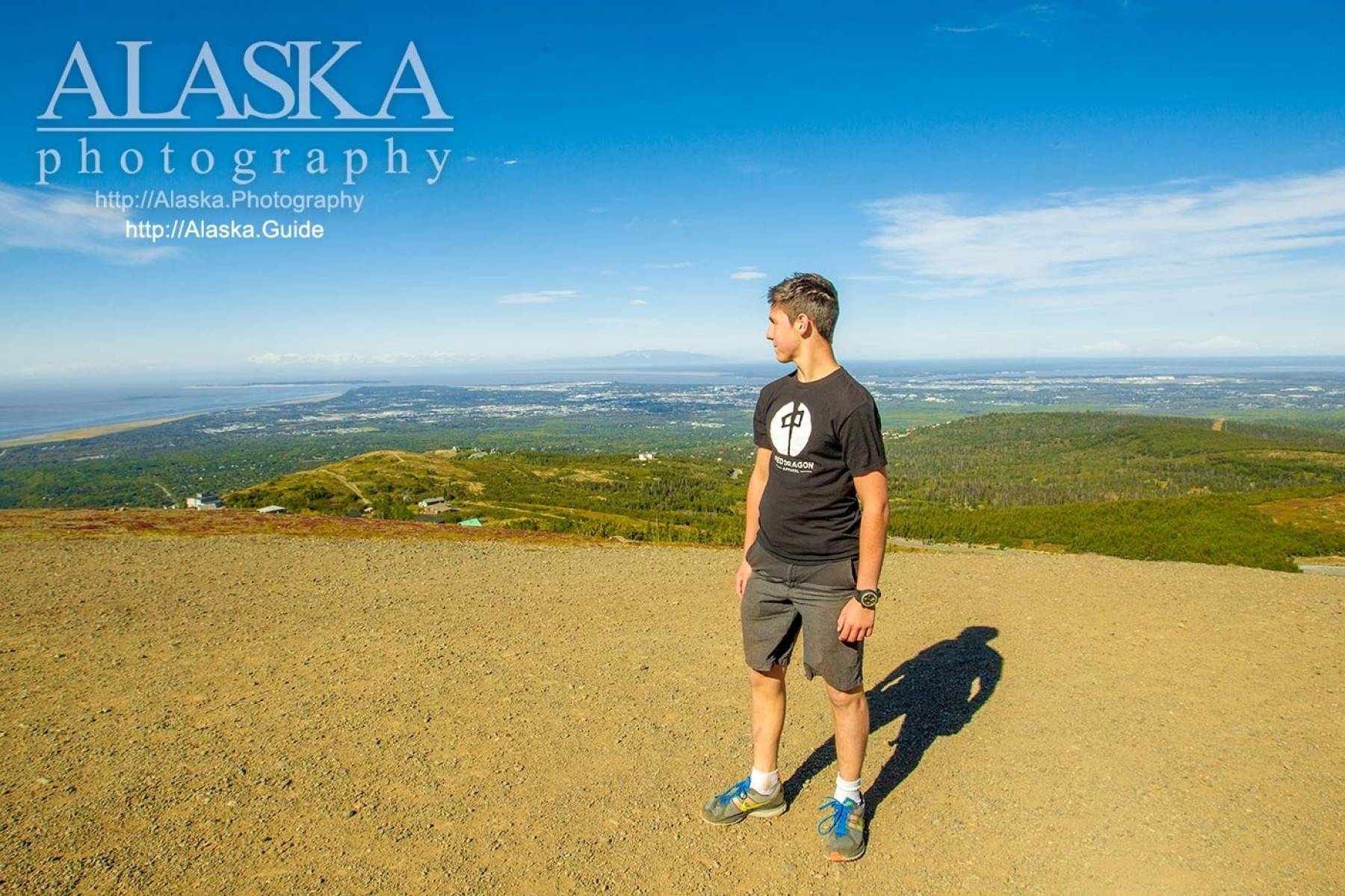
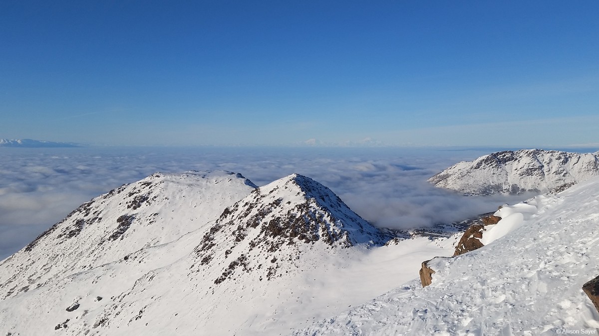
Because of it's short hiking time, close location to Anchorage, and great views the trail can have a lot of traffic on it. The top of the mountain is wide flat and rocky.
From AK-1 or the (Seward Highway) take the O'Malley Road exit, go west about 3.5 miles (towards the mountains), the road climbs up in elevation and you'll be turning, right (south) on Hillside Drive. Go one mile and then you will make a left turn (towards the mountains) on Upper Huffman Drive. The road will appear to come to an end where you turn right on to Toilsome Hill Drive the road quickly makes a hairpin turn before somewhat leveling out on to and seamlessly becomes Glen Alps Road. Almost 2 miles after turning on to Toilsome Hill Dr turn left, into the Flattop Mountain Trail parking lot.
There is a parking fee, and the ticket machine accepts credit cards.
Local descriptive name reported in 1963 by the Mountaineering Club of Alaska.Naming: Flattop Mountain is a local descriptive name recorded in 1963 by the Mountaineering Club of Alaska.
Patricks Beach (not official),
Capes:Beluga Point, Cairn Point, Gull Rock, Windy Point,
Streams:Middle Fork Campbell Creek, Snowhawk Creek,
Dams:Gregory Lake Dam, Lake -O- the Hills Dam, Otter Lake Dam, Ship Creek Dam,
Hills:Routes:Black Lake Falls, Easy Money, Even Hookers Get the Blues, Flame Out, Freak Street, Hypercard, O’Malley Falls, Organ Pipes, Ptarmigan Pillar, Roadside Attraction, Ski Tracks, Twin Pillars, Water World,
Islands:Lakes:Lake Beebe, Cheney Lake, Cochise Lake, Diablo Pond, Dishno Pond, Fish Lake, Goose Lake, Green Lake, Gwenn Lake, Hidden Lake, Lake Hideaway, Hillstrand Pond, Lake Kiowa, Lazy Lake, Long Lake, Lake -O- the Hills, O-Connell Lake, Lake Otis, Otter Lake, Rabbit Lake, Ship Creek Reservoir, Ship Lake, Spring Lake, Taku Lake, Tanaina Lake, Triangle Lake, Tuomi Lake, University Lake, Waldron Lake, Williwan Lakes,
Locales:Ball Field, Bidarka, Black Lake Chute, French Bowl, German Bowl, KCK, Nike Chutes, North Bowl, North Wedgie, O'Malley Gully, Ship Creek Bowl, Solstice Gully, South Wedgie, Thin White Line, Tiki Cruiser, Windboard Love, Wolverine Chutes,
Mountains:Avalanche Mountain, Bidarka Peak, Blueberry Knoll, Flattop Mountain, Mount Gordon Lyon, Highland Mountain, Indianhouse Mountain, Little Teton Mountain, McHugh Peak, Near Point, O-Malley Peak, Ptarmigan Peak, Rainbow Peak, The Ramp, Rendezvous Peak, South Yuyanq’ Ch’ex, Tanaina Peak, Temptation Peak, The Wedge, Mount Williwaw, Wolverine Peak,
Parks:Lake Otis Park, Arnold L Muldoon Park, Bancroft Park, Baxter Bog Park, Campbell Creek Greenbelt Park, Campbell Creek Park, Carlson Park, Centennial Park, Charles W Smith Memorial Park, Chester Creek Greenbelt Park, Cottonwood Park, David Green Park, Davis Park, East Chester/Woodside Park, Fairbanks Park, Fairview Park, Far North Bicentennial Park, Forsythe Park, Goose Lake Park, Hamilton Park, Hillside Park, Jacobson Park, Little Rabbit Creek Bluff Park, Lore Park, Nancy Park, Nichols Park, Oceanview Bluff Park, Oceanview Park, Paxton Memorial Park, Potter Ravine Park, Quyana Park, Rabbit Creek Park, Russian Jack Springs Park, Ruth Arcand Park, Salmon Run Park, Sitka Street Park, Stephenson Park, Storck Park, Taku Campbell Creek Park, Thompson Park, Tkishla Park, University Park, Wickersham Park,
Mountain Passes:Indian Creek Pass, Powerline Pass, South Ship Lake Pass, West Ship Lake Pass,
Peaks:Peak 3, Cedar Point, Elliot, Extra Point, Falls Peak, False Peak, Flaketop Peak, Hidden Peak, Homicide Peak, Hope Mountain, Hope Point, Kanchee Peak, Knoya Peak, Koktoya Peak, Little O'Malley, North Avalanche Mountain, North Yuyanq’ Ch’ex, Peak Two, South Avalanche Mountain, South Powerline Peak, The Dome, The Nipple, Tikishla Peak, Mount William Barrett,
Rivers:Streams:Bay Creek, Bear Creek, Bird Creek, Cripple Creek, Falls Creek, Fossil Creek, Indian Creek, Johnson Creek, Little Campbell Creek, Little Rabbit Creek, Little Survival Creek, McHugh Creek, Middle Branch South Fork Chester Creek, Middle Fork Chester Creek, North Branch South Fork Chester Creek, North Fork Campbell Creek, North Fork Chester Creek, North Fork Little Campbell Creek, North Fork Ship Creek, North Fork Ship Creek, Penguin Creek, Porcupine Creek, Potter Creek, Rabbit Creek, Rainbow Creek, Resurrection Creek, Sixmile Creek, South Branch South Fork Chester Creek, South Fork Campbell Creek, South Fork Chester Creek, South Fork Little Campbell Creek, Sunset Creek, Taylor Creek, Wildhorse Creek,
Routes:Alder Trail, Alder Trail Part 2, Anchorage Overlook Trail, Avalanche Peak, Ballpark Trail, Bird Ridge Interpretive Trail, Bird Ridge Trail, Blueberry Hollow Trail, Blueberry Loop Trail, Bull Rock Trail, Denali View Trail, Eagle River Green Belt Trail, Falls Creek Trail, Flattop Mountain Alternate Trail, Flattop Mountain Trail, Gasline Trail, Golden Grass Trail, Grand View Trail, Hemlock Knob Trail, Hidden Lake Trail, Indian Creek Pass Trail, Little Loop Trail, Little Omalley Trail, Long Lake Trail, Lost Cabin Valley Trail, McHugh Lake Trail, Middle Fork Loop Trail, Muktuk Marston Memorial Trail, Near Point Trail, North Fork Trail, Panorama View Trail, Picnic Loop Trail, Powerline Access Trail, Powerline Trail, Ptarmigan Pass Trail, Rabbit Lake Trail, Ramp Trail, Rondevous Peak Spur Trail, Rondevous Peak Trail, Rondevous Ridge Trail, Ship Lake Pass Trail, Silver Fern Trail, South Fork ER Trail, South Fork Rim Trail, Spencer Loop Trail, Spencer Trail, Turnagain Arm Interpretive Trail, Turnagain Arm Trail, White Spruce Trail, Williwaw Lakes Trail, Wolverine Bowl Loop Trail, Wolverine Bowl Trail, Wolverine Peak Trail,
Valleys:Cities:Airport Heights, Artesian Village, Basher, Blanchard, Bonibrook, Chugach Heights, City View, DeBarr Vista, East Chester, Fairview, Fort Richardson, Grandview Gardens, Green Acres, Hillside, Homesite Park, Hope, Indian, Justamere Ranch, Knik Heights, Lange, Lawrence, Lindale, Mountain View, Nunaka Valley, Potter Hill, Rees, Rogers Park, Rogers Park, Runstettler, Traversie, Tuomi, Vanover, Wilson Village, Wonder Park,
Waterfalls:Pictures of, from, or near Flattop Mountain.

Sorted by Most Common to Least Common Viewings
Lapland Longspur, White-winged Crossbill, Pine Siskin, Willow Ptarmigan, White-tailed Ptarmigan, Common Redpoll, Red Crossbill, Wilson's Warbler, Buff-bellied Pipit, American Robin, Dark-eyed Junco, Golden-crowned Sparrow, Varied Thrush, Gray Jay, Boreal Chickadee, Gray-crowned Rosy Finch, White-crowned Sparrow, Orange-crowned Warbler, Bonaparte's Gull, Common Gull, Arctic Tern, Common Raven, Horned Lark, Violet-green Swallow, Hermit Thrush, Bohemian Waxwing, Fox Sparrow, Savannah Sparrow, Song Sparrow, Lincoln's Sparrow, Black-billed Magpie, Bald Eagle, Black-capped Chickadee, Ruby-crowned Kinglet, Golden-crowned Kinglet, Swainson's Thrush, Rock Ptarmigan, Osprey, Olive-sided Flycatcher, Alder Flycatcher, Townsend's Solitaire, Yellow-rumped Warbler, Common Goldeneye, Wilson's Snipe, Golden Eagle, Northern Harrier, Sharp-shinned Hawk, Northern Goshawk, Red-tailed Hawk, Great Horned Owl, Merlin, Peregrine Falcon, Western Wood-Pewee, Steller's Jay, Tree Swallow, Red-breasted Nuthatch, American Dipper, Yellow Warbler