Baird Peak Gallery
Pictures of, from, or near Baird Peak.
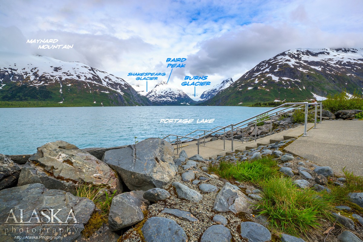
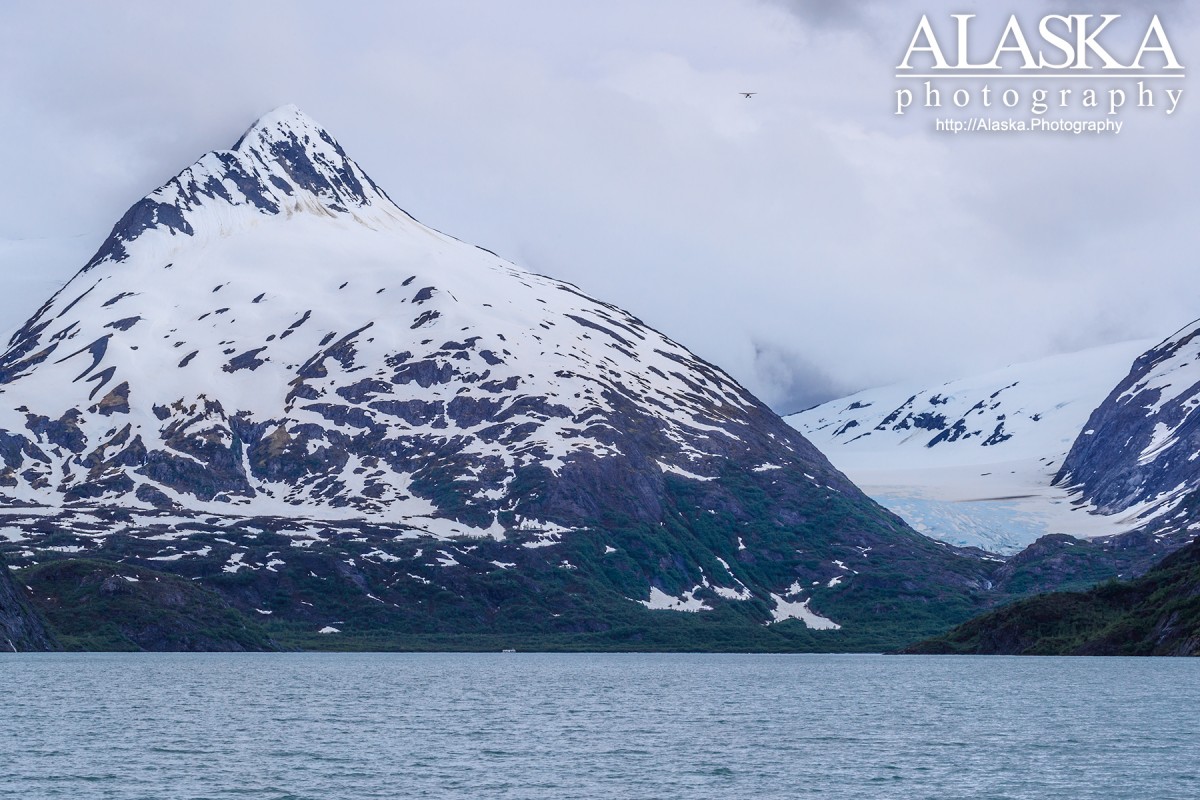
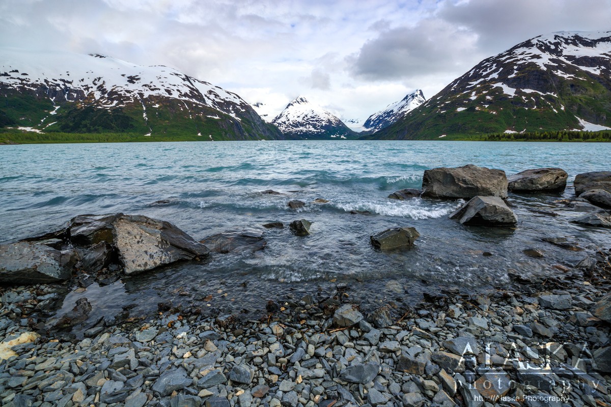
Baird Peak is a large mountain with glacier, water and mountain views in every direction. It's a scramble up your creek of choice, minor bushwhacking, and so long as you're not clouded in it's rewarded with spectacular views. Plan on setting aside 5-8 hours depending on your speed, the weather, and how much time you'd like to play around.
From Anchorage head down the Seward Highway, go around 40 miles and turn left on to Portage Glacier Rd. The turn will be just past the train station as the highway makes a wide sweeping hook to the right. Head into Portage Lake or head to Whittier.
From Portage Lake the easiest way to get down the lake would be by boat. From Whittier there is no trail so there's just about any approach you think looks best to you. Some follow Whittier Creek before crossing towards Shakespeare Shoulder.
Naming: Baird Peak was named in 1886 by Lieutenant Commander A.S. Snow, USN.
Blackstone Bay, Emerald Bay, Passage Canal, Shotgun Cove, Smitty's Cove,
Capes:Bur Point, Gradual Point, Neptune Point, Trinity Point,
Cities:Glaciers:Beloit Glacier, Billings Glacier, Blackstone Glacier, Burns Glacier, Byron Glacier, Carroll Glacier, Concordia Glacier, Cotterell Glacier, Explorer Glacier, Glacier G211071E60936N, Glacier G211071E60936N, Glacier G211107E60948N, Glacier G211110E60758N, Glacier G211176E60873N, Glacier G211226E60788N, Glacier G211235E60779N, Glacier G211254E60750N, Glacier G211360E60891N, Harriman Glacier, Lawrence Glacier, Learnard Glacier, Lowell Glacier, Marquette Glacier, Milton Glacier, Northland Glacier, Portage Glacier, Rainy Glacier, Ripon Glacier, Seth Glacier, Shakespeare Glacier, Skookum Glacier, Spencer Glacier, Taylor Glacier, Tebenkof Glacier, Twentymile Glacier, Whittier Glacier,
Islands:Emerald Island, Willard Island,
Lakes:Airstrip Pond, Carmen Lake, Divide Lake, Portage Lake,
Mine:Mountains:Baird Peak, Bard Peak, Begich Peak, Boggs Peak, Byron Peak, Carpathian Peak, Kinnikinnick Mountain, Mount Luther Kelly, Maynard Mountain, Shakespeare Shoulder,
Mountain Passes:Peaks:Explorer Peak, Learnard Peak, Lowell Peak, Mismapped Mountain, Passage Peak, Pico España, Portage Peak, Roost,
Rivers:Glacier River, South Fork Upper Carmen River, Upper Carmen River,
Streams:Billings Creek, Cove Creek, Placer Creek, Whittier Creek, Whittier Creek,
Routes:Byron Glacier Trail, Portage Pass Trail, Trail of Blue Ice,
Valleys:Pictures of, from, or near Baird Peak.