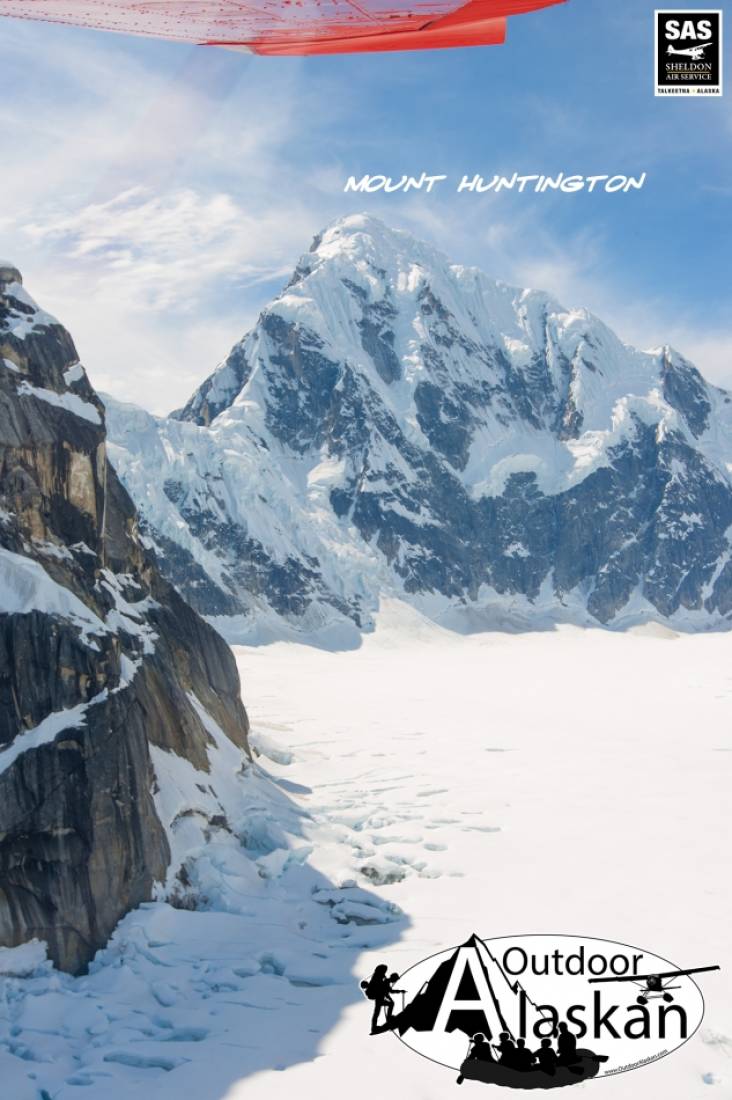
West Fork Ruth Glacier Gallery
Pictures of, from, or near West Fork Ruth Glacier.
heads S. of Denali National Park and trends E. 7.5 mi., joining Northwest Fork at Ruth Amphitheater, 9 mi. E. of Denali Pass
Mountain climbers' name published in the late 1940's.
| May 13, 2021 | 1 person died | mountaineering | Read More |
Ruth Ampitheater, Thayer Basin,
Cliffs:Glaciers:East Fork Kahiltna Glacier, Glacier G209237E62899N, Great Icefall, Harper Glacier, Harper Icefall, Jeffery Glacier, Lower Icefall, Northeast Fork Kahiltna Glacier, Northwest Fork Ruth Glacier, Peters Glacier, Southeast Fork Kahiltna Glacier, Tokositna Glacier, Traleika Glacier, Traleika Icefall, West Fork Ruth Glacier, West Fork Traleika Glacier,
Locales:The Autobahn, Cassin Ridge, Czech Direct, Edge of the World, Football Field, Japanese Couloir, Messner Couloir, Orient Express, Rescue Gully, West Rib, West Rim, Windy Corner,
Mountains:Archdeacons Tower, Mount Barrille, Browne Tower, Mount Carpe, Carter Horn, Churchill Peaks, Mount Dan Beard, Mount Dickey, Farthing Horn, Mount Hunter, Mount Huntington, Jeffery Dome, Jeffery Point, Mount Johnson, Kahiltna Peaks, Mount Koven, Denali, North Peak, Pease Peak, The Rooster Comb, South Peak - Denali, Mount Stevens, Mount Tatum, West Pyramid Peak,
Mountain Passes:Denali Pass, The Gateway, Gunsight Pass, Kahiltna Notch, Karstens Col, One Shot Gap, Parker Pass, Pittock Pass, Ruth Gap, Silverthrone Col, Traleika Col, Windy Corner,
Peaks:Ridges:Carpe Ridge, East Buttress, Flatiron, Karstens Ridge, Pioneer Ridge, South Buttress, Southeast Spur, Taylor Spur, Thunder Mountain, West Buttress,
Routes:Pictures of, from, or near West Fork Ruth Glacier.