Blueberry Knoll Trail Gallery
Pictures of, from, or near Blueberry Knoll Trail.
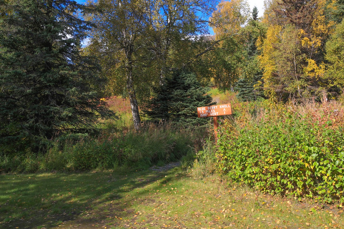
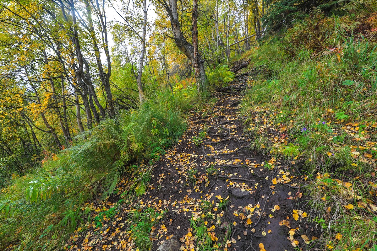
Blueberry Knoll Trail is a moderate-steep 1.5 mile, hike 1,550 ft up Blueberry Knoll and on up to Government Peak. The trail is easily followed but not in the best of conditions and may not be suitable for children.
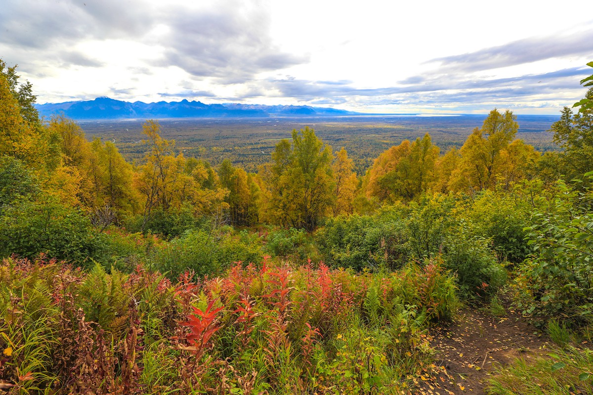
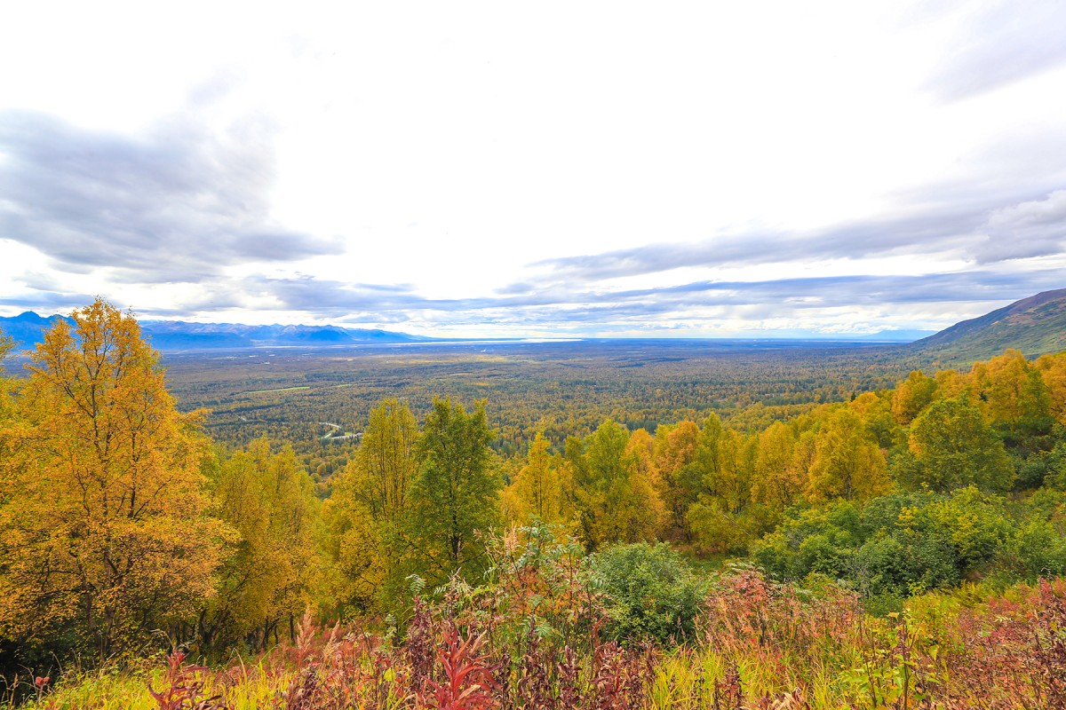
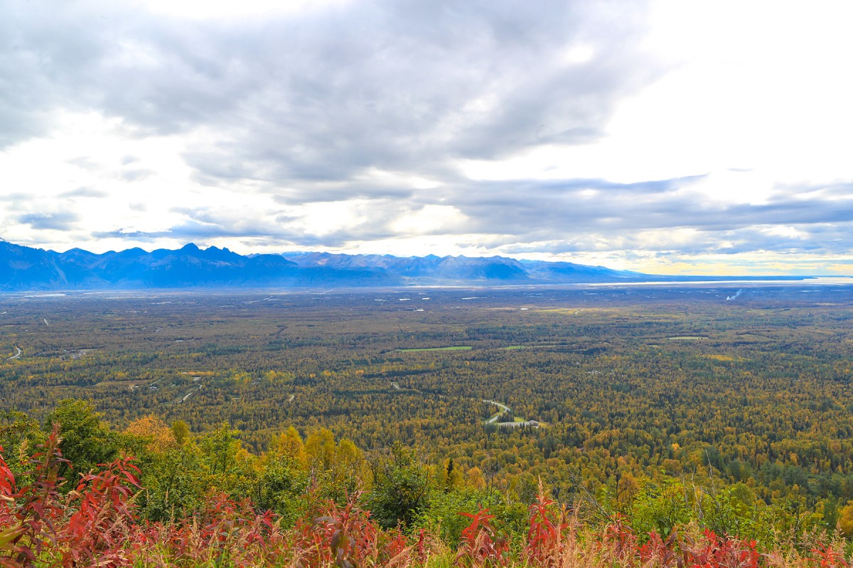
At the top of Blueberry Knoll there is a picnic table to rest and enjoy the broad views of the Matanuska Valley, outward to Cook Inlet.
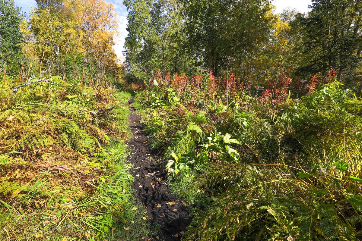
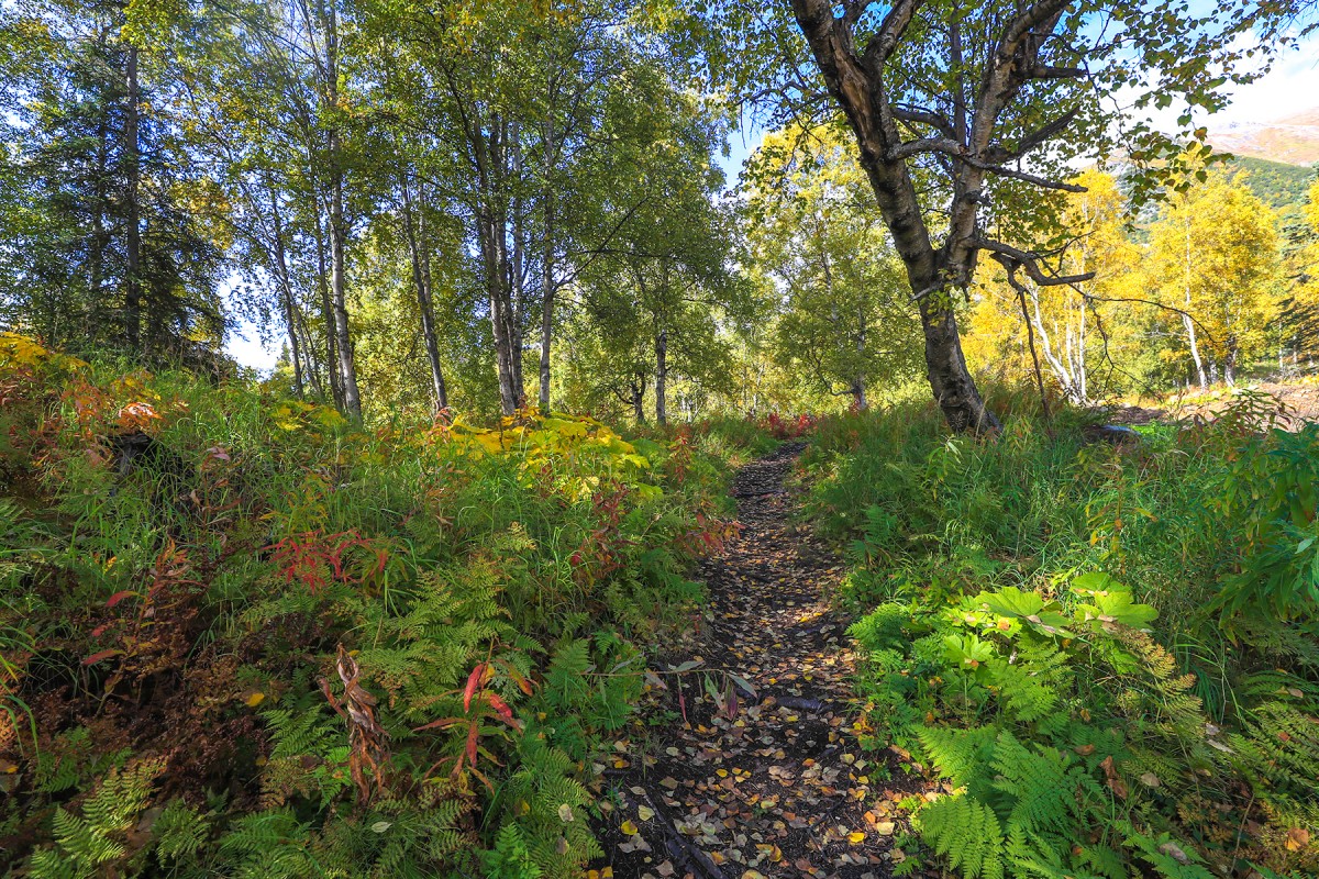
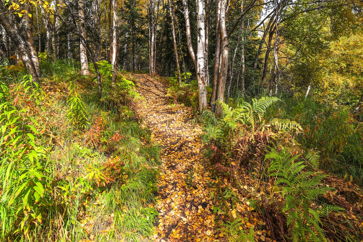
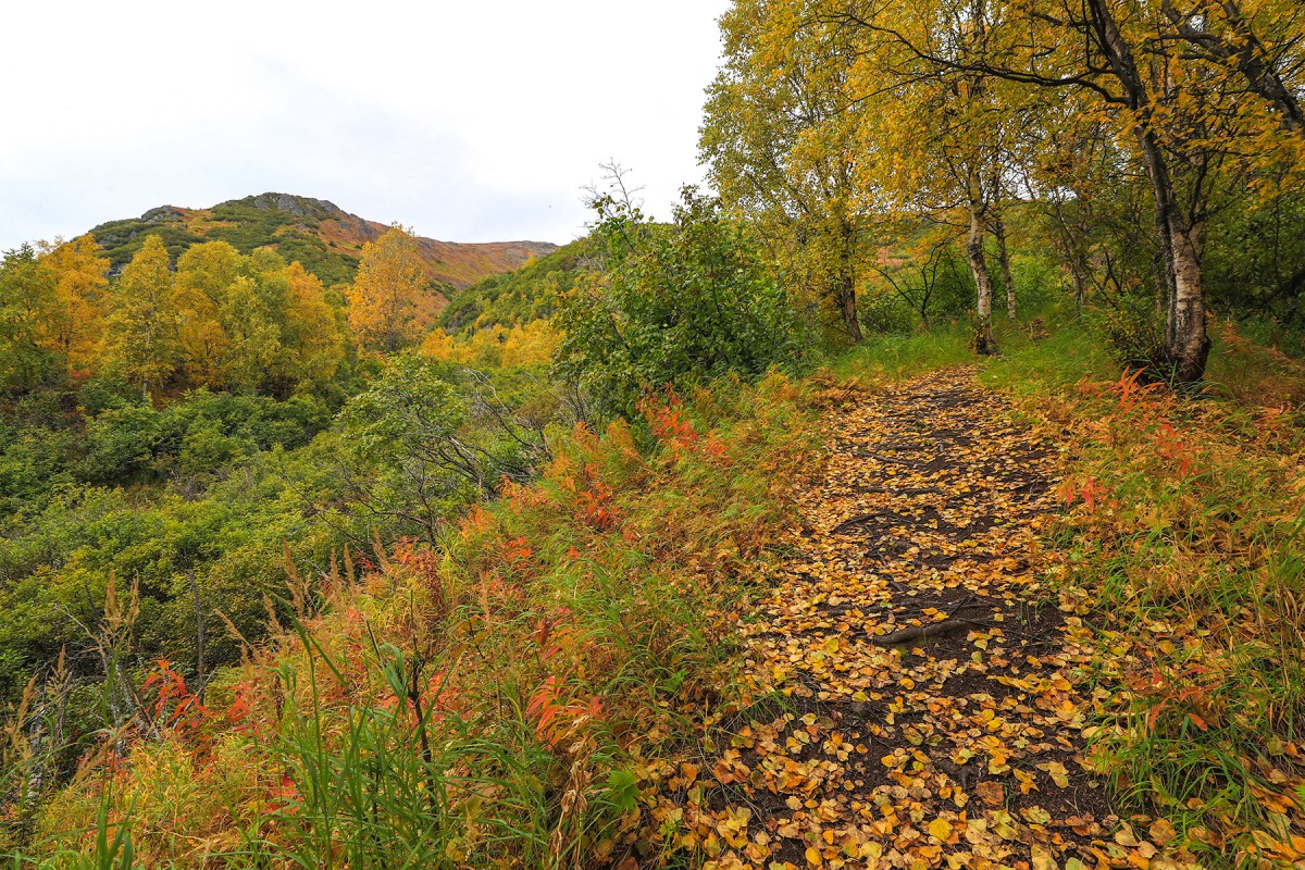
The trail is often done in early season and the trail conditions seem to deteriorate later in the season. Later on the in the season stinging nettle grows along and leans into the trail so be sure to hike it in pants. Also in wet times the trail can become very muddy and in the steeper sections very slick. Bear activity has been observed on the trail so be mindful and prepared for a bear encounter.
The hike takes an average of two-three hours to complete. From the top of Blueberry Knoll one can hike the ridge, continuing up to Government Peak.
From Palmer take Palmer-Fishhook Road toward Hatcher Pass. Turn left onto Edgerton Parks Road at milepost 7. Go one mile down then turn right on to Mountain Trails Drive, the entrance. There is a parking fee. The parking lot is gated and the gate is closed from 10pm-8am.
Ch-atan Kaq-, Chuqilin Kaq-, Skitnu Hdakaq-,
Cities:Crags:Dams:Independence Mine Dam, Memory Lake Estates Dam Number 1, Memory Lake Estates Dam Number 2,
Flats:Routes:Lakes:Anderson Lake, Baird Lake, Black Lake, Bradley Lake, Canoe Lake, Chignaki Pond, Clear Lake, Cornelius Lake, Cottonwood Lake, Dandy Lake, Dinkel Lake, Dry Lake, Duck Lake, Dusk Lake, Echo Lake, Emerald Lake, Ezi Slough, Finger Lake, Gold Cord Lake, Gooding Lake, Hart Lake, High Ridge Lake, Irene Lake, Johnson Lake, Kennedy Lake, Kepler Lake, Kings Lake, Klaire Lake, Loberg Lake, Long Lake, Lower Reed Lake, Lucile Lake, Matanuska Lake, McLeod Lake, Meier Lake, Memory Lake, Mud Lake, Mud Lake, Neklason Lake, Nik-udatl-ech-a Bena, Paradise Lake, Pinnacle Lake, Reed Lake, Reedy Lake, Summit Lake, Triangle Lake, Upper Reed Lake, Walby Lake, Wasilla Lake, Weinie Lake, Wolf Lake,
Locales:7 Sacred Chutes, April Bowl, Baby Ruth, Bennet's Ridge, Black Prospect, Eldorodo Bowl, Face of Hatch, Fairangel Cirque Gully, Farside, Gold Chord Death Traverse, Lake Run, Lake Run, Nixon's Nose, Nosebleed, Nunatak East, Nunatak West, Point 30, Rock Garden, Seldom Seen, Stairstep, Sunnyside, Sunnyside of Hatch, Swimmin' Tims, The Glades, The Lost Couloir, Valley of Sin, Wimp Bowl, Womens Run,
Mine:Arch Prospect, Baxter Mine, Black Prospect, Conrock North Pit, Eldorado Mine, Fern Mine, Gold Bullion Mine, Gold Cord Mine, High Grade Mine, Holland Prospect, Independence Mine, Kelly-Willow Prospect, Lane Prospect, Lonesome Mine, Lucky Shot Mine, Mabel Mine, Marion Twin Mine, Martin Mine, Premier Mine, Rae-Wallace Mine, Schroff-O-Neil Mine, Snowbird Mine, Talkeetna Mine, Thorpe Mine, War Baby Mine, Webfoot Prospect,
Mountains:Bullion Mountain, Government Peak, Idaho Peak, Marmot Mountain, Skyscraper Mountain,
Parks:Independence Mine State Historical Park, Finger Lake State Recreation Site, Wolf Lake State Recreation Site,
Mountain Passes:Backdoor Gap, Birthday Pass, Bomber-in-a-day Pass, Cottonwood Slough, Dogsled Pass, Friendship Pass, Hatcher Pass, Palmer Slough, Point 40, Rabbit Slough, Sobriety Pass, Spring Creek,
Peaks:3 Bell Spire, Arkose Peak, Blueberry Knoll, Delia Benchmark, Didikama, Fairangel Cirque, Fairangel Peak, Fish Peak, Gold Chord, Good Hope Towers, Granite Mountain, Hatch Peak, Higher Spire, Hunchback Spire, Lower Spire, Luck Peak, Lynx Peak, Managemint, Microdot, Nelteni, Nunatak, Outpost Peak, Ozone, Parlimint, Pass Peak, The Pinnacle, Rae-Wallace, Rainy Day Knoll, Teeny Weene, Tenemint, Top Peak, Turnkey Peak, Yisbo,
Ridges:Arkose Ridge, Bald Mountain Ridge, Murphy Ridge, President's Ridge,
Rivers:Routes:Mile 16 Ski Run, Paradise Ski Run,
Streams:Archangel Creek, Buffalo Creek, Carnegie Creek, Coal Creek, Cottonwood Creek, Craigie Creek, Delia Creek, East Fork Fishhook Creek, Ezi Slough, Fairangel Creek, Fishhook Creek, Glacier Creek, Goat Creek, Goodhope Creek, Government Creek, Grubstake Creek, Hatcher Creek, Homestake Creek, Moon Princess Creek, Premier Creek, Reed Creek, Shorty Creek, Sidney Creek, Spring Creek, Upper Willow Creek, Wasilla Creek, West Fork, West Fork Grubstake Creek,
Routes:April Bowl Trail, Arch Prospect Trail, Assay Spur Trail, Blueberry Knoll Trail, Fairangel Trail, Gold Cord Lake Trail, Gold Mint Trail, Hard Rock 2 Trail, Hard Rock Trail, Hatcher Pass Snowmobile Trail, Hatcher Pass Snowmobile Trail 1, Hatcher Pass Snowmobile Trail 2, Hatcher Pass Winter Maintenance Trail, Independence Mine Trail, Lane Basin (Old Road) Trail, Lane Basin Trail, Marmot Mountain Trail, Martin Mill Trail, Mill Loop Trail, Rae-Wallace Mine Trail, Reed Lakes Trail, Snow Trail to Lodge, Snowbird Trail,
Valleys:Cable Valley, Grubstake Gulch, Lone Tree Gulch, Matanuska Valley, West Fork Grubstake Gulch, Wet Gulch,
Cities:Pictures of, from, or near Blueberry Knoll Trail.