Couverden Island Gallery
Pictures of, from, or near Couverden Island.
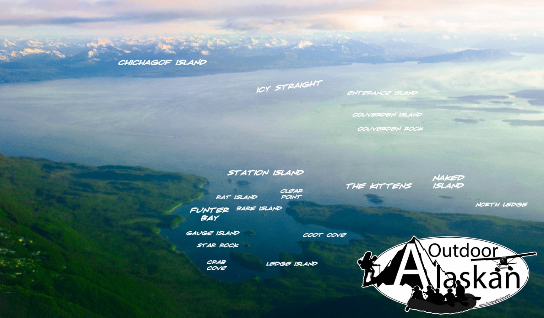
off W shore of Lynn Canal at junction with Icy Strait, 7 mi. SW of Funter and 25 mi. SW of Juneau, St. Elias Mts. 3 miles long.
Probably named in 1868 by Commander R. W. Meade, U.S. Navy (USN), for nearby Point Couverden, and published in 1881 on Hydrographic Chart 882.
Favorite Reef, Hanus Reef, North Ledge, Sisters Reef,
Bays:Barlow Cove, Coot Cove, Crab Cove, Curlew Ledge, Funter Bay, Howard Bay, Swanson Harbor, Whitestone Harbor,
Beaches:Capes:Point Augusta, Barlow Point, Clear Point, Point Couverden, False Point Retreat, Point Howard, Point Retreat,
Channels:Cliffs:Dams:Tenakee Spring School Dam, Tenakee Springs Dam,
Islands:Ansley Island, Bare Island, Barlow Island, Couverden Island, Couverden Rock, Entrance Island, Gauge Island, The Kittens, Ledge Island, Naked Island, Pulizzi Island, Rat Island, Rocky Island, The Sisters, Spasski Island, Star Rock, Station Island,
Lakes:Mine:Admiralty Mine, Alaska Dano Mine,
Mountains:Parks:Streams:Cordwood Creek, Spasski Creek, Suntaheen Creek,
Cities:Pictures of, from, or near Couverden Island.