Bering Glacier Gallery
Pictures of, from, or near Bering Glacier.
heads in Bagley Ice Field at 603200N1423500W, trends SW to its 1950 terminus, 66 mi. ESE of Cordova, Malaspina Coastal Plain. 48 miles long.
Named by U.S. Coast and Geodetic Survey (USC&GS) in 1880 to commemorate Captain Commander Ivan Ivanovich (Vitus) Bering, a Dane in the naval service of Peter the Great, and as leader of an official voyage of exploration, credited with the discovery of Alaska. His first landfall was made in this area in July 1741.
Foottrack Cove, Tashalich Arm,
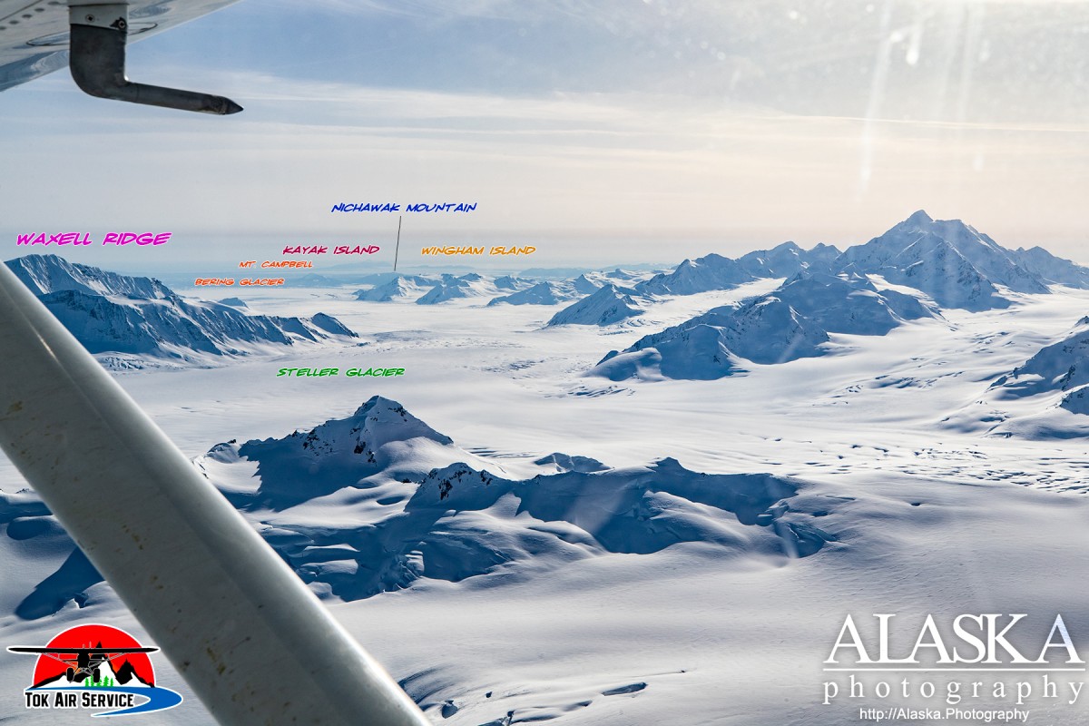
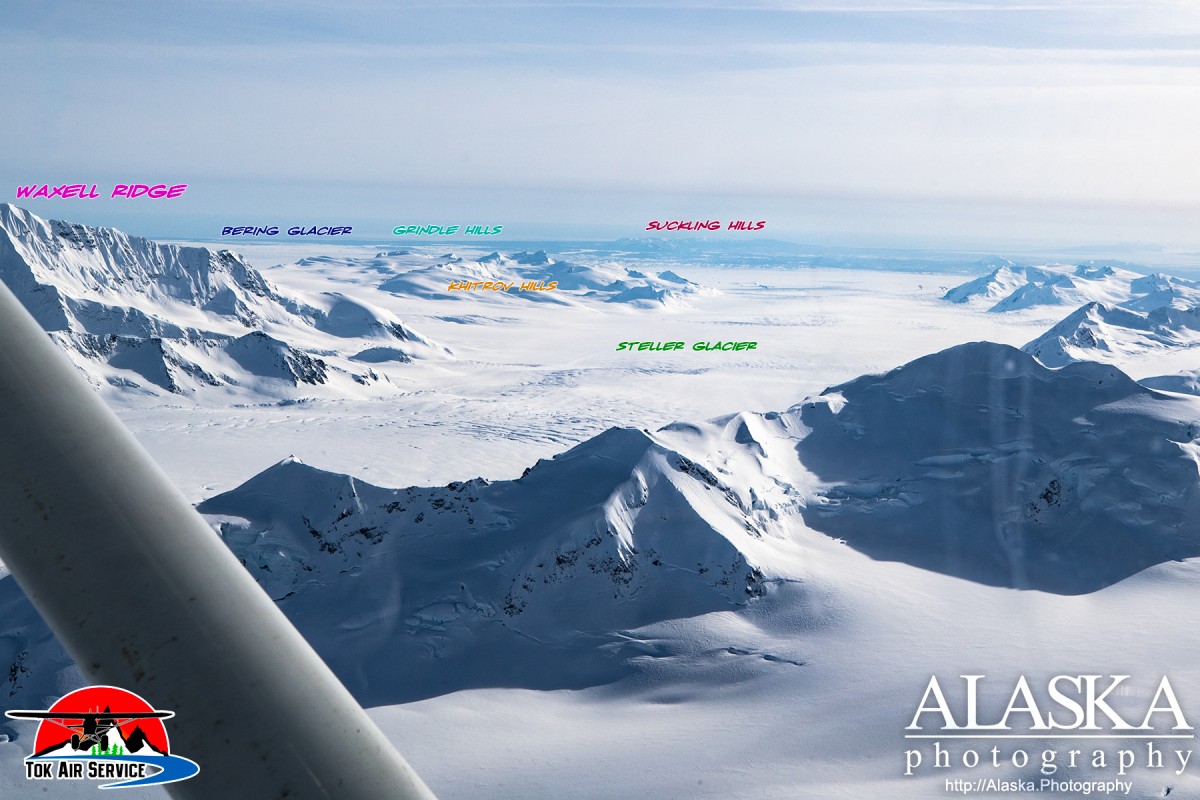
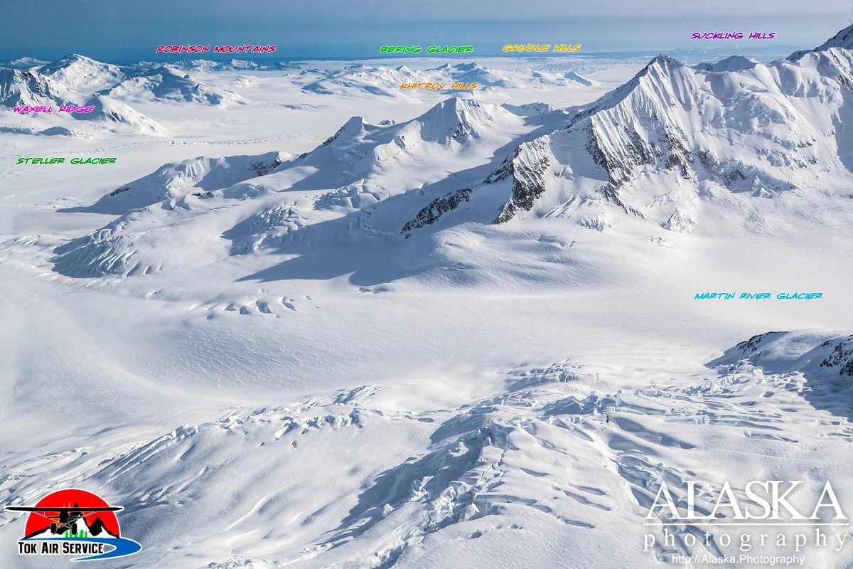
Capes:Glaciers:Bering Glacier, Bering Lobe, Griddlecake Glacier, Steller Glacier, Yushin Glacier,
Islands:The Wallypogs, Bentwood Island, Beringia Novaya, Peat Falls Island, Pointed Island, Tsitus Island, Weeping Peat Island, Whaleback Island,
Lakes:Lake Sofron, Hohlinsock Lake, Tsiu Lake, Vitus Lake,
Mountain Passes:Mountain Ranges:Grindle Hills, Khitrov Hills, Plenisner Hills,
Rivers:Pictures of, from, or near Bering Glacier.