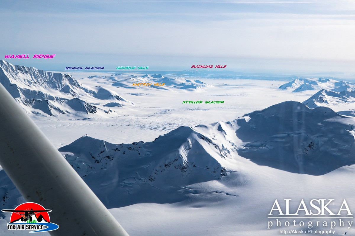
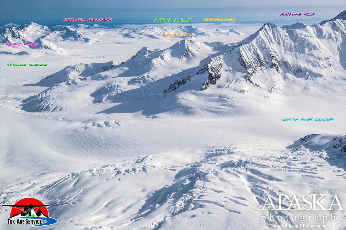
Grindle Hills Gallery
Pictures of, from, or near Grindle Hills.
Forms the W portion of the Robinson Mountains, extending NW from Hanna Lake into the Bering Glacier, 18 mi. SW of Mount Steller, Chugach Mts. 7 miles long.
Named in 1938 by oil company geologists for Melvin Grindle, who trapped and guided in this area for many years before his death in 1951.
Bering Glacier, Bering Lobe, Griddlecake Glacier, Kaliakh Lobe, Yushin Glacier,
Islands:The Wallypogs, Bentwood Island, Beringia Novaya, Peat Falls Island, Pointed Island, Tsitus Island, Weeping Peat Island, Whaleback Island,
Lakes:Hanna Lake, Hohlinsock Lake, Midimber Lake, Tsiu Lake, Tsivat Lake, Vitus Lake,
Mountain Passes:Mountain Ranges:Ridges:Rivers:Pictures of, from, or near Grindle Hills.