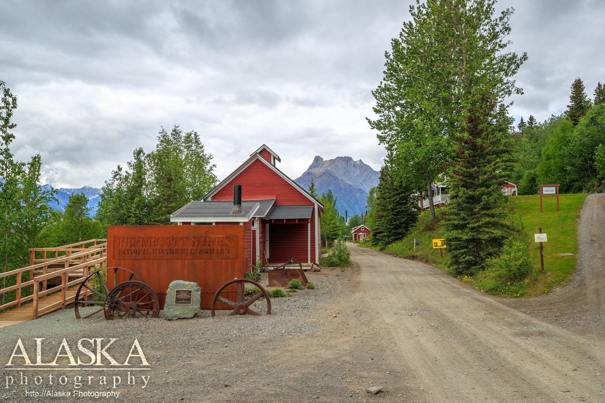
Kennecott Mines National Historic Landmark Gallery
Pictures of, from, or near Kennecott Mines National Historic Landmark.
Kennecott Mines National Historic Landmark is a beautiful look in to Alaska's past. The large red buildings in such a remote dramatic landscape have a feel like no where else.
Driving you if starting from Anchorage you will need to take the Glenn Highway to Glennallen and then south on Richardson Highway. From Fairbanks head south on the Richardson Highway. About 30 miles after Glennallen, after to reach Pippin Lake, turn left on to AK-10/Edgerton Hwy. Stay on the for 33 miles until you reach Chitina. The road will make a sharp left turn at the restaurant. Stay on it as it turns into McCarthy Rd, stay on that till it ends 60 miles later.
At McCarthy you park at "Basecamp" and proceed across the foot bridge. ATV's and bikes are permitted on the foot bridge. If on foot during the summer season there is a shuttle every half hour $5 each way.
In its prime Kennecott Mine was the largest producer of copper in the world.
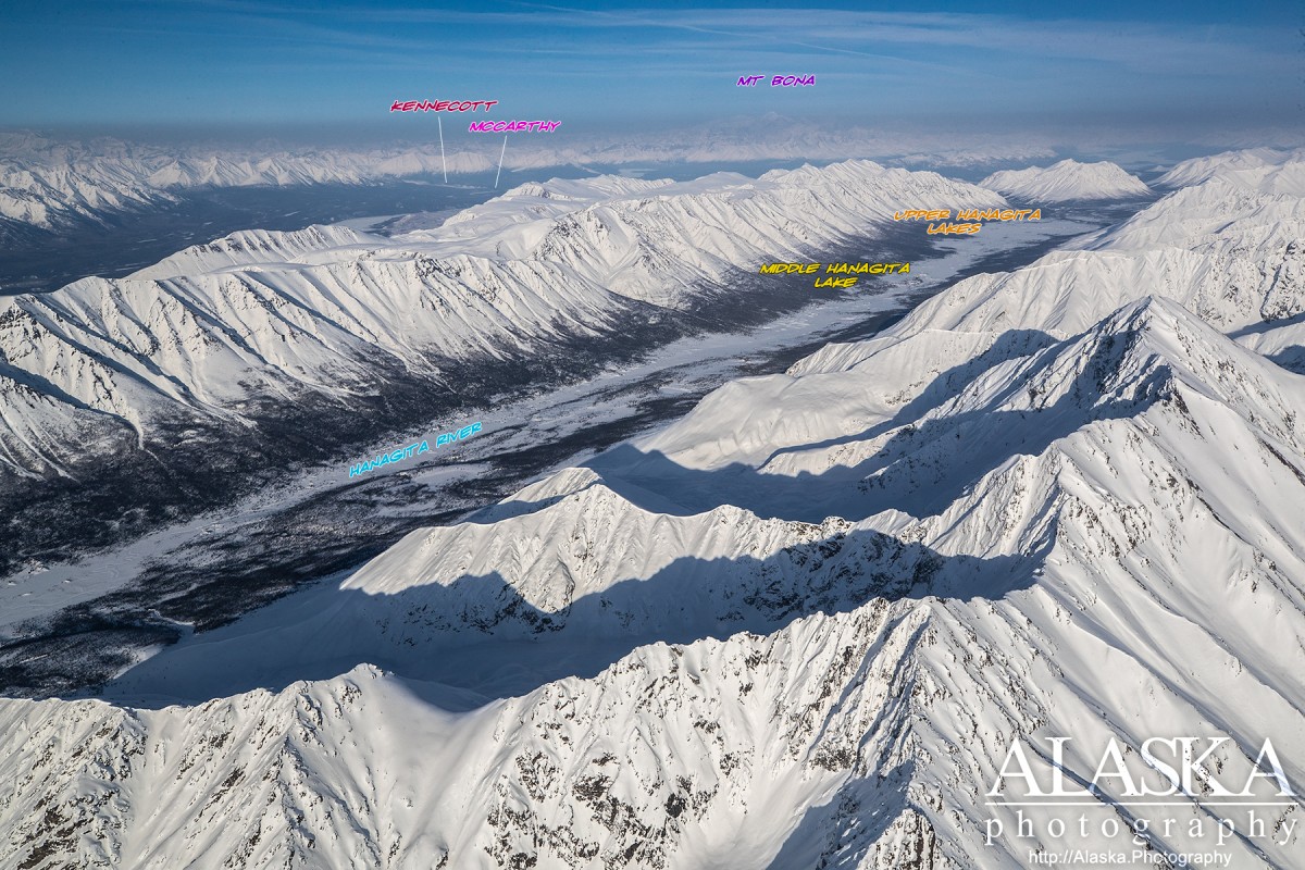
Gates Glacier, Kennicott Glacier, McCarthy Creek Glacier, Root Glacier, Stairway Icefall, West Fork Glacier,
Lakes:Baultoff Lakes, Camel Lake, Hidden Creek Lake, Star Lake, Threemile Lake, Wheat Lake,
Mine:Bonanza Mine, Green Butte Mine, Jumbo Mine, Mother Lode Mine, Nikolai Mine, Regal Mine,
Mountains:Bonanza Peak, Donoho Peak, Green Butte, Porphyry Mountain, Sourdough Peak,
Parks:Kennecott Mines National Historic Landmark,
Ridges:Bonanza Ridge, Sourdough Hill,
Rivers:Streams:Amazon Creek, Bonanza Creek, Chititu Creek, Dimond Creek, East Fork McCarthy Creek, Farm Creek, Fireweed Creek, Fourth of July Creek, Jumbo Creek, Lubbe Creek, May Creek, McCarthy Creek, National Creek, Nikolai Creek, Swift Creek, Young Creek,
Routes:Bonanza Mine Road, Bonanza-Jumbo Mine Road, Erie Mine Trail, Jumbo Mine Trail, Root Glacier Trail,
Valleys:Amazon Gulch, Fivemile Gulch, Kaufman Gulch, Sawmill Gulch,
Cities:Pictures of, from, or near Kennecott Mines National Historic Landmark.