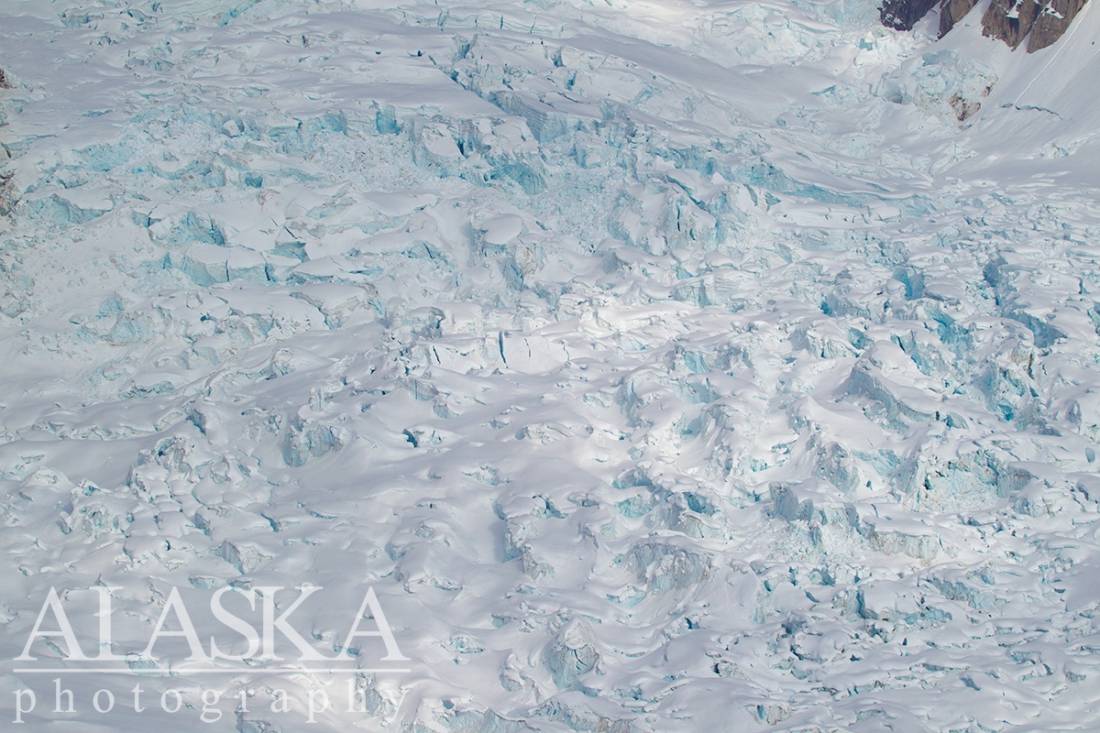
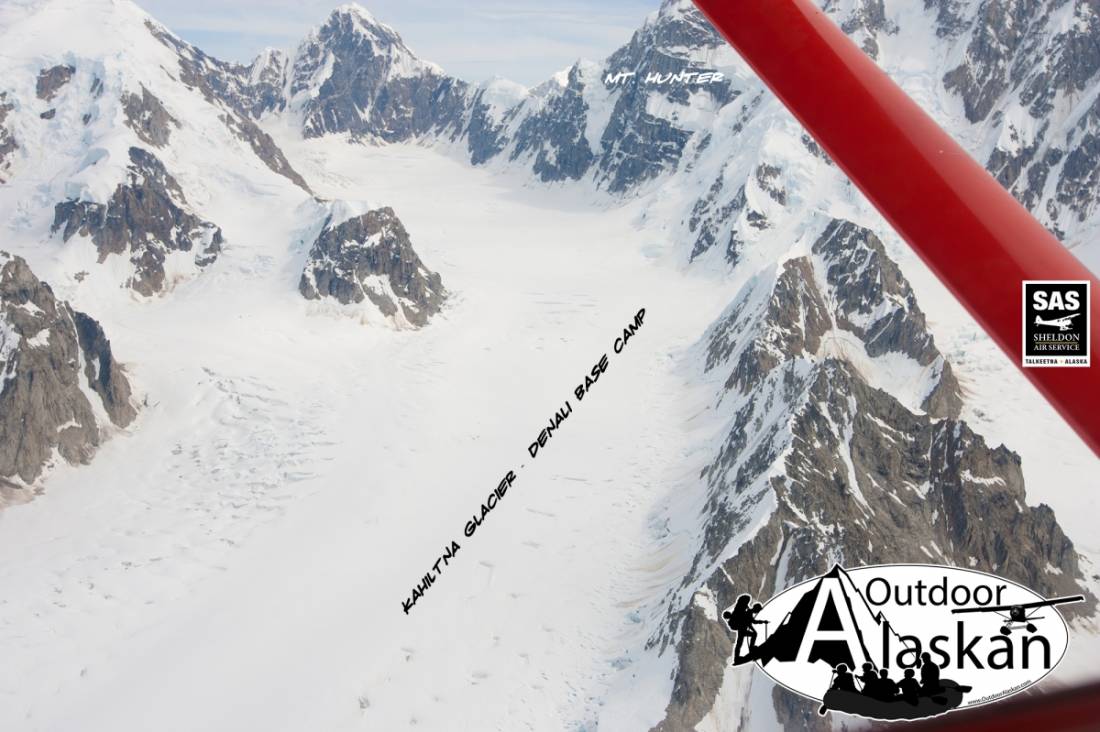
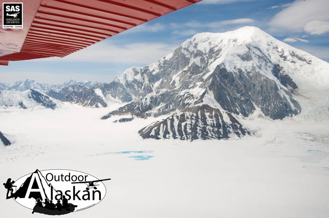
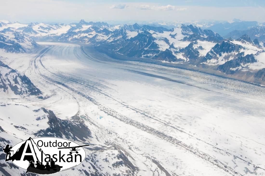
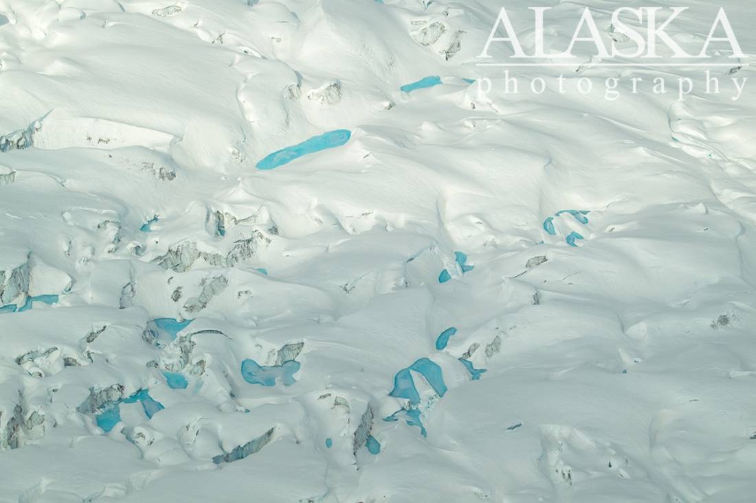
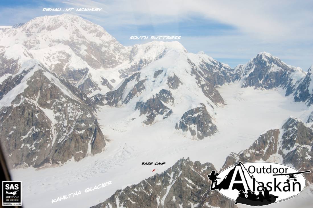
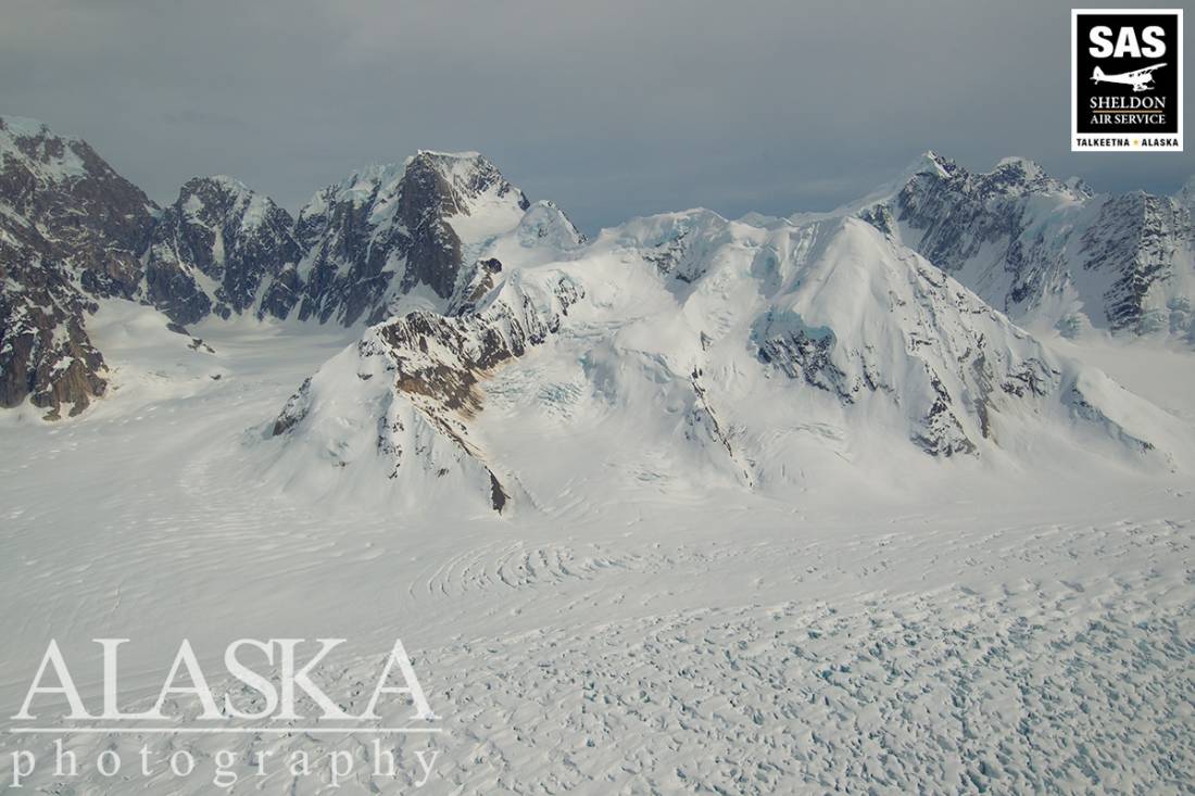
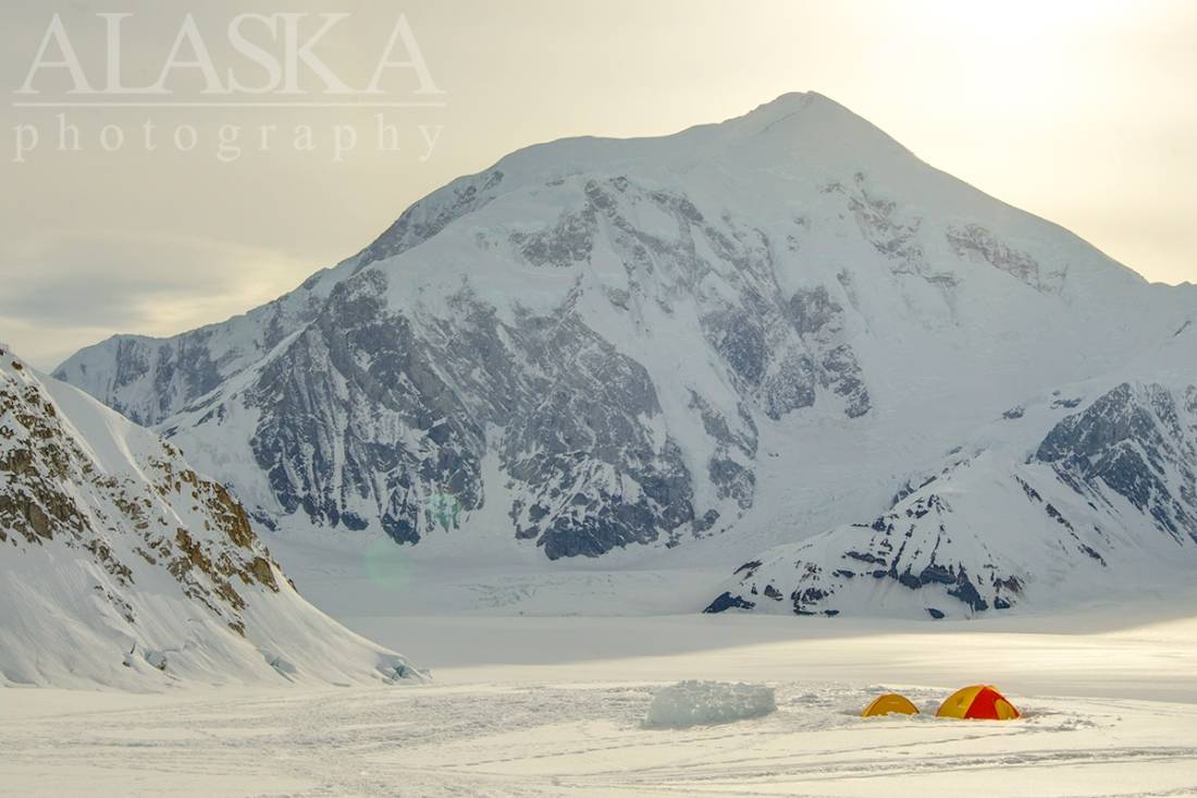
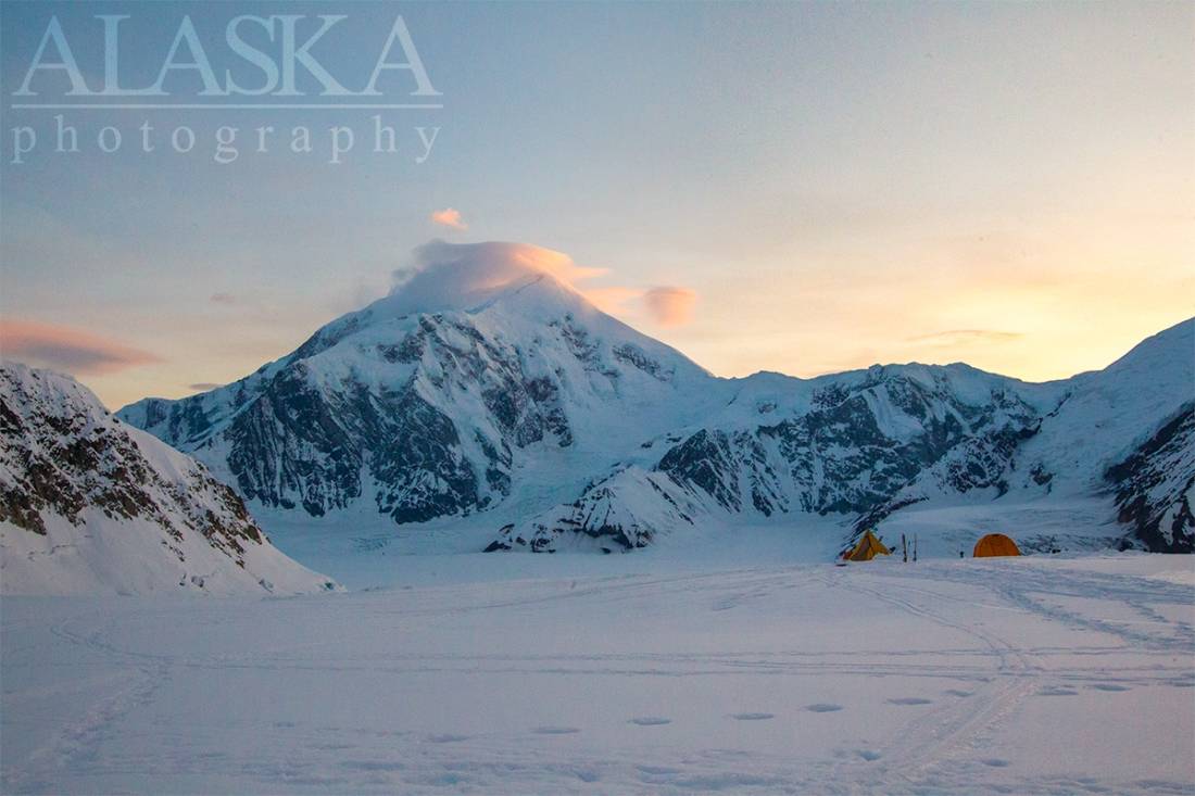
Kahiltna Glacier Gallery
Pictures of, from, or near Kahiltna Glacier.
heads in icefield between Mount Foraker and Mount Hunter, trends S 30 mi. to head of Kahiltna River, 5 mi. E of Chelatna Lake and 35 mi. NE of Talkeetna; Alaska Range
Tanaina Indian name reported in 1899 by Lieutenant J. S. Herron (1901, p. 45 and map), USA, as "Car-ilt-nu." spelling was published by Adolph Knopf and Sidney Paige (in Brooks and others, 1906, p. 118), U.S. Geological Survey (USGS).
Crown Glacier, Glacier G208496E62655N, Glacier G208532E62681N, Glacier G208541E62705N, Glacier G208558E62721N, Glacier G208579E62609N, Glacier G208594E62593N, Glacier G208726E62664N, Glacier G208814E62659N, Glacier G208835E62676N, Glacier G208859E62713N, Hidden Glacier, Kahiltna Glacier, Pika Glacier, Southeast Fork Kahiltna Glacier,
Locales:Denali Base Camp, Heartbreak Hill,
Mountains:Coronet, Crown Jewel, Dragon Spine, Dragons Head, Mount Foraker, Hobbit King, Mount Hunter, Italys Boot, Lady in Waiting, Munchkin, North Troll, Peak 6835, Royal Tower, Scimitar, South Troll, The Throne, Witches Hat, Your Highness,
Mountain Passes:Peaks:Avalanche Spire, Middle Troll, Peak P626926W511545, Radio Control Tower, Voyager Peak,
Ridges:Annie's Ridge, Thunder Mountain,
Routes:Deprivation, Moonflower Buttress,
Streams:Routes:Pictures of, from, or near Kahiltna Glacier.