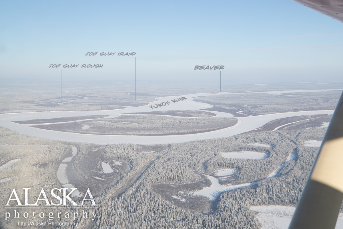
Joe Guay Slough Gallery
Pictures of, from, or near Joe Guay Slough.
an anabranch of the Yukon River, flows SW to New Cutoff, 4 mi. SW of Beaver, Yukon Flats.
Name derived from Joe Guay Island; reported in 1956 by T. E. Taylor, U.S. Geological Survey (USGS).
Joe Guay Island, Whirlpool Island,
Lakes:Annie Lake, Argo Bill Lake, Beaverdam Lake, Big Lake, Elbow Lake, Greenhorn Lake, Island Lake, Nelson Lake, North Fork Lake, Pitka Lake, Sunken Lake, Sweeney Lake, Twin Lakes,
Mountain Passes:Streams:Streams:Beaver Creek, Beaver Slough, Fish Creek, Whirlpool Slough,
Cities:Pictures of, from, or near Joe Guay Slough.