Rainbow Ridge Gallery
Pictures of, from, or near Rainbow Ridge.
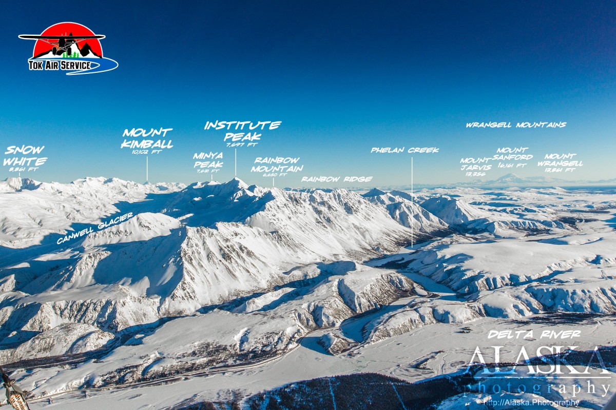
extends NW from McCallum Creek, E of Richardson Highway, 15 mi. NW of Paxson, near Alaska Highway, Alaska Range
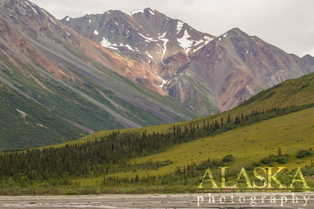
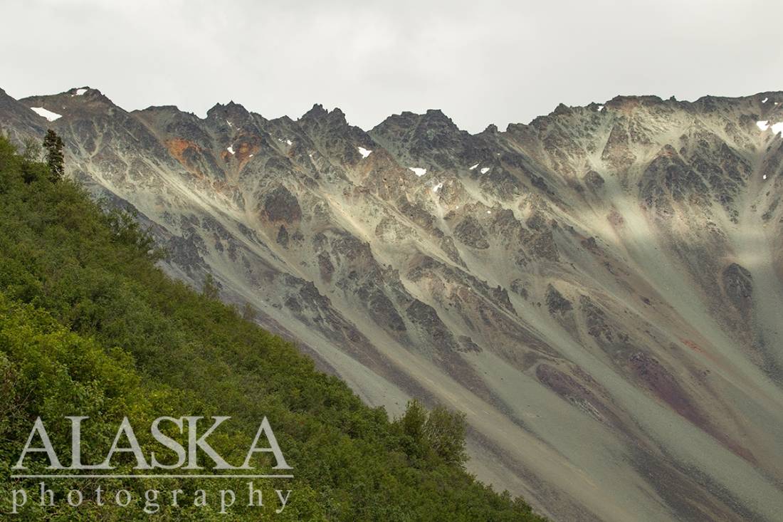
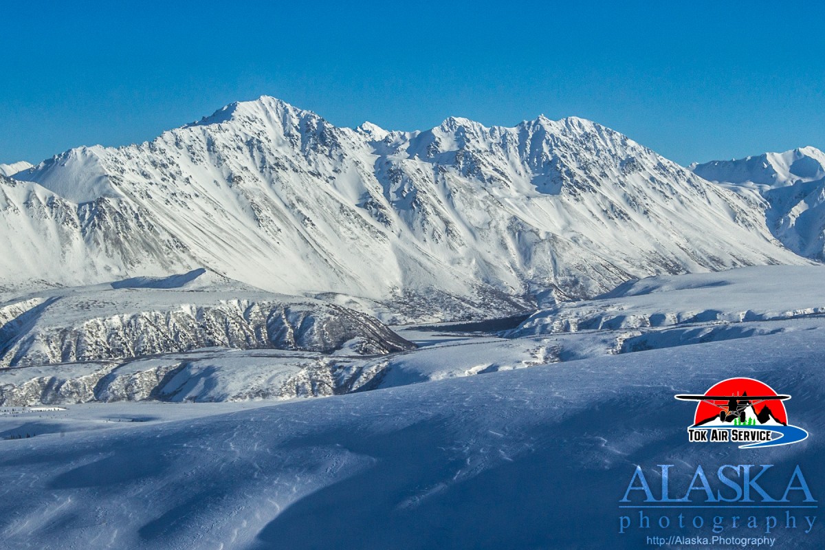
Rainbow Ridge is a long sweeping ridge the flows mostly north to south. It's steep slopes run parallel to the east shoulder of the Richardson Highway.
Rainbow Ridge is located Mile 206, and to the east of the Richardson Highway just south Canwell Glacier. South of Delta Junction, to access rainbow ridge drive to milepost 206 and walk off the east shoulder off the Richardson Highway.
Name published on relatively recent maps.Rainbow Ridge received its name from Rainbow Mountain being its highest peak. Which received its name from having colorful strata on its slopes.
Broken Glacier, Canwell Glacier, Castner Glacier, Eel Glacier, Fels Glacier, Gabriel Icefall, McCallum Glacier, West Gulkana Glacier,
Lakes:Crystal Lakes, Dude Lake, Fielding Lake, Moose Lakes, Oxbow Lake, Rapids Lake, Sevenmile Lake, Two Bit Lake,
Mine:Mountains:Cony Mountain, Devils Thumb, The Hoodoos, Institute Peak, Minya Peak, Ogive Mountain, Rainbow Mountain, Rainy Mountain, Mount Silvertip, Skull Peak, Traingle Peak,
Mountain Passes:Ridges:Streams:Ann Creek, Boulder Creek, Cabin Creek, Camp Terry Creek, Castner Creek, College Creek, Eureka Creek, Falls Creek, Fish Creek, Flood Creek, Garret Creek, Garrett Creek, Gunn Creek, Gunnysack Creek, Lower Miller Creek, McCallum Creek, Michael Creek, Miller Creek, Phelan Creek, Rainy Creek, Trims Creek, West Phelan Creek, Whistler Creek,
Routes:Gulkana Glacier Trail, Trans-Alaska Trail - Paxson to Summit Lake, Trans-Alaska Trail - Summit Lake to Black Rapids,
Pictures of, from, or near Rainbow Ridge.