Wishbone Hill Gallery
Pictures of, from, or near Wishbone Hill.
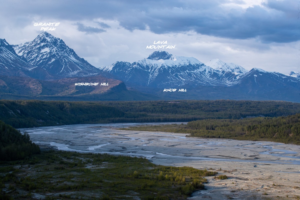
E of Moose Creek, 10 mi. NE of Palmer, Cook Inlet Low.
Local name reported in 1910 by G. C. Martin (in Brooks and others, 1911, pl.8), U.S. Geological Survey (USGS). So named because of its shape.
Glacier G210960E61831N, Mint Glacier,
Hills:Routes:Lakes:Burkholder Lake, Butte Lake, Coyote Lake, Elks Lake, Falks Lake, Gull Lake, Jim Lake, Kleinsmith Lake, Leaf Lake, Lower Reed Lake, McLeod Lake, Seventeenmile Lake, Slipper Lake, Swan Lake, Upper Reed Lake, Wishbone Lake, Wolverine Lake,
Mine:Baxter Mine, Buffalo Mine, Eska Mine, Evan Jones Mine, Lonesome Mine, Matanuska Sinner Mine, New Black Diamond Mine, Premier Mine,
Mountains:Bodenburg Butte, Eska Mountain, Granite Peak, Idaho Peak, Knob Hill, Lava Mountain, Lazy Mountain, Matanuska Peak, Montana Peak, Souvenir Peak, Wishbone Hill,
Parks:Coyote Lake Park, Moose Creek State Recreation Area,
Mountain Passes:Backdoor Gap, Bomber-in-a-day Pass, Grizzly Pass, Moosehead Pass, Sobriety Pass,
Peaks:3 Bell Spire, Arkose Peak, Crag, Delia Benchmark, Dewlap Peak, Doublemint, Frontier Peak, Good Hope Towers, Hunchback Spire, Lynx Peak, Managemint, Nelteni, Outpost Peak, Ozone, Parlimint, Peppermint, Rainy Day Knoll, Spearmint, Teeny Weene, Telemint, Tenemint, Triplemint, Troublemint, Turnkey Peak, Vegetarian Peak,
Ridges:Rivers:Streams:Buffalo Creek, Doone Creek, Eska Creek, Gloryhole Creek, Granite Creek, Iron Creek, Knob Creek, Little Granite Creek, McRoberts Creek, Moose Creek, Premier Creek, Wolverine Creek,
Valleys:Lone Tree Gulch, Matanuska Valley, Tsadaka Canyon,
Cities:Pictures of, from, or near Wishbone Hill.