Grand Pacific Glacier Gallery
Pictures of, from, or near Grand Pacific Glacier.
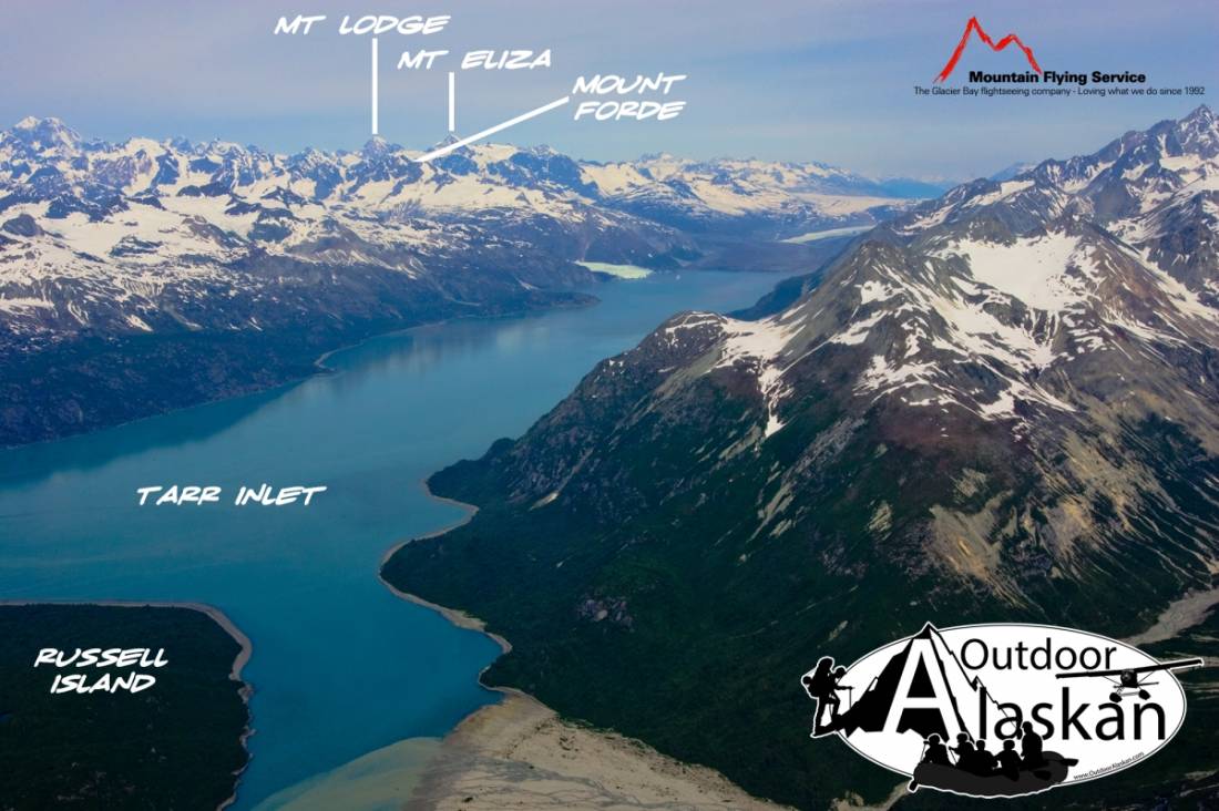
heads in St Elias Mts., 7 mi. SW of Mount Hay, trends E into British Columbia then SE to head of Tarr Inlet at Alaska-Canada boundary, 68 mi. SW of Skagway.
Named by John Muir in 1879. In 1892 Reid (1896, pl. 86 and p. 432), U.S. Geological Survey (USGS), found that the front of the glacier had receded so far as to convert it into three distinct glaciers. He retained the name Grand Pacific for the most northerly and largest, and named the middle one Johns Hopkins Glacier. The smallest and most southerly glacier was named Reid Glacier in 1899 by the Harrington Expedition.
Johns Hopkins Inlet, Tarr Inlet,
Capes:Glaciers:Charley Glacier, Grand Pacific Glacier, John Glacier, Jones Glacier, Kadachan Glacier, Kashoto Glacier, Margerie Glacier, Rendu Glacier, Topeka Glacier, Toyatte Glacier, Tyeen Glacier,
Mountains:Mount Barnard, Boundary Peak 159, Mount Cooper, Mount Forde, Mount Parker,
Streams:Pictures of, from, or near Grand Pacific Glacier.