Portland Island Gallery
Pictures of, from, or near Portland Island.
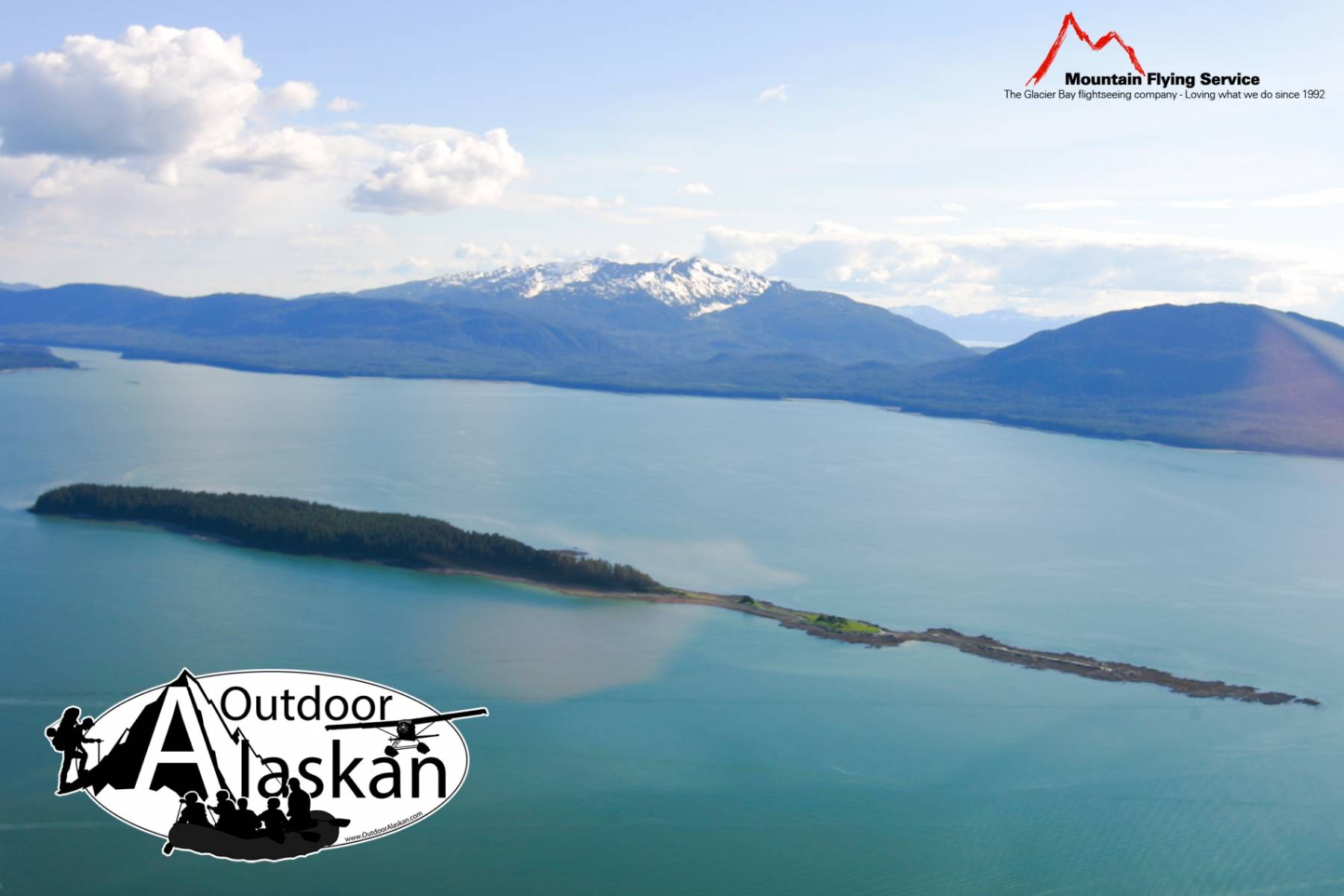
trends NW in Stephens Passage, 2 mi. S of Point Louisa and 12 mi. NW of Juneau, Coast Mts.
Named in 1880 by Captain L. A. Beardslee, U.S. Navy (USN) and published by US@C&GS in the 1883 Coast Pilot (p. 174).
Battleship Reef, Cohen Reef, Dornin Rock, Eagle Reef, Faust Rock, Favorite Reef, George Rock, Gibby Rock, Horse Shoal, Mendenhall Bar, North Ledge, Poundstone Rock,
Bays:Adams Anchorage, Admiralty Cove, Amalga Harbor, Auke Bay, Auke Nu Cove, Barlow Cove, Coot Cove, Crab Cove, Curlew Ledge, Eagle Harbor, Fritz Cove, Funter Bay, Halibut Cove, Hand Trollers Cove, Hawk Inlet, Huffman Harbor, Indian Cove, Lena Cove, Pearl Harbor, Shelter Cove, Smugglers Cove, Tee Harbor, Young Bay,
Beaches:The Sand Beach, Eagle Beach, Young Beach,
Capes:Auke Cape, Barlow Point, Clear Point, Entrance Point, False Arden, Hut Point, Indian Point, Inner Point, Inspiration Point, Point Lena, Point Louisa, Mansfield Peninsula, Mendenhall Peninsula, Middle Point, Outer Point, Piling Point, Point Retreat, Spaulding Point, Spuhn Point, Point Stephens, Sunny Point, Symonds Point, Point Young,
Channels:Favorite Channel, North Pass, Saginaw Channel,
Cliffs:Dams:Glaciers:Hills:Islands:Aaron Island, Bare Island, Barlow Island, Battleship Island, Bird Island, Coghlan Island, Cohen Island, Colt Island, Gauge Island, Gull Island, Horse Island, Indian Island, Kishbrock Island, The Kittens, Ledge Island, Naked Island, Portland Island, Rat Island, Scull Island, Sentinel Island, Shaman Island, Shelter Island, Spuhn Island, Star Rock, Station Island, Strauss Rock, Suedla Island,
Lakes:Auke Lake, Cropley Lake, Dredge Lake, Mendenhall Lake, Nugget Creek, Peterson Lake, Salt Lake, Shelter Lake, Windfall Lake,
Mine:Admiralty Mine, Alaska Dano Mine, Alaska Empire Mine, Lower Montana Creek Mine, Peterson Mine, Windfall Creek Mine,
Mountains:Mount Anderson, Auke Mountain, Mount Ben Stewart, Green Mountain, Lone Mountain, McGinnis Mountain, Mount Meek, Mount Robert Barron, Snowy Mountain, Stroller White Mountain, Thunder Mountain, Treasury Hill,
Parks:Auke Recreation Area, Funter Bay State Marine Park, Shelter Island State Marine Park,
Rivers:Eagle River, Herbert River, Mendenhall River,
Streams:Admiralty Creek, Arastra Creek, Auke Creek, Auke Nu Creek, Bay Creek, Bear Creek, Boulder Creek, Cordwood Creek, Cove Creek, Duck Creek, Elevenmile Creek, Fish Creek, Fowler Creek, Goose Creek, Johnson Creek, Jordan Creek, Lake Creek, Lena Creek, McGinnis Creek, Montana Creek, Ninemile Creek, Nugget Creek, Peterson Creek, Peterson Creek, Shrine Creek, Slate Creek, Steep Creek, Tee Creek, Tenk Creek, Tusta Creek, Waydelich Creek, Windfall Creek,
Routes:Amalga Trail, Bear Creek Trail, Herbert Glacier Trail, Mount McGinnis Trail, Montana Creek Trail, Peterson Creek Trail, Rainforest Trail, Spaulding Trail, West Glacier Trail, Windfall Lake Trail, Yankee Basin Trail, Young Lake Trail,
Valleys:Mendenhall Valley, Prairie Basin,
Cities:Auke Bay, Dobson Landing, Fairhaven, Funter, Hawk Inlet, Lena Beach, Mendenhall Valley, Mendenhaven, Saint Terese, Tee Harbor,
Pictures of, from, or near Portland Island.
Sorted by Most Common to Least Common Viewings
Surf Scoter, Ruddy Turnstone, Black Turnstone, Bonaparte's Gull, American Crow, Black Oystercatcher, Surfbird, Pacific Loon, White-winged Scoter, Bald Eagle, Common Raven, Barrow's Goldeneye, Harlequin Duck, Wandering Tattler, Pigeon Guillemot, Northern Shoveler, Marbled Murrelet, Pine Siskin, Mallard, Bufflehead, Whimbrel, Tufted Puffin, Herring Gull, American Wigeon, Lesser Scaup, Song Sparrow, Black Scoter, Red-breasted Merganser, Horned Grebe, Rufous Hummingbird, Black-bellied Plover, Pelagic Cormorant, Belted Kingfisher, Rock Sandpiper, Least Sandpiper, Parasitic Jaeger, Common Murre, Common Gull, Glaucous-winged Gull, Arctic Tern, Common Loon, Red-breasted Sapsucker, Ruby-crowned Kinglet, Rock Pigeon