Blackstone Glacier Gallery
Pictures of, from, or near Blackstone Glacier.
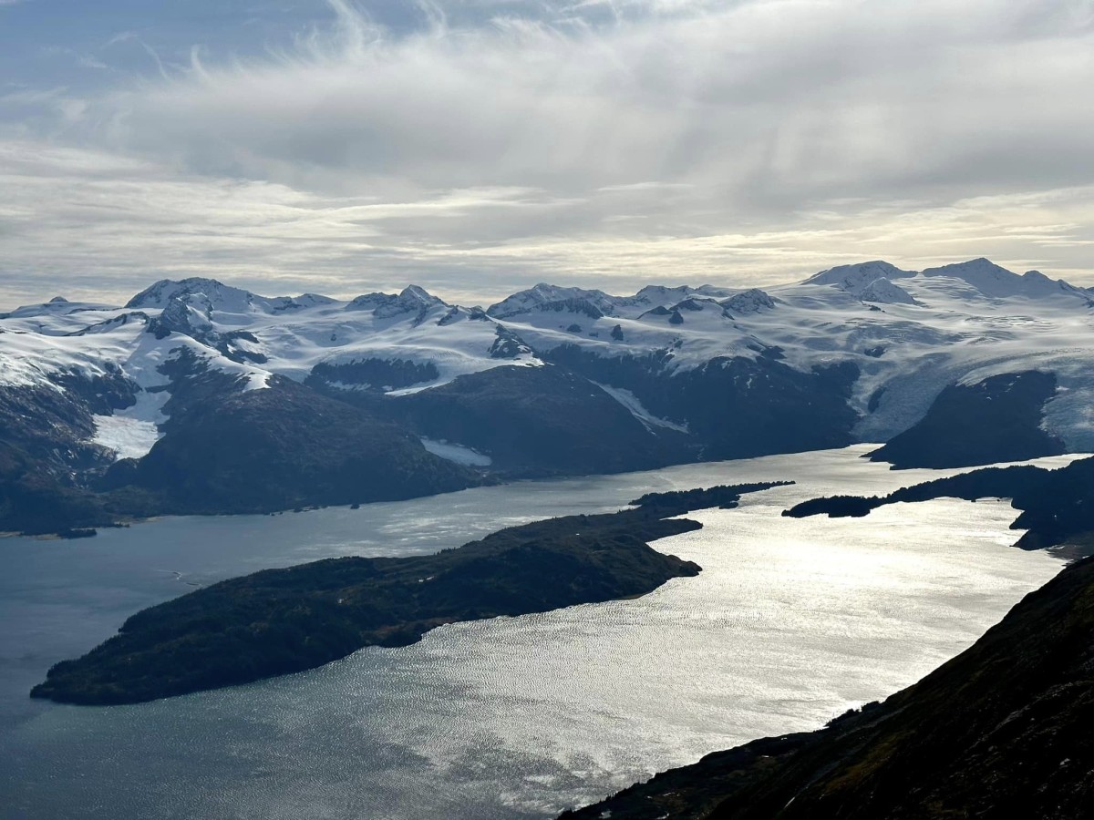
trends NE to its terminus at the head of Blackstone Bay, 8 mi. S of Whittier, Chugach Mts. 7 miles long.
Local name reported in 1899 by W. C. Mendenhall, U.S. Geological Survey (USGS). "Named for a miner, who with two companions, lost his life there in the winter of 1896" (Mendenhall, 1900 p. 325).
Blackstone Bay, Emerald Bay, Kings Bay, Passage Canal, Shotgun Cove, Smitty's Cove,
Capes:Bur Point, Gradual Point, Kings Point, Neptune Point, Trinity Point,
Cities:Glaciers:Applegate Glacier, Beloit Glacier, Blackstone Glacier, Burns Glacier, Byron Glacier, Carroll Glacier, Claremont Glacier, Concordia Glacier, Cotterell Glacier, Explorer Glacier, Falling Glacier, Glacier G211110E60758N, Glacier G211226E60788N, Glacier G211235E60779N, Glacier G211254E60750N, Kings Glacier, Lawrence Glacier, Learnard Glacier, Lowell Glacier, Marquette Glacier, Milton Glacier, Northland Glacier, Portage Glacier, Rainy Glacier, Ripon Glacier, Shakespeare Glacier, Skookum Glacier, Spencer Glacier, Taylor Glacier, Tebenkof Glacier, Whittier Glacier,
Islands:Emerald Island, Willard Island,
Lakes:Airstrip Pond, Alder Pond, Divide Lake, Portage Lake,
Mountains:Baird Peak, Bard Peak, Begich Peak, Boggs Peak, Byron Peak, Carpathian Peak, Mount Luther Kelly, Maynard Mountain, Shakespeare Shoulder,
Mountain Passes:Peaks:Explorer Peak, Learnard Peak, Lowell Peak, Portage Peak, Roost,
Rivers:Kings River, Nellie Juan River,
Streams:Billings Creek, Cove Creek, Placer Creek, Whittier Creek, Whittier Creek,
Routes:Byron Glacier Trail, Portage Pass Trail, Trail of Blue Ice,
Valleys:Pictures of, from, or near Blackstone Glacier.