Lituya Bay Gallery
Pictures of, from, or near Lituya Bay.
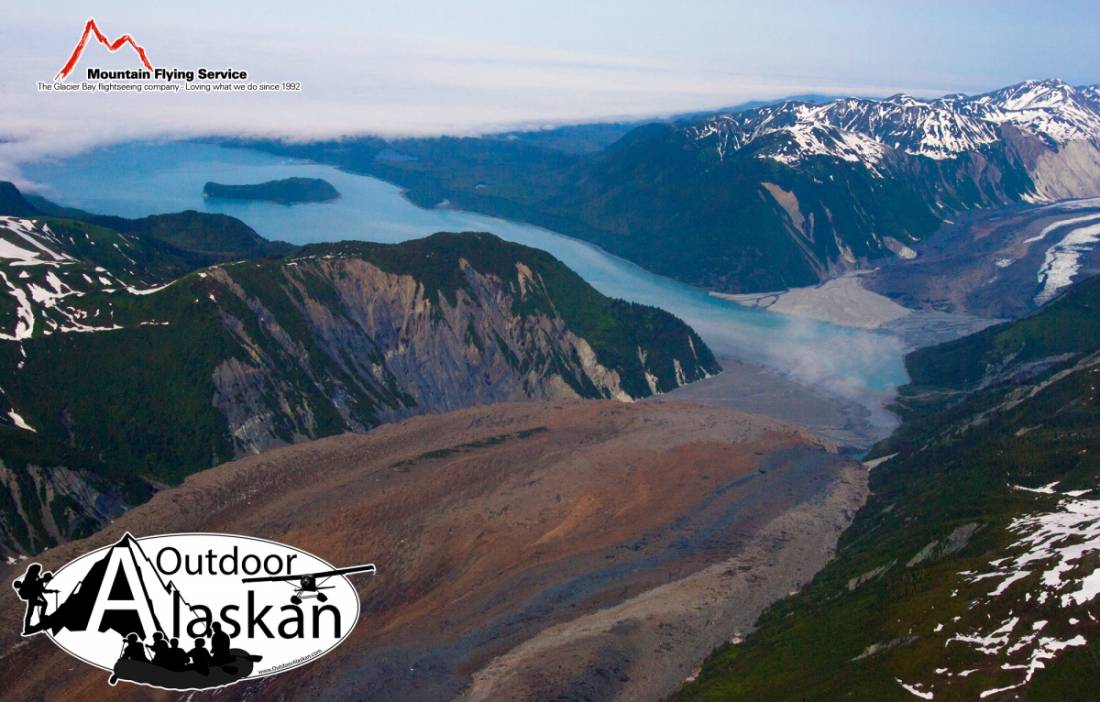
in Glacier Bay National Monument, heads at terminus of Cascade Glacier, trends SW to Gulf of Alaska, at Harbor Point, 88 mi. NW of Hoonah, Malaspina Coastal Plain
Tlingit Indian name obtained and used by the Russians. In 1805 Captain Lisianski (1814, p. 221), Imperial Russian Navy (IRN), called it "L'tooa Bay." It was published in Russian as "Z(aliv) L'tua." by Captain Tebenkov (1852, map 8), Imperial Russian Navy (IRN) and the Russian Hydrographic Dept. Chart 1378 shows "Zal(iv) Altua ili Port Frantsuzov" meaning "Altua Bay or Port of Frenchmen." La Perouse (1797, map 19) originally called the bay "Port des Francais" meaning the "Bay of the Frenchmen." Whalers knew it as Frechman's Bay. La Perouse visited and surveyed the bay in 1786 and made observations about the Indians living there.
Cormorant Rock, La Chaussee Spit, Passage Rock,
Bays:Anchorage Cove, Crillon Inlet, Gilbert Inlet, Lituya Bay,
Capes:Cenotaph Point, Harbor Point, Three Saints Point,
Glaciers:Cascade Glacier, Desolation Glacier, Fairweather Glacier, Huscroft Glacier, Lituya Glacier,
Hills:Islands:Lakes:Crillon Lake, Fish Lake, Grassy Pond,
Mountains:Bald Mountain, Bay Peak, Mount Escures, Grassy Mountain, Lituya Mountain, Mount Salisbury, South Billy Goat Mountain,
Ridges:Grassy Ridge, Solomon Railroad,
Rivers:Streams:Boulder Creek, Butcher Creek, Campbell Creek, Coal Creek, Eagle Creek, Echo Creek, Fall Creek, Fish Creek, Fourmile Creek, Justice Creek, Mineral Creek, Mudslide Creek, Portage Creek, Steelhead Creek, Topsy Creek, Whale Creek,
Valleys:Pictures of, from, or near Lituya Bay.