Hines Creek Gallery
Pictures of, from, or near Hines Creek.
flows NE to Riley Creek, 10 mi. S of Healy, Alaska Range. 6.5 miles long.
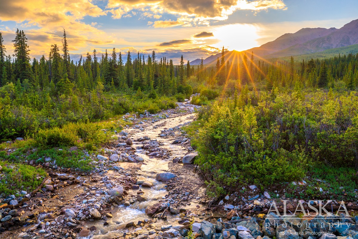
Hines Creek is a clear water creek that flows out of the mountains in Denali National Park and Preserve, and leaves the park just prior to joining the Nenana River. It is a steep descent and not considered a navigable body of water for much of it's run.
From Parks Highway turn on to Denali Park Road, drive just over 7 miles where the creek passes under the road. Or park near the turn off for Denali Park Road and walk south along the Parks Highway and proceed down to the creek where it crosses under the Parks Highway.
Local name reported by Woodbury Abbey, U.S. Army Corps of Engineers, on the blueprint of his 1921 Mount Mckinley National Park survey.
Stl-uuli Caek-e, Tl-ahwdicaaxi Caek-e, Tsenesdghaas Caek-e,
Cities:Lakes:Deneki Lakes, Horseshoe Lake, Lake L636947W488662, Lake L637006W488781, Otto Lake, Triple Lakes,
Mine:Cripple Creek Mine, Usibelli Mine,
Mountains:Dora Peak, Mount Fellows, Mount Healy, Sugar Loaf Mountain,
Rivers:Streams:Alaska Creek, Antler Creek, Carlo Creek, Copeland Creek, Coyote Creek, Cripple Creek, Dora Creek, Dragonfly Creek, Dry Creek, Eagle Creek, Fox Creek, Frances Creek, Gagnon Creek, Gold Run, Grizzly Creek, Healy Creek, Hines Creek, Hornet Creek, Junco Creek, Kingfisher Creek, Lignite Creek, Little Creek, Louise Creek, Lynx Creek, Montana Creek, Moody Creek, Panguingue Creek, Poker Creek, Popovitch Creek, Riley Creek, Sanderson Creek, Sheep Creek, Slime Creek, Suntrana Creek,
Valleys:Bison Gulch, French Gulch, Iceworm Gulch, Nenana River Gorge,
Cities:Pictures of, from, or near Hines Creek.