Favorite Channel Gallery
Pictures of, from, or near Favorite Channel.
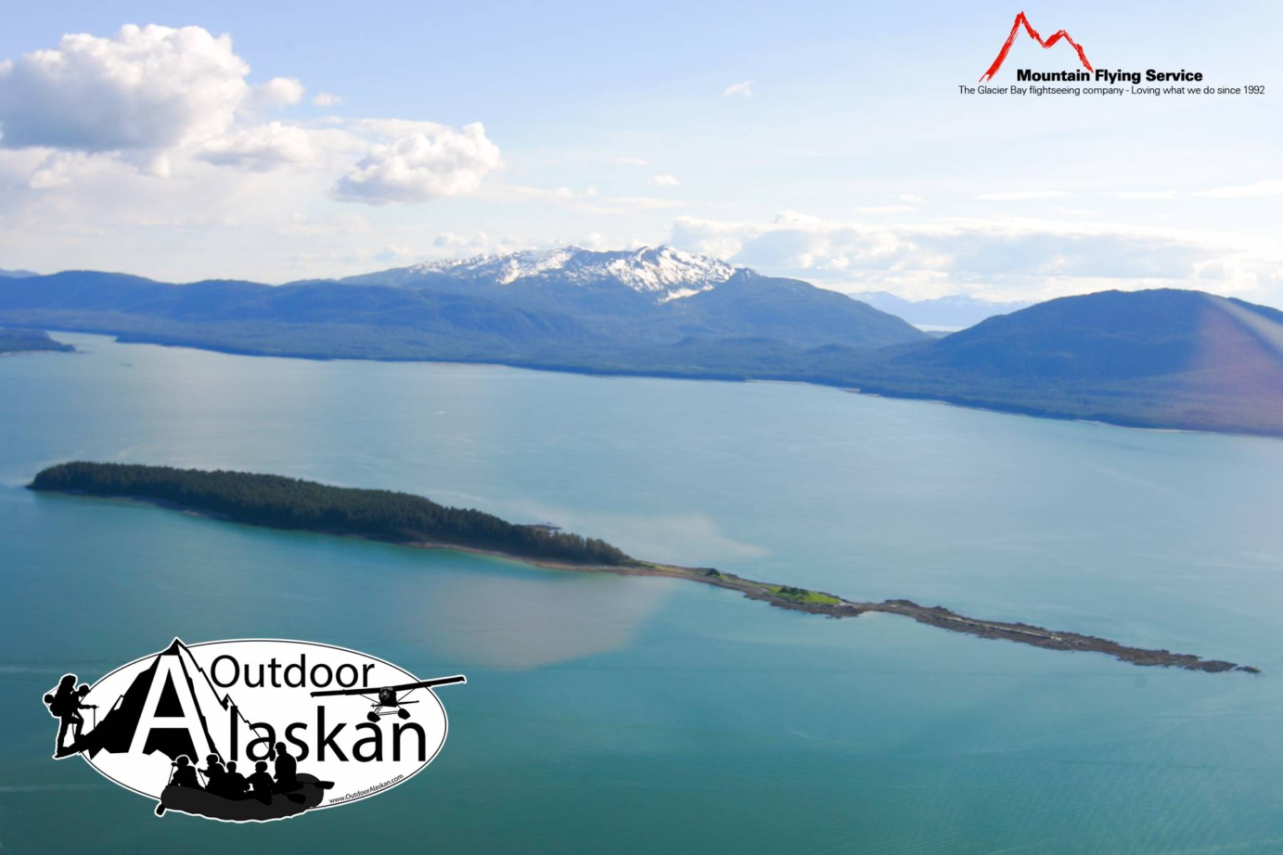
16 miles long. Extends NW from Stephens Passage to Lynn Canal, N of Lincoln I. and 28 mi. NW Juneau, Coast Mts.
Named in 1880 by Y. S. Navy officers for the 80 ft. steamboat Favorite, built in 1874. The vessel was chartered by the Navy for Alaskan surveying work and was later used to conduct trading and fishing for the herring-reduction plant at Killisnoo. It was in operation until about 1900 (DeArmond, 1957, p. 19).
Auke,
Archipelagos:Bars:Cohen Reef, Dornin Rock, Eagle Reef, Faust Rock, Favorite Reef, George Rock, Gibby Rock, Poundstone Rock, Vanderbilt Reef,
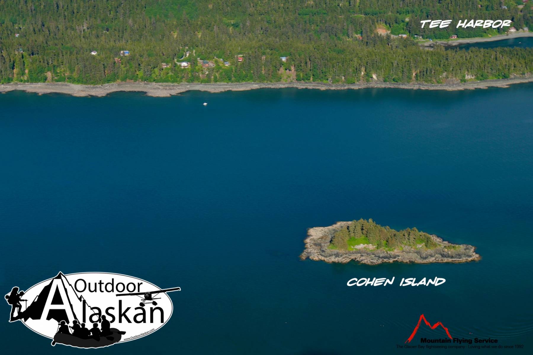
Basins:Bays:Adams Anchorage, Amalga Harbor, Auke Bay, Auke Nu Cove, Barlow Cove, Bridget Cove, Eagle Harbor, Echo Cove, Halibut Cove, Hand Trollers Cove, Howard Bay, Huffman Harbor, Indian Cove, Lena Cove, Lincoln Anchorage, Pearl Harbor, Shelter Cove, Tee Harbor, Yankee Cove,
Beaches:Capes:Point Bridget, Auke Cape, Barlow Point, False Point Retreat, Point Howard, Indian Point, Inspiration Point, Point Lena, Point Louisa, Outer Point, Piling Point, Point Retreat, Point Stephens, Symonds Point,
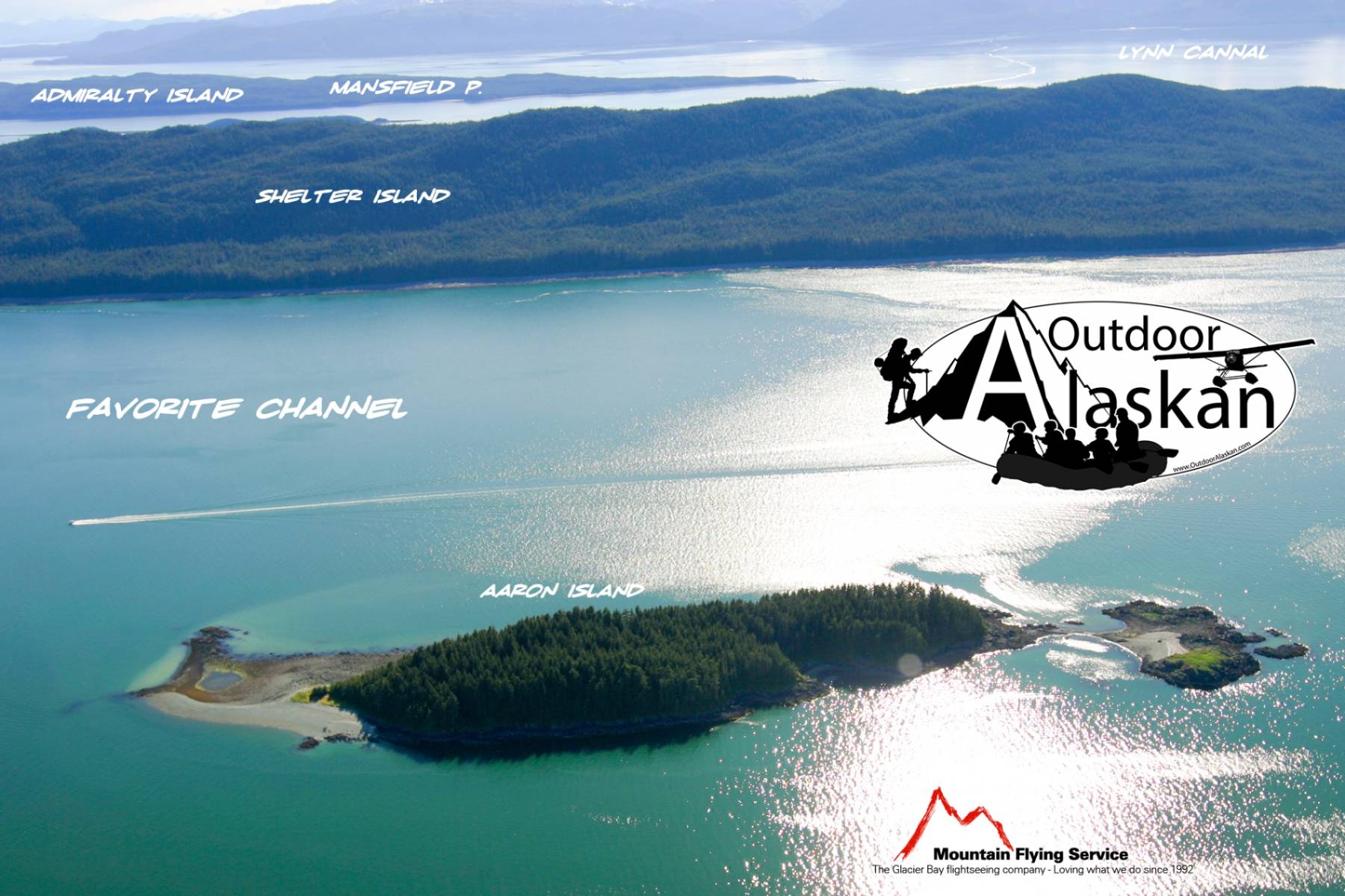
Channels:Favorite Channel, North Pass, Saginaw Channel,
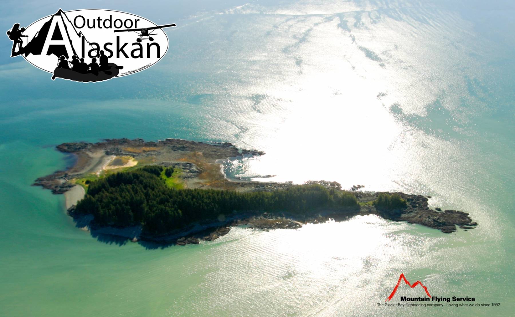
Cliffs:Glaciers:Islands:Aaron Island, Barlow Island, Benjamin Island, Bird Island, Coghlan Island, Cohen Island, Gull Island, Hump Island, Indian Island, Kishbrock Island, Lincoln Island, Little Island, Mab Island, North Island, Portland Island, Ralston Island, Sentinel Island, Shaman Island, Shelter Island, Strauss Rock,
Lakes:Peterson Lake, Salt Lake, Shelter Lake, Windfall Lake,
Mine:Aurora Borealis Mine, Bessie Mine, Eagle River Mine, Peterson Mine, Windfall Creek Mine,
Mountains:Mount Adolph Knopf, Auke Mountain, Green Mountain, Lone Mountain, Thane Mountain, Treasury Hill,
Parks:Auke Recreation Area, Shelter Island State Marine Park,
Rivers:Streams:Bear Creek, Bessie Creek, Boulder Creek, Canyon Creek, Cordwood Creek, Cowee Creek, Davies Creek, Goose Creek, Lena Creek, Peterson Creek, Peterson Creek, Shrine Creek, Slate Creek, South Fork Cowee Creek, Tee Creek, Tenk Creek, Tusta Creek, Windfall Creek,
Routes:Amalga Trail, Bear Creek Trail, Bessie Creek Trail, Davies Creek Trail, Herbert Glacier Trail, Montana Creek Trail, Peterson Creek Trail, Point Bridget Trail, Rainforest Trail, Spaulding Trail, Windfall Lake Trail, Yankee Basin Trail,
Valleys:Cities:Dobson Landing, Fairhaven, Lena Beach, Saint Terese, Tee Harbor,
Pictures of, from, or near Favorite Channel.