Suslota Lake Trail Gallery
Pictures of, from, or near Suslota Lake Trail.
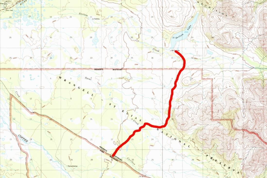
The Suslota Lake Trail obviously begins off the Nabesna Road then leads upward to Suslota Lake. Travel can be extremely difficult due to muskeg, mud bogs, standing water and tussocks. Conditions vary with seasonal rains and amount of use, but are generally poor and very wet.
After approximately 8 miles the trail crosses out of the National Preserve and on to State of Alaska land. Suslota Lake is outside of the Park boundary on State land. There are a number of privately owned cabins around the lake. Heaviest use is during mid-August through mid-September.
The trail is not recommended for hiking it's originally an ORV (Off-Road Vehicle) trail but last we checked it was currently closed to ORV. When traveling in the park ORV permits are required for all recreational users. To obtain a permit, apply in person at the Slana Ranger Station (907) 822-7401 or Park Headquarters (907) 822-7250.
From the Glenn Highway south of Tok and north of Glennallen take the turn east off the highway to Slana. There is parking at Milepost 11.2 Nabesna Road, while the trailhead is at Milepost 11 Nabesna Road.
Boomerang Lake, Carlson Lake, Copper Lake, Suslota Lake,
Mountain Passes:Streams:Streams:Caribou Creek, Carlson Creek, Natat Creek, Porcupine Creek, Rufus Creek, Suslositna Creek, Suslota Creek, Tanada Creek,
Routes:Pictures of, from, or near Suslota Lake Trail.