Murphy Dome Gallery
Pictures of, from, or near Murphy Dome.
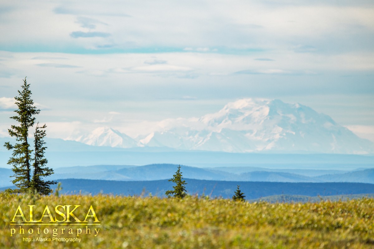
Murphy Dome is the highest point close to Fairbanks. The last couple hundred feet of the domes elevation is actually alpine. It's a good place to go if you just need a quick break from the city. There are three trails off Murphy Dome. The first one, a road the turns off to the left before reaching the summit, runs out along the ridge line and out above Minto Lakes and down to the Chatanika River.
The second and third trails which you can also drive down from the summit. These roads may be a little too rough for some cars to make it down. Most motor vehicles on these trails are often ATV's.
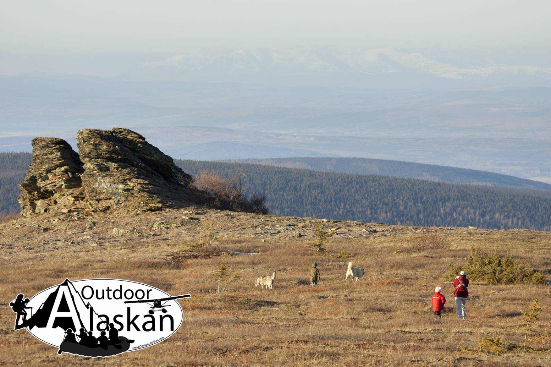
The third trail, the road the splits to the right, runs along a ridge and passes by some tors, or medium sized granite rocks, about 25ft high. The trail also continues down the ridge to the Chatanika River.
The top of Murphy Dome is low vegetation for easy off trail exploration. There are a couple tors along the western end of Murphy Dome. Fun to climb on and just sit and enjoy the view from. Nothing really technical.
Murphy Dome can offer good star gazing or northern lights viewing. Especially when Fairbanks is covering in ice fog.
There are no public restrooms available on Murphy Dome. (We've been asked. So just putting it out there.)
Getting to Murphy Dome is quite simple, go north behind Fairbanks. From highway 2 (Steese Hwy) turn on to Sheep Creek Rd, or highway 3 (Parks Hwy) turn on to Goldstream Rd. Both meet up and become the other. Either way you come from you'll be looking to turn North on to Murphy Dome Rd, then follow it to the end.
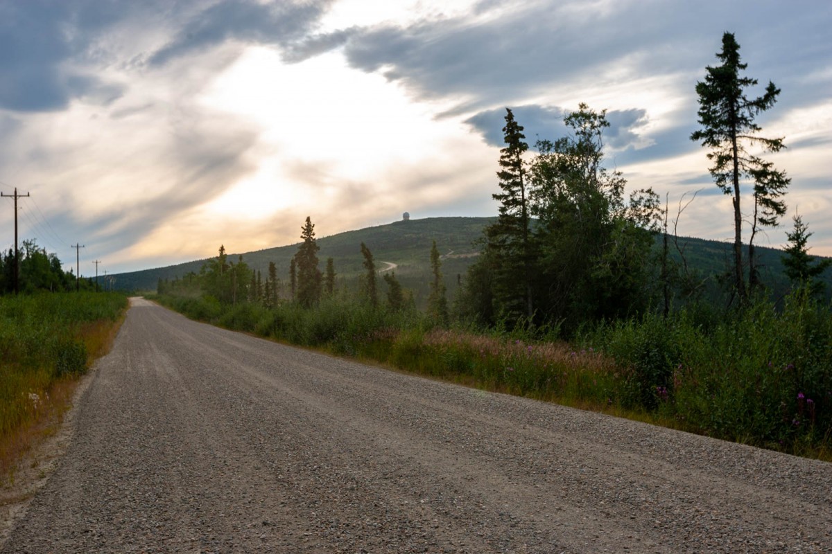
Starting in the 1950's Murphy Dome used to be used as an Air Force defense radar station, on the prowl for Soviet attacks. It was closed November 1, 1983. One of the radar domes is still in operation today as part of the Alaska Radar System.
Naming: Murphy Dome was a local name published in 1949 by the USGS.
Aggie Creek, Allen Creek, Baldry Creek, Cache Creek, Dawson Creek, Fortune Creek, Keystone Creek, Left Fork Cache Creek, Lincoln Creek, Ohio Creek, Shovel Creek, Spier Creek, Spinach Creek, Standard Creek, Straight Creek,
Cities:Pictures of, from, or near Murphy Dome.