Information About

Bogoslof Island

Quick Facts

Open in The Map Bogoslof Island on The Map

Location

53 ° 56' 8.999" N,
168 ° 2' 20" W

Region

Aleutians West (CA)

Nearest City

Unalaska

Length

1 mi (1.61 km)

Elevation

16 ft (4.88 m)

Bogoslof Island in Detail.

About

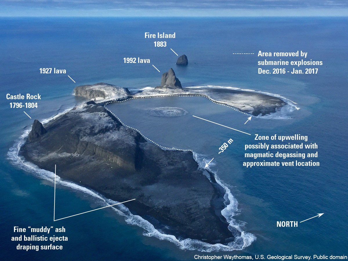
1 mile long. 27 miles north of Umnak Island.

Bogoslof Island Gallery

Pictures of, from, or near Bogoslof Island.

Places Near Bogoslof Island
Islands:

Bogoslof Island, Fire Island,