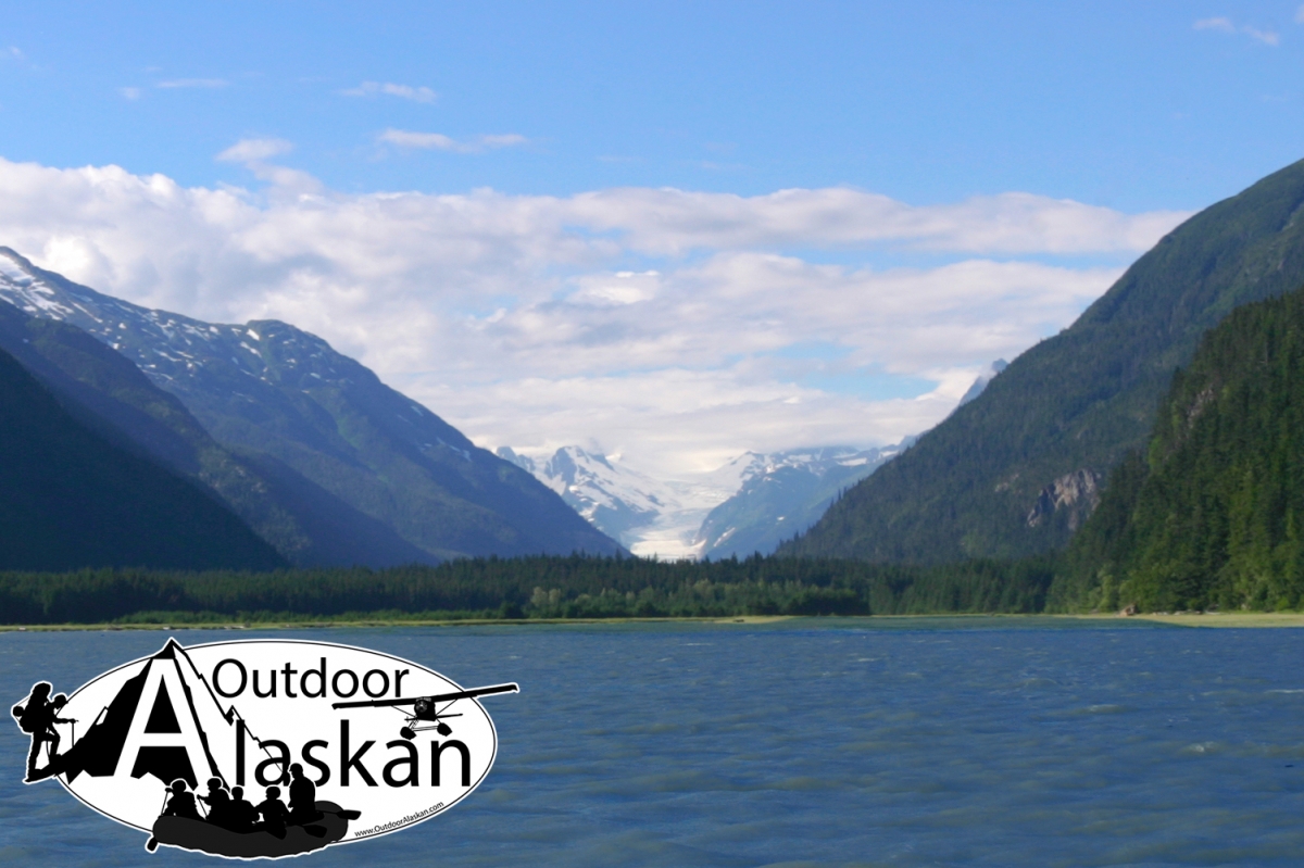
Information About

Ferebee River

Quick Facts

Open in The Map Ferebee River on The Map

Location

59 ° 17' 43.001" N,
135 ° 25' 52" W

Region

Haines

Nearest City

Haines

Length

13 mi (20.92 km)

Ferebee River in Detail.

About

heads in Ferebee Glacier, flows SE 13 mi. to Taiyasanka Harbor, at head of Chikoot Inlet, 10 mi. SW of Skagway; Coast Mts.

History

named in 1880 by the U.S. Navy for surgeon Nelson MacPherson Ferebee, U.S. Navy (USN), who visited the region in 1880. published by U.S. Coast and Geodetic Survey (USC&GS) in the 1883 Coast Pilot (p. 194).

Ferebee River Gallery

Pictures of, from, or near Ferebee River.

Places Near Ferebee River
Cities:

Chilkoot, Denver, Gantegastaki, Rocky Point,

Bars:

Indian Rock, Jenkins Rock, Johnson Rock, McClellan Flats,

Bays:

Carrs Cove, Chilkat Inlet, Chilkoot Inlet, Kalhagu Cove, Kelgaya Bay, Letnikof Cove, Lutak Inlet, Mud Bay, Nahku Bay, Paradise Cove, Portage Cove, Pyramid Harbor, Shiyi Bay, Smugglers Cove, Taiya Inlet, Taiyasanka Harbor, Tanani Bay,

Beaches:

Tanani Beach, Tlegu Beach,

Capes:

Anchorage Point, Battery Point, Chilkat Peninsula, Dok Point, Dyea Point, False Battery Point, Glacier Point, Green Point, Halutu Peninsula, Kaskulu Point, Kelgaya Point, Lehunua Point, Low Point, Nukdik Point, Seduction Point, Taiya Point, Tanani Point, Yakutania Point, Zimovia Point,

Cities:

Haines, Skagway,

Dams:

Haines Army Depot Water Supply Dam, Louie Nelson Homestead Dam, Lower Dewey Lake Forebay Dam, Lower Dewey Lake Number 1 Dam, Upper Dewey Lake Dam,

Fictional Places:

Cicely,

Glaciers:

Davidson Glacier, Rainbow Glacier, Schubee Glacier, Villard Glacier,

Islands:

Dalasuga Island, Kochu Island, Lehunua Island, Pyramid Island,

Lakes:

Black Lake, Chilkoot Lake, Devils Punch Bowl, Icy Lake, Lily Lake, Lower Dewey Lake, Paradise Lake, Rustabach Lake, Rutzebeck Lake, Upper Dewey Lake,

Mountains:

Face Mountain, Mount Gollum, Mount Harding, Mount Riley, Mount Ripinski, Tukgahgo Mountain, Twin Dewey Peaks, Mount Villard,

Parks:

Chilkat State Park, Chilkoot Lake State Recreation Area,

Peaks:

Lactic Acid Peak, Mount Mordor, Nelson Tower, Shakuseyi Peak, Twin,

Ridges:

Halutu Ridge, Ziskokadlo,

Rivers:

Chilkat River, Chilkoot River, East Fork Skagway River, Ferebee River, Katzehin River, Kicking Horse River, Skagway River, Taiya River,

Streams:

Burro Creek, Dayehas Creek, Dewey Creek, Haska Creek, Johnson Creek, Johnson Creek, Kasidaya Creek, Ludaseska Creek, Mink Creek, Nelson Creek, Reid Creek, Shakuseyi Creek, Snyder Creek, Yeldagalga Creek,

Routes:

Mount Riley Trail, Battery Point Trail, Dewey Lakes and Devils Punch Bowl, Lower Dewey Lake Loop Trail, Mount Ripinsky and 7 Mile Saddle Trail, Nahku Portage, Reid Falls Trail, Seduction Point Trail, Sturgill's Landing Trail,

Valleys:

Ferebee Valley,

Cities:

Lutak, Mud Bay, Port Chilkoot, Tanani,

Waterfalls:

Reid Falls,