Information About

Meteorite Mountain

Quick Facts

Open in The Map Meteorite Mountain on The Map

Location

60 ° 58' 46.999" N,
145 ° 58' 0.001" W

Region

Valdez-Cordova (CA)

Nearest City

Valdez

Elevation

6207 ft (1891.89 m)

Meteorite Mountain in Detail.

Getting There

Around 12 mile on the Richardson Highway there are a couple dirt roads that lead to the south. The one just east of the old highway is the most direct route. It follows the Lowe River atop a dike immediately after it flows out of Keystone Canyon. The dike brings you to a pipeline access bridge that it gated. That's where you'd park.

From there cross the bridge and follow the access road until reaches a T junction. One side (left) looking up the mountain, and right leads to Browns Creek. Head right towards the creek. You can cross at any point you'd like but the creek bed gets narrower the further up you go so it's often easiest to cross near the pipeline.

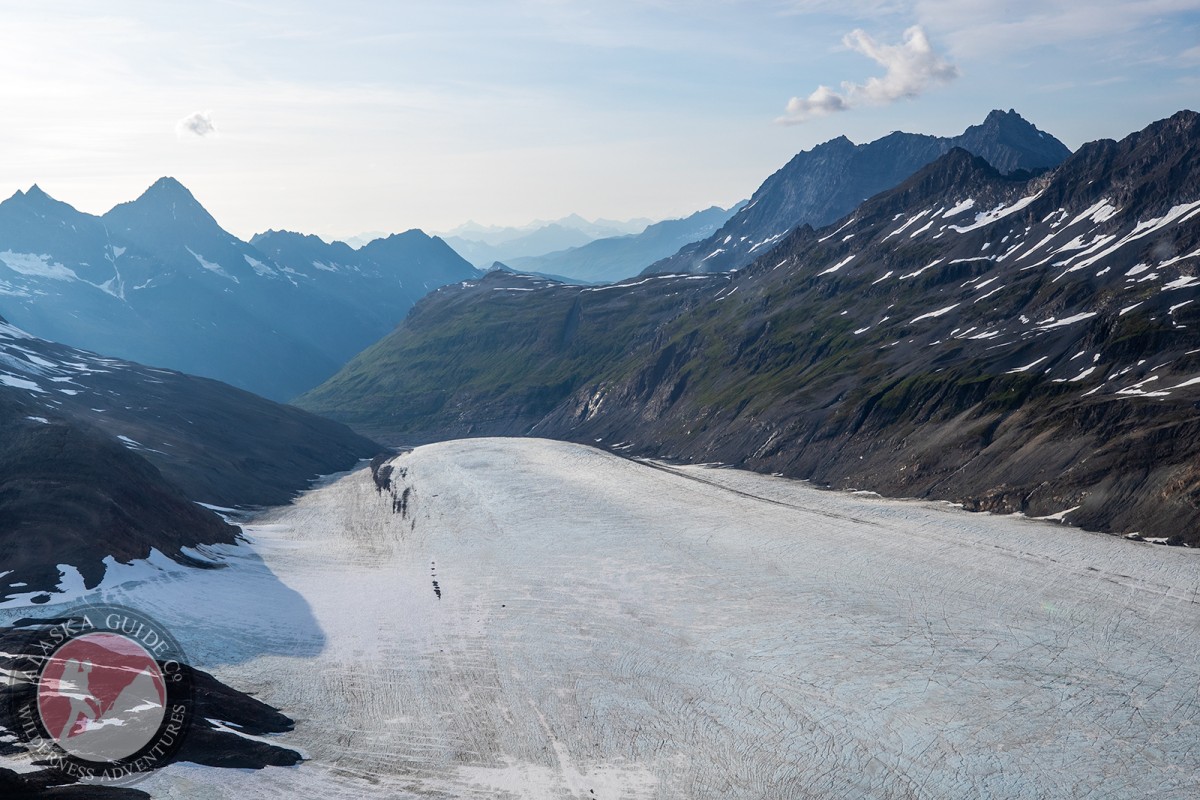
Head up Browns Creek (southeast) you can follow along the creek which will get difficult at the bend, or cut over the knoll (west side of creek) at the bend and rejoin the creek on the backside.

When you reach the glacier facing Browns creek head up.

About

15 mi. NE of Mount Denson, 32 mi. NW of Cordova, Chugach Mts.

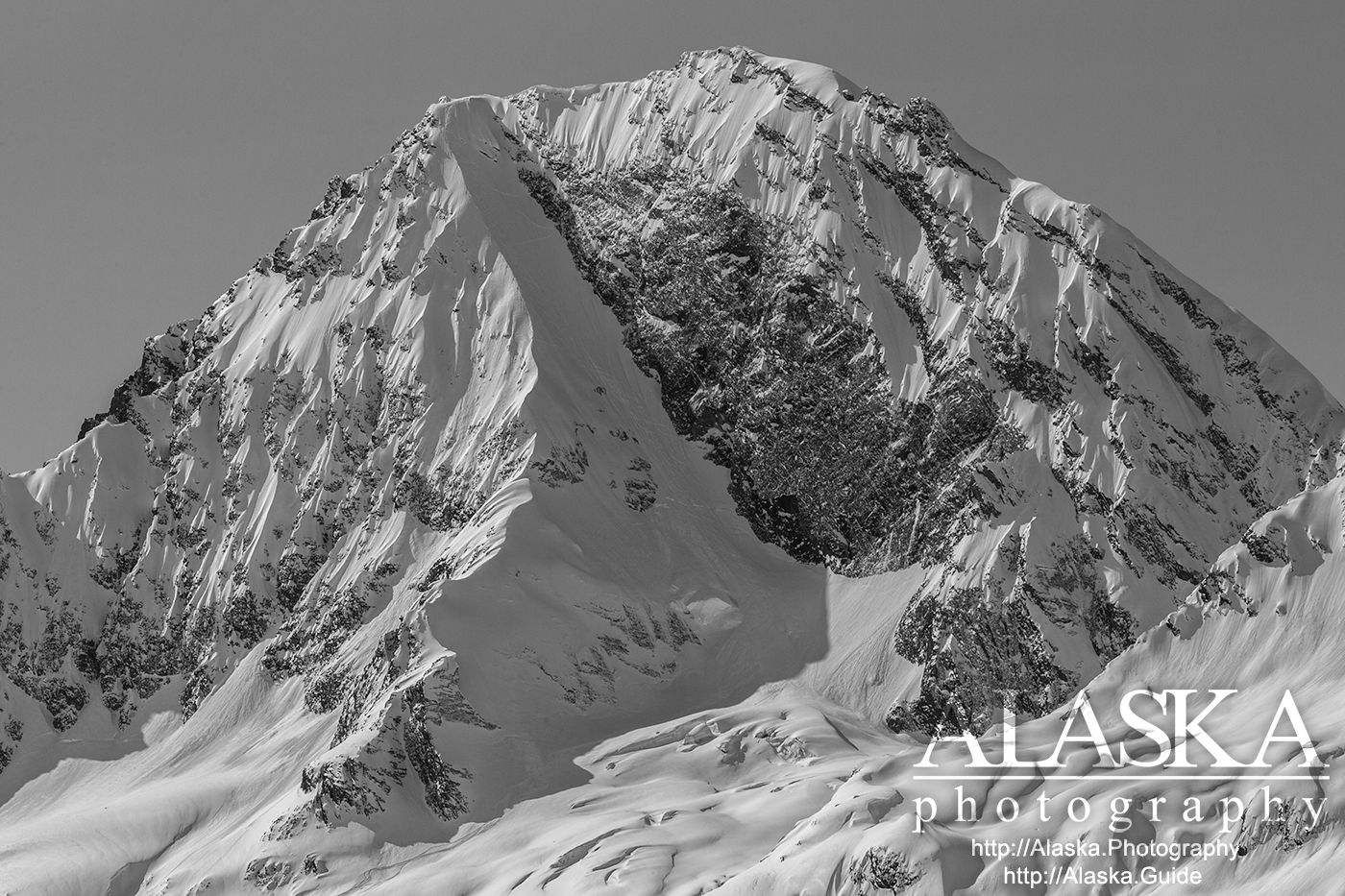
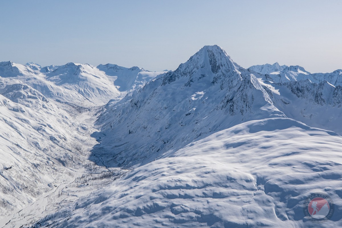
Meteorite Mountain is an impressive mountain, it's a bit taller than surrounding peaks and has an appeal wide, angled, run called Dragons Back, going down its east face.

History

Local name published in 1953 by U.S. Geological Survey (USGS).

First Descent: Local resident and heli-guide Dean Cummings takes credit for the fist descent.

Naming: Meteorite Mountain was a local name published in 1953 by the USGS.

Meteorite Mountain Gallery

Pictures of, from, or near Meteorite Mountain.

Places Near Meteorite Mountain
Cities:

Wortmanns,

Basins:

Washbowl Basin,

Flats:

Dutch Flat,

Glaciers:

Brickslide Glacier, Camicia Glacier, Corbin Glacier, DOT Glacier, Glacier G213821E60955N, Glacier G213835E60986N, Glacier G213860E61028N, Glacier G213869E60950N, Glacier G213881E61189N, Glacier G213882E60988N, Glacier G213883E61190N, Glacier G213898E61187N, Glacier G213914E60880N, Glacier G213934E61146N, Glacier G213941E60895N, Glacier G213942E60986N, Glacier G213944E60979N, Glacier G213945E60907N, Glacier G213952E61151N, Glacier G213958E60963N, Glacier G213959E60945N, Glacier G213962E60977N, Glacier G213967E60919N, Glacier G213971E60895N, Glacier G213982E60906N, Glacier G213982E61094N, Glacier G213986E60928N, Glacier G214001E60962N, Glacier G214004E60942N, Glacier G214005E60907N, Glacier G214017E60985N, Glacier G214019E61092N, Glacier G214021E60977N, Glacier G214022E60997N, Glacier G214027E61088N, Glacier G214030E60925N, Glacier G214032E61170N, Glacier G214039E60964N, Glacier G214042E61141N, Glacier G214048E60957N, Glacier G214049E60918N, Glacier G214053E61154N, Glacier G214070E61096N, Glacier G214099E61139N, Glacier G214116E60878N, Glacier G214117E61192N, Glacier G214132E60990N, Glacier G214139E61173N, Glacier G214141E60880N, Glacier G214148E60959N, Glacier G214151E61165N, Glacier G214161E60914N, Glacier G214166E60906N, Glacier G214169E60899N, Glacier G214170E60888N, Glacier G214175E61036N, Glacier G214183E60923N, Glacier G214183E61143N, Glacier G214188E61150N, Glacier G214199E61016N, Glacier G214222E60989N, Glacier G214237E60874N, Hogback Glacier, Keystone Glacier, Rubin Glacier, Twentyseven Mile Glacier, Worthington Glacier,

Routes:

Angel, Bridal Veil Falls (Ice Climb), Cidersicle, Crystal Visions, Dire Straits, Fang Gully, Fast Friends, Fishing for Fools, Flying Cloud, Foolagain, Glass Onion, Greensteps, Hanging Tree Left, Hanging Tree Right, Horsetail Falls (Ice Climb), Hung Jury, Jaws Wall, Mud Slide, My Three Rats, Oil Slick, Popsicle Pillar, POS, Secret Journey, Simple Twist of Fate, Ski Race, Spring Loaded, Stem City, The Bight, Tokyo Express, Tsuri Gane, VAC,

Lakes:

Crater Lake, Deep Lake, Robe Lake, Valdez Glacier Lake,

Locales:

19 Mile Wall, Bro Bowl, DOT Face, Girls, Heiden View Face, Loveland Basin,

Mountains:

East Peak, Girls Mountain, Hogsback, Meteorite Mountain,

Peaks:

Acapulco, Mount Bonet, Heidi Peak, Loveland Peak, Repeater Peak, Sapphire, Satellite, Stone Mountain, Tones Temple, Twentyseven Mile Peak, Whistlers Mother,

Rivers:

Gravina River,

Streams:

Bear Creek, Bench Creek, Brown Creek, Browns Creek, Cameron Creek, Camicia Creek, Canyon Slough, Dead Creek, Goat Creek, Sheep Creek, Slater Creek, Wortmanns Creek,

Routes:

Browns Creek Trail, East Peak Access Trail, Pack Trail of 1899,

Valleys:

Browns Basin, Goat Gully, Heiden Canyon, Keystone Canyon, Snowslide Gulch, Sulphide Gulch,

Waterfalls:

Bridal Veil Falls, Horsetail Falls, Rudleston Falls,