Quick Facts
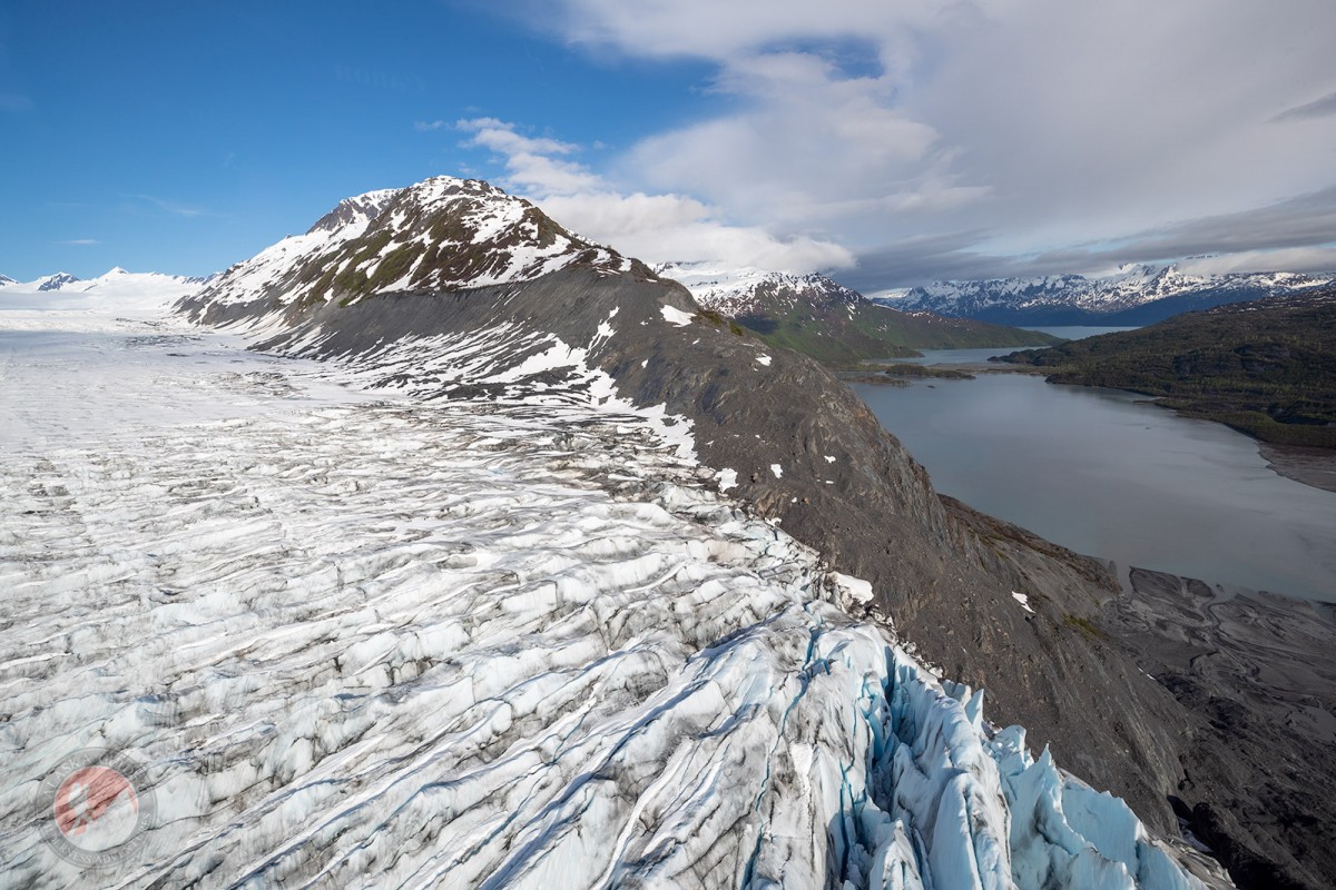
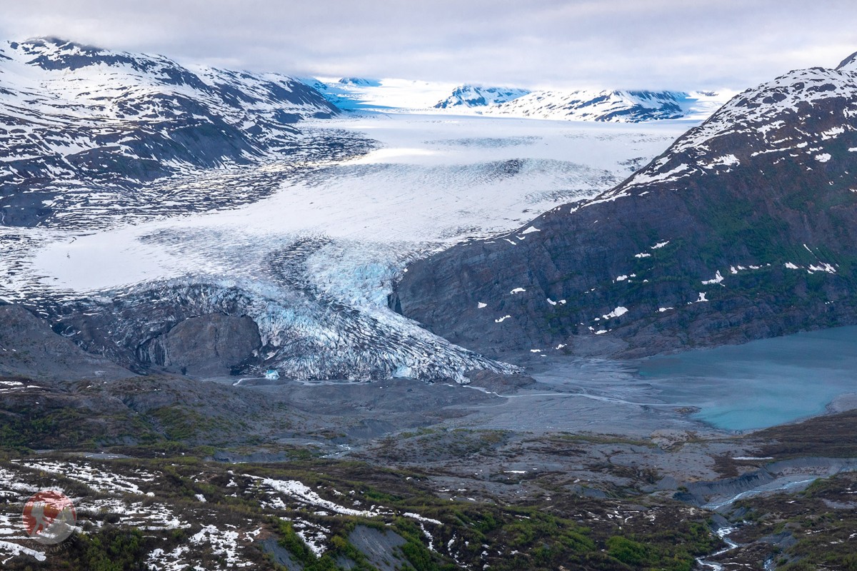
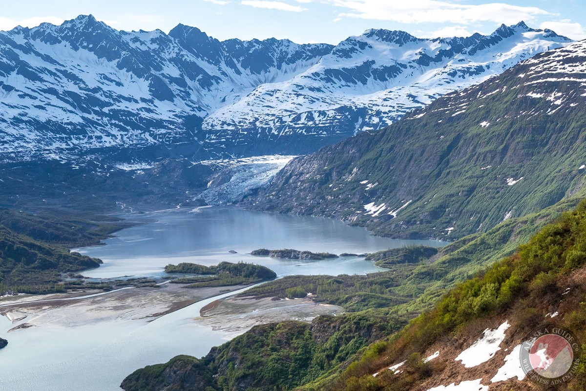
trends SW to its terminus, 0.4 mi. NW of head of Shoup Bay and 12 mi. W of Valdez, Chugach Mts.
HistoryNamed Canyon Creek Glacier in 1898 by Captain W. R. Abercrombie, USA; the local name Shoup Glacier was reported by him in 1899.
Shoup Glacier once bore the name Canyon Creek Glacier. It furnished a highway to various lode gold prospects within its drainage area as well as ice for the town of Valdez.
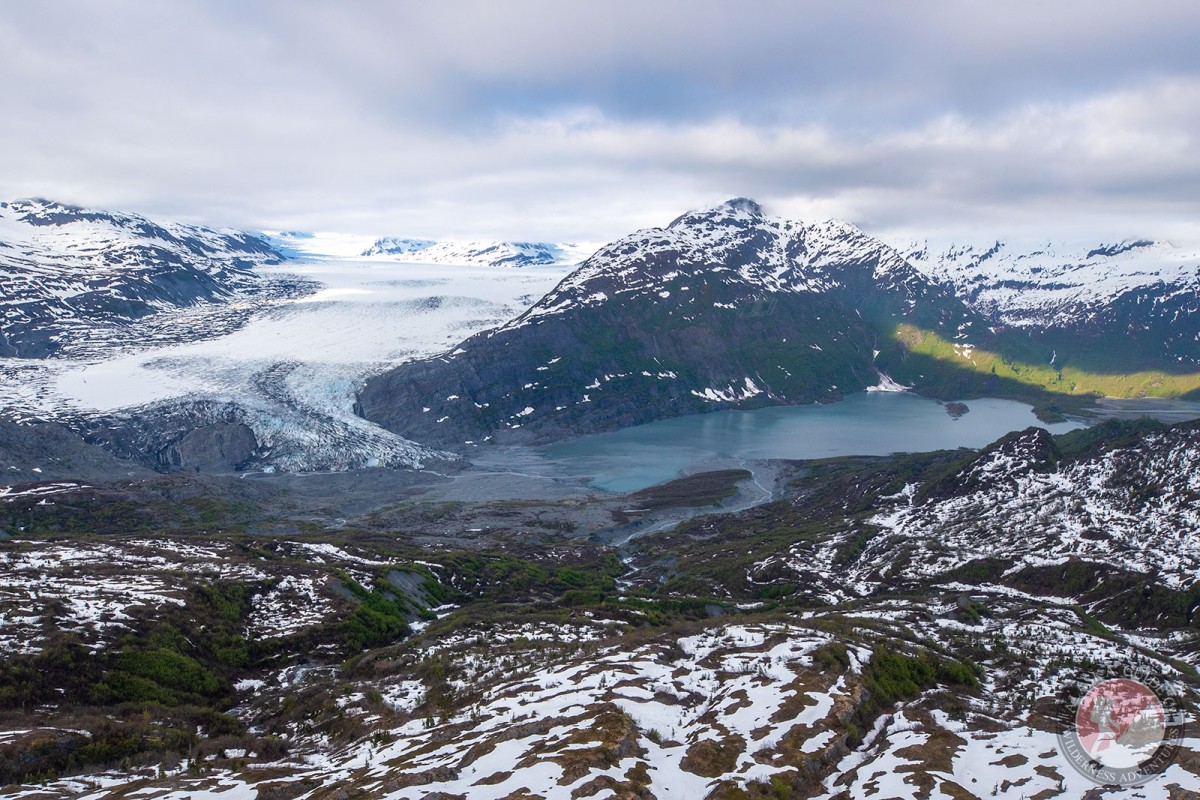
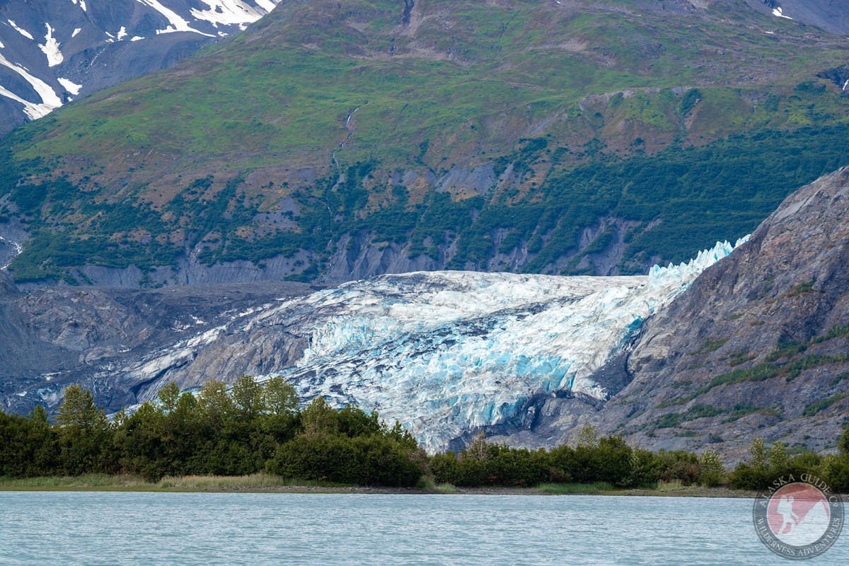
Pictures of, from, or near Shoup Glacier.
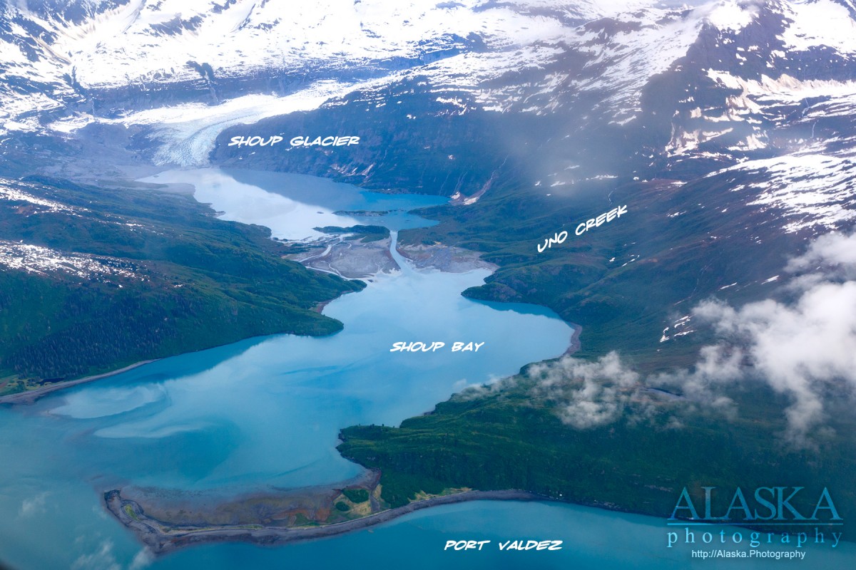
Anderson Bay, Jack Bay, Port Valdez, Shoup Bay,
Capes:Allison Point, Entrance Point, Jackson Point, Point Lowe, Potato Point, Tongue Point,
Channels:Cities:Glaciers:Glacier G213478E61182N, Allison Glacier, Anderson Glacier, Annin Glacier, Glacier G213498E61160N, Glacier G213500E61175N, Glacier G213550E61021N, Glacier G213583E61167N, Glacier G213585E61165N, Glacier G213585E61165N, Glacier G213602E61200N, Glacier G213603E61218N, Glacier G213614E61180N, Glacier G213653E61264N, Johnson Glacier, Kate Glacier, Salmon Creek Glacier, Shoup Glacier, Westbrook Glacier,
Routes:Blue Horizons, Excalibur, Gravy Tran, Peggy's Mane, Wowie Zowie,
Islands:Lakes:Locales:Chuck Chute, Chuck Junior, Jago Chute, Runner's Delight, Sentinel, Sheepshead Chute,
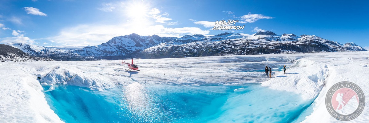
Mountains:Mount Cameron, Mount Cashman, Flandreau Mountain, Mount Kate, Lindita Peak, Madean Peak, Mount Hogan, Mummy Mountain, Pandora Peak, Mount Shasta, Mount Shouplina, Tazcol Peak, Tazlina Tower, Mount Thomas,
Parks:Jack Bay State Marine Park, Shoup Bay State Marine Park,
Mountain Passes:Peaks:Dorothita, Freuchen, Mile High Peak, Mount Rachel Carson, Stegosaurus,
Streams:Allison Creek, Big Creek, Dayville Creek, Gold Creek, Gregorioff Creek, Horsetail Creek, Johnson Creek, Levshakoff Creek, McAllister Creek, Mineral Creek, Palmer Creek, Salmon Creek, Sawmill Creek, Uno Creek,
Routes:High School Hill, High School Hill to Summit Trail, High School Hill Water Tower Trail, Homestead Trail, Jack Bay Island Trail, Mineral Creek East Trail, Mineral Creek West Trail, Shoup Bay Trail, Valdez Bike Path, Valdez Overlook Trail,