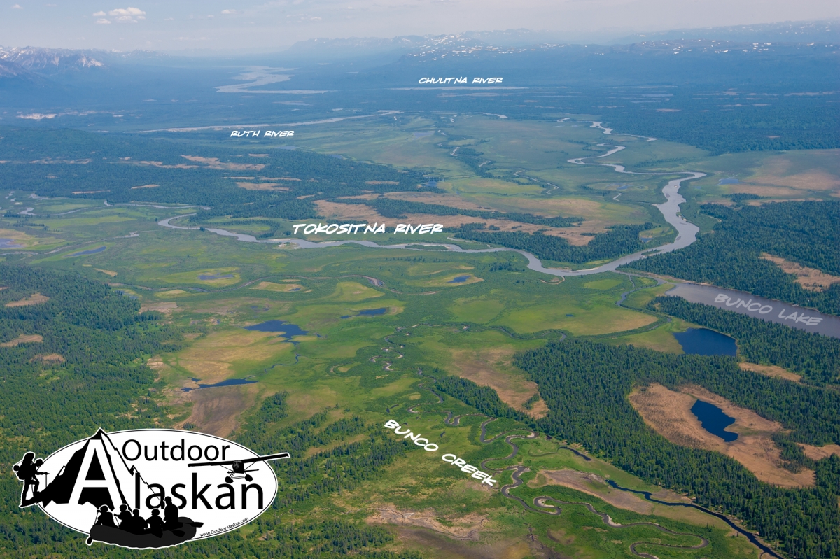
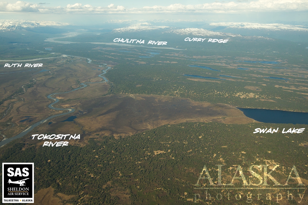
Information About

Ruth River

Quick Facts

Open in The Map Ruth River on The Map

Location

62 ° 37' 25" N,
150 ° 21' 11.999" W

Region

Matanuska-Susitna

Nearest City

Petersville

Tributary to

Tokositna River

Length

13 mi (20.92 km)

Elevation

620 ft (188.98 m)

Ruth River in Detail.

About

heads in a lake to Tokosha Mts. and flows SE around terminus of Ruth Glacier, to Tokositna River, 22 mi. NW of Talkeetna, Cook Inlet Low.

History

Mountain climbers' name published in the late 1940's.

Ruth River Gallery

Pictures of, from, or near Ruth River.