Quick Facts
Location
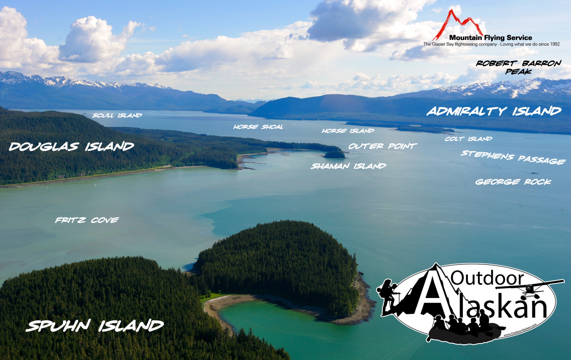
58 ° 18' 20.999" N,
134 ° 41' 2" W
Region
Juneau
Nearest City
Part of
Length
635 ft (193.55 m)
Width
336.00 ft (102.41 m)
Area
3 acres
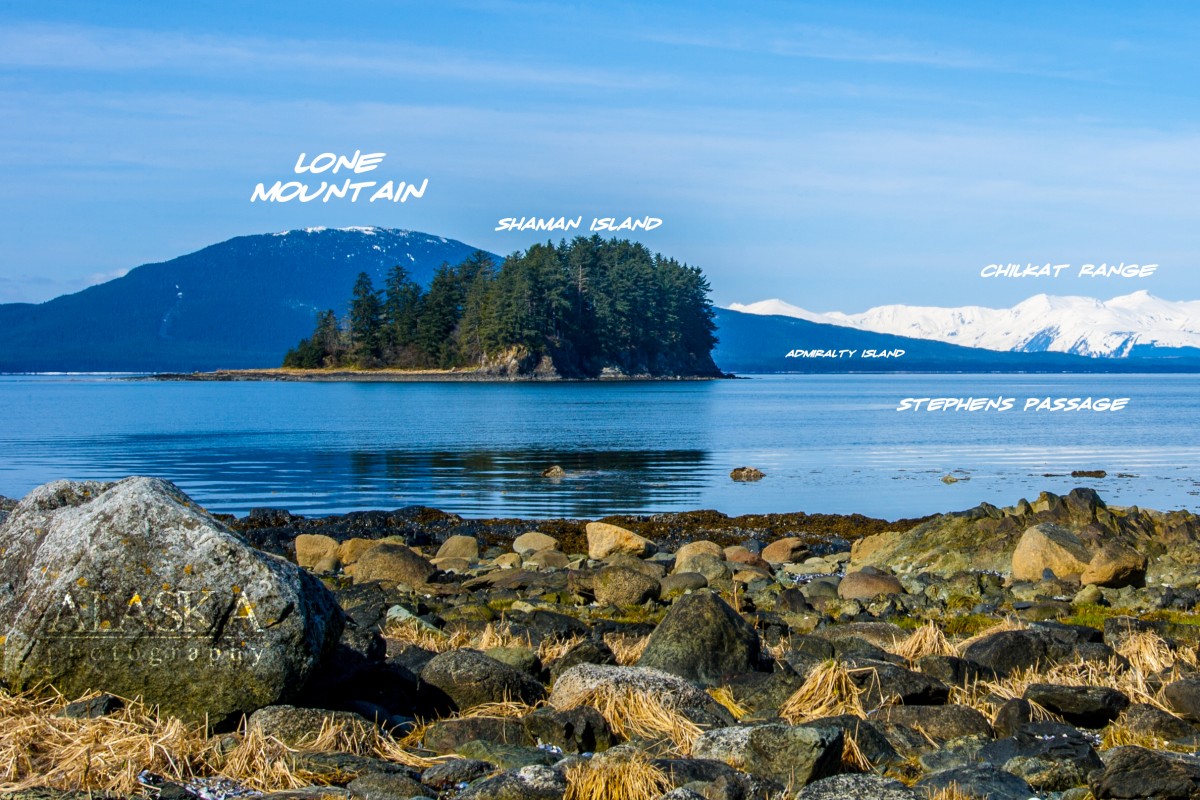
Elevation
60 ft (18.29 m)