Information About

Valdez Glacier

Quick Facts

Open in The Map Valdez Glacier on The Map

Conditions: Calving at the center face of the glacier, beneath the center of the middle moraine. Between 100-200ft across and around 50ft back. Sept 8, 2:45pm. Updated: 8 September 14:45


Location

61 ° 17' 24" N,
146 ° 12' 28.001" W

Region

Valdez-Cordova (CA)

Nearest City

Valdez

Tributary to

Valdez Glacier Lake

Length

21 mi (33.8 km)

Elevation

3189 ft (972.01 m)

Uses

Ice Climbing

Fatalities

27

Valdez Glacier in Detail.

Getting There

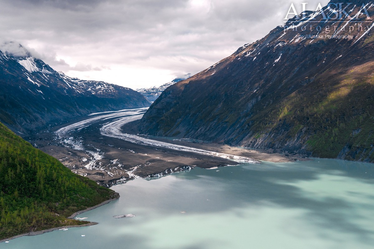
From downtown Valdez get on the Richardson Highway, turn left on to Airport Road stay on it to the end(even as it becomes Glacier Campground Rd). This will get you to the lake. The glacier has receded up between steep walls it carved out, and it resting behind the lake. To reach the glacier a boat is recommended. Though it is physically possible to reach the glacier clinging to dear life traversing through the brush.

About

heads 0.7 mi. S of Mount Cashman, trends SE to its terminus, 2 mi. SE of West Peak and 4 mi. NE of Valdez, Chugach Mts

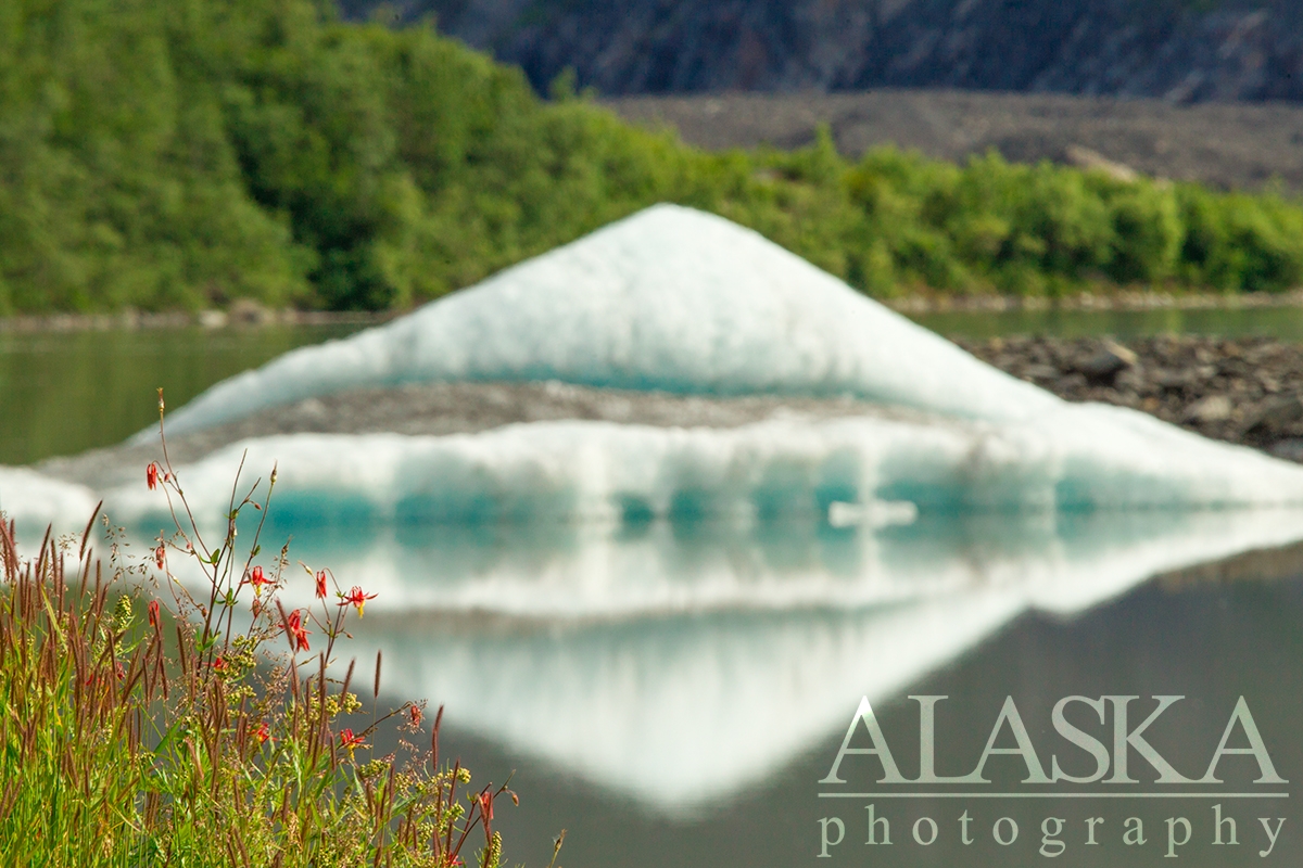
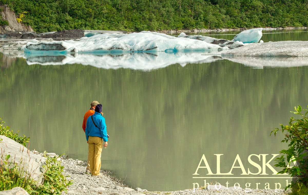
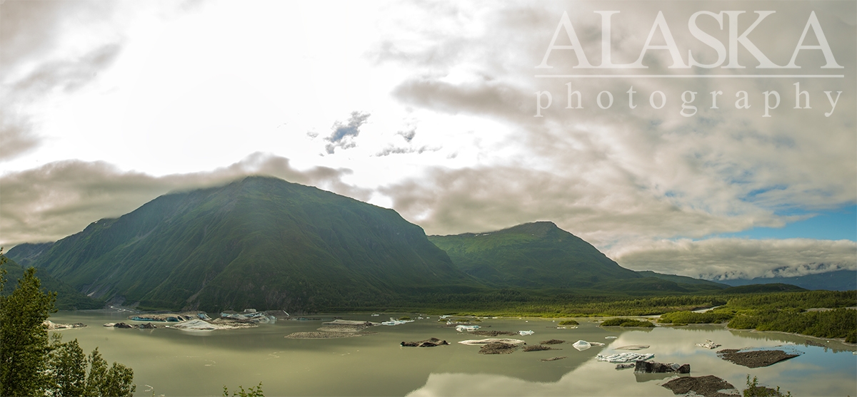
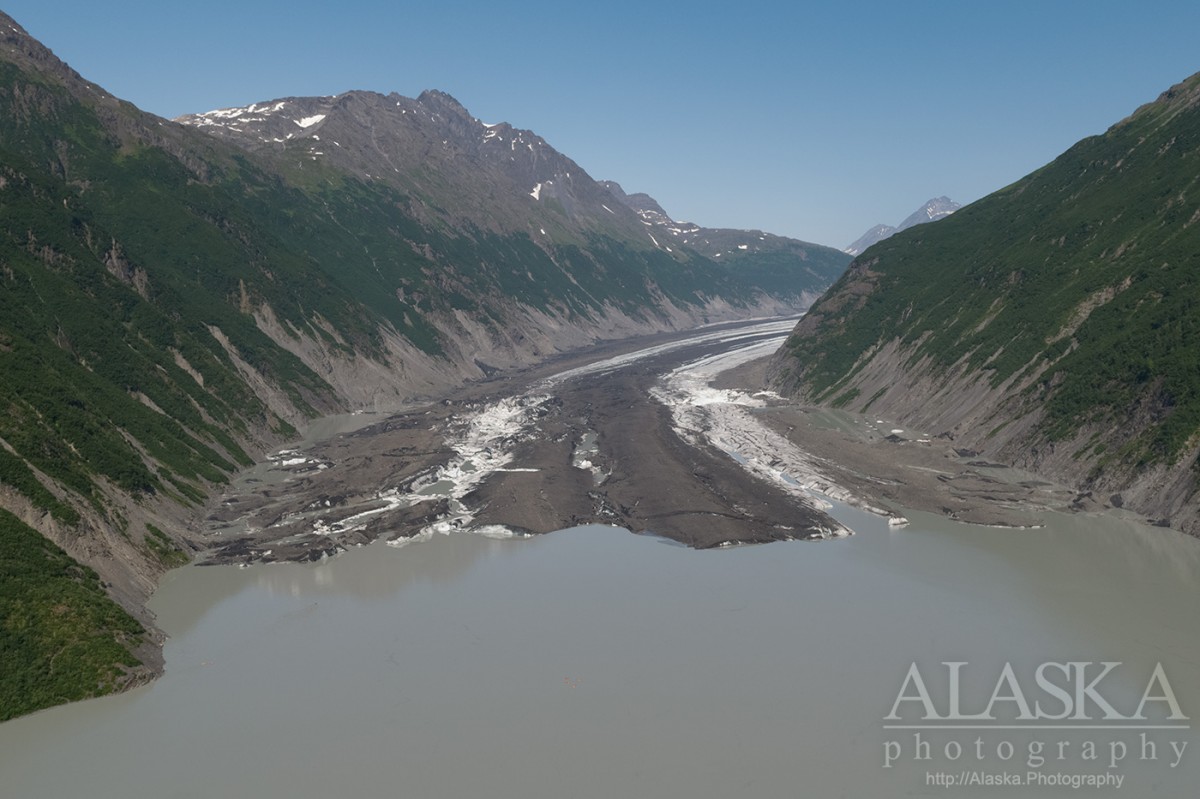
Valdez Glacier is rapidly thinning and retreating. In the mean time it is still one of the highlights of Valdez. There is a large parking lot with a couple picnic tables at Valdez Glacier Lake. From here many people park and walk along the shore looking at the icebergs that may be floating in the middle of the lake or occasionally pressed up against the shore. The glacier itself has retreated around the bend and only a small portion of its terminus is visible from the shore.

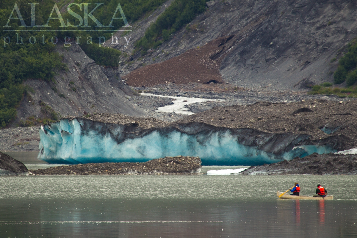
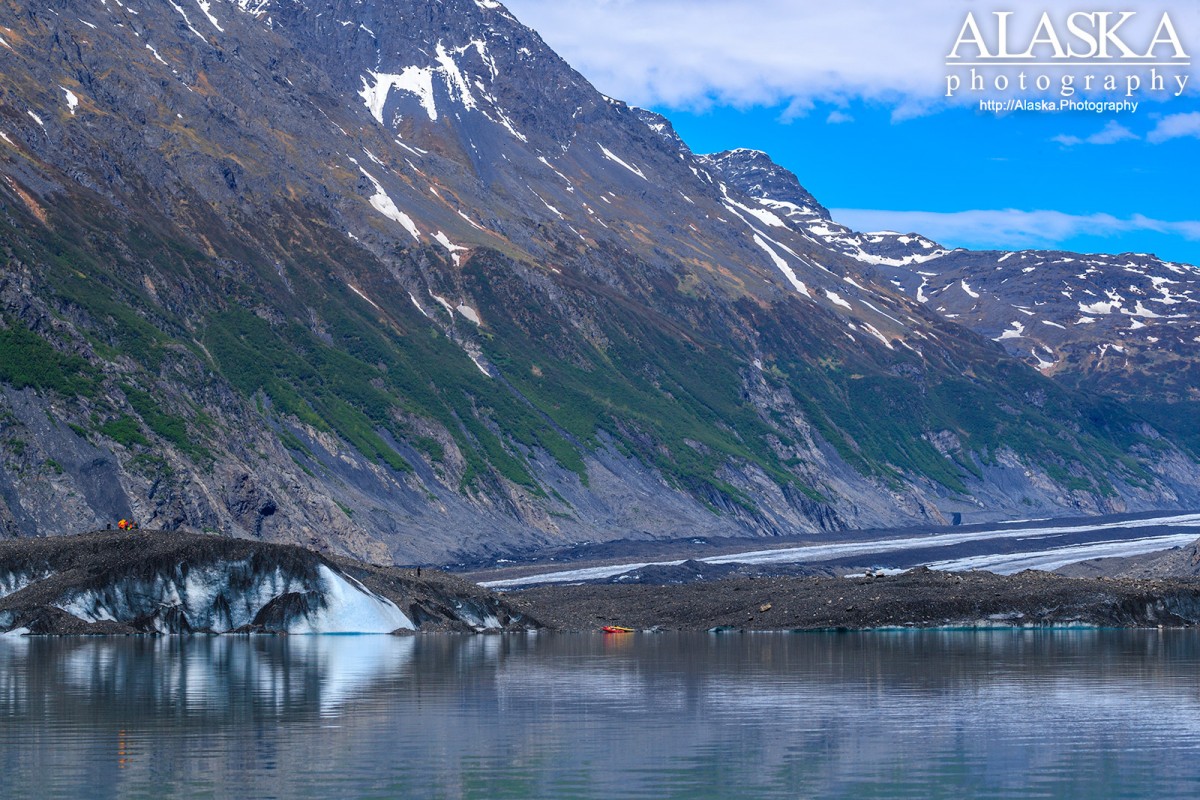
To best enjoy Valdez Glacier one must kayak or canoe out to the see the glacier. We offer private canoe tours to the glacier and there is one other company in Valdez that offers mixed group kayaking tours around the lake but not to glacier.

In summer of 2019 a German couple along with a man from Austria were out in an inflatable canoe in an area that showed signs of instability weeks earlier and imminent calving hours earlier. They were caught inside a small inlet inside the glacier as it calves. Ice broke off from the glacier rising up and tipping them out of the canoe. None of the party survived. Independent travel on the glacier is not recommended.

As of 2019 there is a large crevasse running across the glacier that it only passable by repelling in packrafting across and climbing out. The entire floating portion of the glacier is breaking apart and there are over 2 dozen large crevasses that formed in 2019.

About 5 miles back from the terminus on the east side of Valdez Glacier there is a valley with a retreated fork of glacier that drains into the valley. Since the fork had retreated the east edge of Valdez Glacier spills into the valley. Those broken chunks of ice, some the size of city buildings dam up the drainage creating a deep lake. When the lake reaches the height of the glacier the largest chunks of ice still damming the valley float upwards and the lake drains underneath Valdez Glacier.

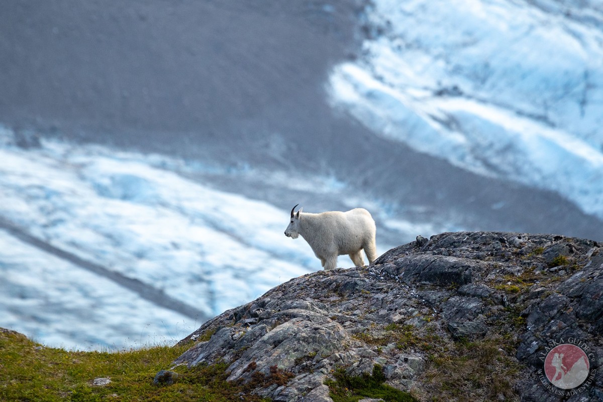
Due to the high concentration of glacier silt in the water there are no fish. Also since we've been asked on tours, whales, otters, nor any other marine life travel up the stream to the lake. Other than insects and birds no wildlife lives in/on the lake.

In winter the lake freezes over and it's common for people to cross-country ski, snowshoe, snowmobile, or walk out to the glacier. Winter travel to the glacier will depend on wind and snow depth. One day there can be 3 feet of snow on the lake and a couple days of strong wind will have it down to bare ice.

History

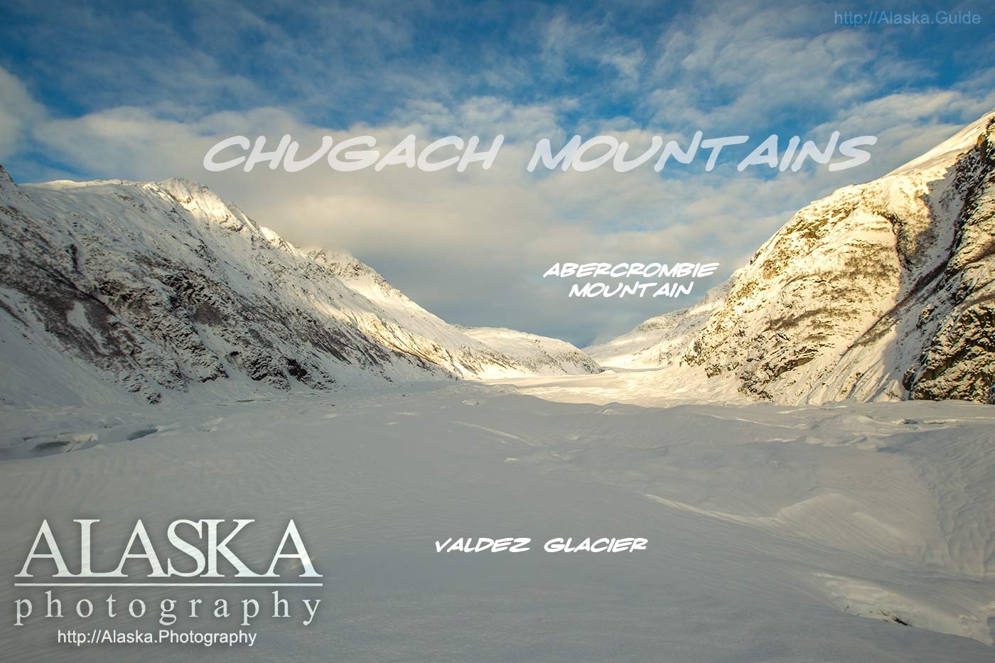
Named in 1898 by Captain W. R. Abercrombie, USA.

Due to its long gradual descent, Valdez Glacier was used as a trail for many looking to enter the interior of Alaska in search of gold back in the late 1800's.

From June 1909 to June 1911 L. S. Camicia recorded that Valdez Glacier had receded 36ft.

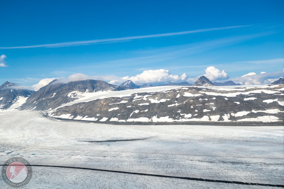
During the twentieth century, Valdez Glacier thinned by more than 300 feet. The summer of 2017 the last mile of Valdez Glacier that floats in the lake had major shifting with extensive splitting and change to the glacier.

In spring of 2012 three scientist (Anthony Arendt, Gabriel Wolken, Alessio Gusmeroli) were able to snowmachine (snowmobile) up to the summit of the glacier since the 400+ inches of snow that fell that winter provided plenty of protection from the glaciers many crevasses.

Fatalities

On July 29, 2019, 3 people died while canoeing. Read More

On March 20, 1899, 1 person died while hiking. Read More

On February 27, 1899, 7 people died while hiking. Read More

On January 7, 1899, 5 people died while hiking. Read More

On September 30, 1898, 2 people died while hiking. Read More

On April 30, 1898, 3 people died while hiking. Read More

On January 15, 1898, 6 people died while hiking. Read More

Valdez Glacier Gallery

Pictures of, from, or near Valdez Glacier.

Places Near Valdez Glacier
Capes:

Allison Point, Dock Point, Jackson Point,

Cities:

Valdez,

Crags:

Valdez Glacier Campground Wall, Lookout Rock, Panorama Point,

Dams:

Solomon Gulch Dam A, Solomon Gulch Dam B, Solomon Lake Dam,

Flats:

Duck Flats,

Glaciers:

Abercrombie Shelf Glacier, Camicia Glacier, Glacier G213583E61167N, Glacier G213585E61165N, Glacier G213585E61165N, Glacier G213602E61200N, Glacier G213603E61218N, Glacier G213606E61497N, Glacier G213608E61504N, Glacier G213614E61180N, Glacier G213653E61264N, Glacier G213685E61168N, Glacier G213723E61170N, Glacier G213727E61240N, Glacier G213739E61247N, Glacier G213740E61167N, Glacier G213742E61233N, Glacier G213750E61221N, Glacier G213756E61212N, Glacier G213756E61263N, Glacier G213763E61411N, Glacier G213767E61200N, Glacier G213767E61245N, Glacier G213768E61385N, Glacier G213770E61226N, Glacier G213777E61166N, Glacier G213778E61174N, Glacier G213780E61222N, Glacier G213780E61222N, Glacier G213781E61419N, Glacier G213790E61394N, Glacier G213802E61478N, Glacier G213808E61415N, Glacier G213811E61486N, Glacier G213815E61401N, Glacier G213822E61414N, Glacier G213822E61478N, Glacier G213822E61486N, Glacier G213881E61189N, Glacier G213883E61190N, Glacier G213898E61187N, Glacier G213910E61368N, Glacier G213914E61380N, Glacier G213925E61388N, Glacier G213927E61398N, Glacier G213934E61146N, Glacier G213935E61200N, Glacier G213952E61151N, Glacier G213956E61364N, Glacier G213959E61371N, Glacier G213959E61389N, Glacier G213964E61199N, Glacier G213979E61354N, Glacier G213981E61263N, Glacier G213982E61094N, Glacier G214001E61199N, G-g-g-g-g Glacier, Johnson Glacier, Klutina Glacier, Mineral Creek Glacier, Rubin Glacier, Stephens Glacier, Valdez Glacier,

Hills:

Horsethief Hill,

Routes:

Blue Horizons, Diamond in the Sky, Excalibur, Gravy Tran, Kayaker's Delight, Necromancer, Peggy's Mane, Wowie Zowie,

Islands:

Ammunition Island, Mineral Creek Islands,

Lakes:

Crater Lake, Deep Lake, Robe Lake, Solomon Gulch Lake, Solomon Lake, Valdez Glacier Lake,

Locales:

Airport Chute, Alaska Guide Company - Office, Basin Cove, Cabell Chute, Chuck Chute, Chuck Junior, Delta Chute, Grant Chute, Jago Chute, Lookout Bowl, Lucky 13, Runner's Delight, Sentinel, Sheepshead Chute,

Mountains:

Prospectors Peak, Abercrombie Mountain, Mount Brookfield, Camp Mountain, East Peak, Mount Evans, Garrett Peak, Hogsback, Mount Logan, Mount Mahlo, Mount Ourand, Mount Schrader, Sharp Peak, Townsend Peak, Valdez Summit, West Peak,

Peaks:

Mount Bonet, High Back, Mile High Peak, Titan Chair,

Rivers:

Lowe River, Robe River,

Routes:

Lazy Days, No Floss Necessary, Route number 1, Route number 3, Trim the Bush, Wet Finish,

Routes:

Already Herd, Bicentennial, Bongo That Bitch, Brand New, Canadian Heat Wave, Cotter Unlimited, Danger Stranger, Dragon's Teeth, Dynosaur, The Firing Line, Gusel Jugs, Harristotle, Kentner's Mill, Leaf BlowersL, Ledgeway to Sleven, Lefty Lucy, People Get Up And Drive Your Funky Soul, Quartzsite's Strike, Reacharound, Redheaded Stepchild, Righty Tighty, Route number 2, Slabawooke, The Nose Knows, Your Favorite Weapon,

Streams:

Abercrombie Creek, Allison Creek, Brevier Creek, Cameron Creek, Camicia Creek, Corbin Creek, Crooked Creek, Dayville Creek, East Fork Mineral Creek, Glacier Creek, Goat Creek, Horsetail Creek, Mineral Creek, Slater Creek, Stephens Creek, Valdez Glacier Stream, Wood Creek,

Routes:

Area 51 Access Trail, Dayville Power Line Trail, Dock Point Trail, East Peak Access Trail, Mount Francis Winter Trail, High School Hill, High School Hill to Summit Trail, High School Hill Water Tower Trail, Hogsback Trail, Homestead Trail, John Hunter Memorial Trail, Levee to Valdez Glacier Trail, Lost Toque Trail, Mineral Creek East Trail, Mineral Creek Stamp Mill Trail, Mineral Creek West Trail, Northern Robe Lake Trail, River Drive Trail, Robe River Hogsback Access Trail, Shoup Bay Trail, Solomon Gulch Valdez Overlook Spur, Southern Robe Lake Trail, Valdez Bike Path, Valdez Overlook Trail,

Valleys:

Abercrombie Gulch, Goat Gully, Solomon Gulch,

Cities:

Old Valdez,