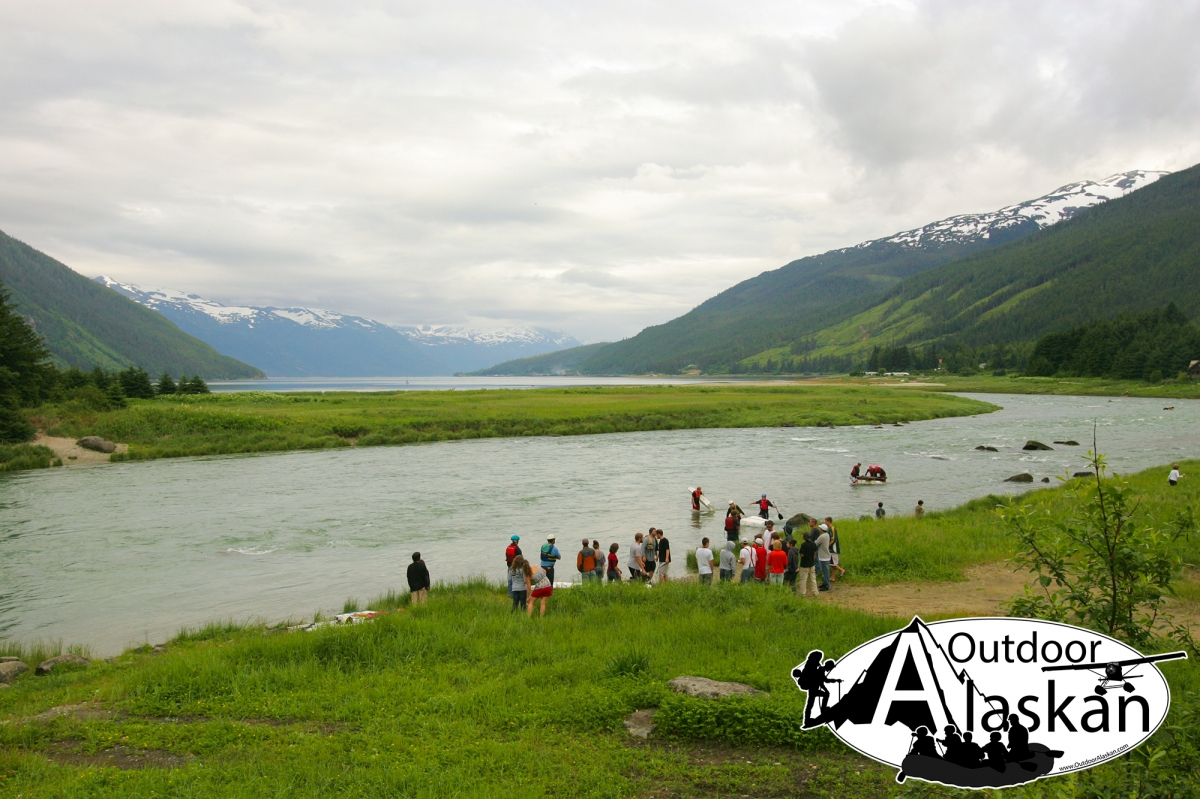
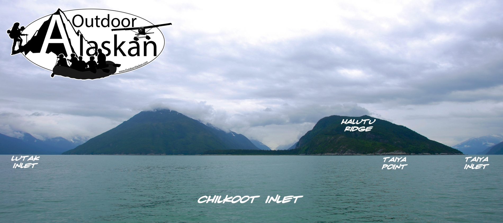
Information About

Lutak Inlet

Quick Facts

Open in The Map Lutak Inlet on The Map

Location

59 ° 18' 10.001" N,
135 ° 30' 2.999" W

Region

Haines

Nearest City

Haines

Tributaries

Chilkoot River,

Lutak Inlet in Detail.

Getting There


About

trends NW from head of Chilkoot Inlet to outlet of Chilkoot Lake, 0.5 mi. S of Chilkoot and 13 mi. SW of Skagway, Coast Mts.


History

Tlingit Indian name published in 1923 on International Boundary Commission (IBC) Sheet 9 (1951 atlas).

Lutak Inlet Gallery

Pictures of, from, or near Lutak Inlet.

Places Near Lutak Inlet
Cities:

Chilkoot, Gantegastaki,

Bars:

Indian Rock, Jenkins Rock, Johnson Rock, McClellan Flats,

Bays:

Carrs Cove, Chilkat Inlet, Chilkoot Inlet, Kalhagu Cove, Kelgaya Bay, Letnikof Cove, Lutak Inlet, Mud Bay, Nahku Bay, Paradise Cove, Portage Cove, Pyramid Harbor, Shiyi Bay, Smugglers Cove, Taiya Inlet, Taiyasanka Harbor, Tanani Bay,

Beaches:

Tanani Beach, Tlegu Beach,

Capes:

Anchorage Point, Battery Point, Chilkat Peninsula, Dok Point, Dyea Point, False Battery Point, Glacier Point, Green Point, Halutu Peninsula, Kaskulu Point, Kelgaya Point, Lehunua Point, Low Point, Nukdik Point, Taiya Point, Tanani Point, Yakutania Point, Zimovia Point,

Cities:

Haines, Skagway,

Dams:

Haines Army Depot Water Supply Dam, Louie Nelson Homestead Dam, Lower Dewey Lake Forebay Dam, Lower Dewey Lake Number 1 Dam,

Fictional Places:

Cicely,

Glaciers:

Garrison Glacier, Rainbow Glacier,

Islands:

Dalasuga Island, Kochu Island, Lehunua Island, Pyramid Island,

Lakes:

Chilkoot Lake, Connolly Lake, Icy Lake, Lily Lake, Lost Lake, Lower Dewey Lake, Paradise Lake, Rustabach Lake, Rutzebeck Lake,

Mountains:

Cathedral Peak, Mount Emmerich, Face Mountain, Mount Gollum, Mount Harding, Mount Kashagnak, Mount Riley, Mount Ripinski, Tukgahgo Mountain, Mount Villard,

Parks:

Chilkat State Park, Chilkoot Lake State Recreation Area,

Peaks:

Lactic Acid Peak, Nelson Tower, Shakuseyi Peak,

Ridges:

Halutu Ridge, Ziskokadlo,

Rivers:

Chilkat River, Chilkoot River, Ferebee River, Katzehin River, Kicking Horse River, Skagway River, Taiya River, Takhin River,

Streams:

Burro Creek, Dayehas Creek, Dewey Creek, Haska Creek, Johnson Creek, Johnson Creek, Kasidaya Creek, Ludaseska Creek, Mink Creek, Nelson Creek, Reid Creek, Shakuseyi Creek, Snyder Creek,

Routes:

Mount Riley Trail, Battery Point Trail, Dewey Lakes and Devils Punch Bowl, Lower Dewey Lake Loop Trail, Mount Ripinsky and 7 Mile Saddle Trail, Nahku Portage, Reid Falls Trail, Seduction Point Trail, Skyline Trail, Sturgill's Landing Trail,

Valleys:

Ferebee Valley,

Cities:

Lutak, Mud Bay, Port Chilkoot, Tanani,

Waterfalls:

Reid Falls,